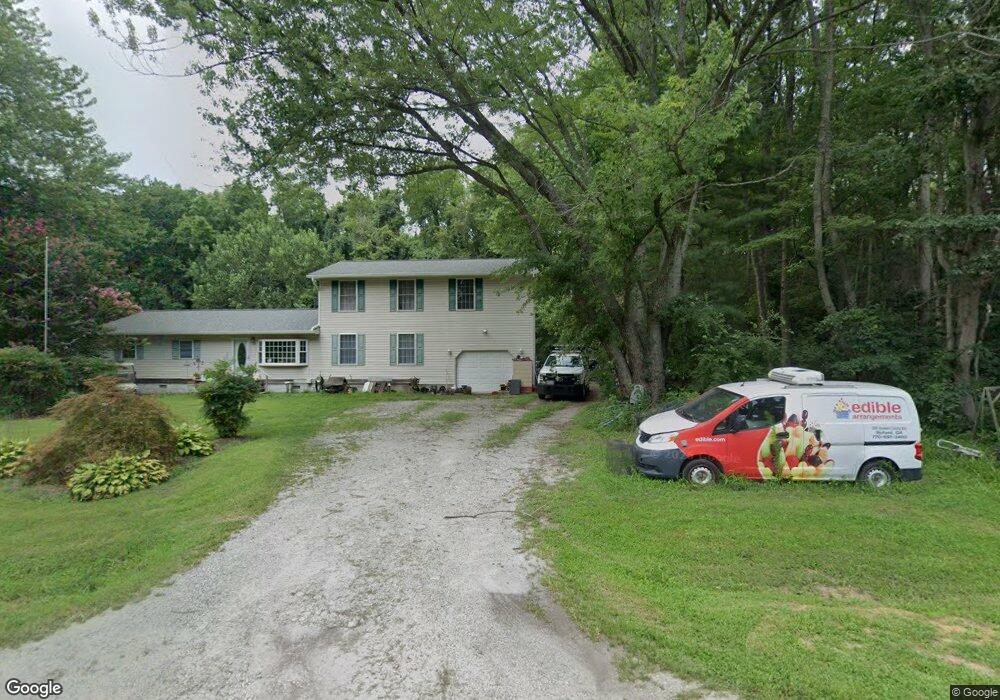
113 Lagorce Dr Stevensville, MD 21666
Estimated Value: $363,000 - $451,000
--
Bed
1
Bath
1,359
Sq Ft
$297/Sq Ft
Est. Value
About This Home
This home is located at 113 Lagorce Dr, Stevensville, MD 21666 and is currently estimated at $403,890, approximately $297 per square foot. 113 Lagorce Dr is a home located in Queen Anne's County with nearby schools including Matapeake Elementary School, Matapeake Middle School, and Kent Island High School.
Ownership History
Date
Name
Owned For
Owner Type
Purchase Details
Closed on
Jun 16, 1999
Sold by
Boerman W Alan
Bought by
Boerum W Alan
Current Estimated Value
Purchase Details
Closed on
Nov 13, 1996
Sold by
Coogan Dolores H
Bought by
Boerman W Alan
Purchase Details
Closed on
Feb 27, 1981
Sold by
Shaffer Mary V
Bought by
Coogan Dolores H
Home Financials for this Owner
Home Financials are based on the most recent Mortgage that was taken out on this home.
Original Mortgage
$15,000
Interest Rate
15.3%
Create a Home Valuation Report for This Property
The Home Valuation Report is an in-depth analysis detailing your home's value as well as a comparison with similar homes in the area
Home Values in the Area
Average Home Value in this Area
Purchase History
| Date | Buyer | Sale Price | Title Company |
|---|---|---|---|
| Boerum W Alan | -- | -- | |
| Boerman W Alan | $92,500 | -- | |
| Coogan Dolores H | $43,000 | -- |
Source: Public Records
Mortgage History
| Date | Status | Borrower | Loan Amount |
|---|---|---|---|
| Previous Owner | Coogan Dolores H | $15,000 | |
| Closed | Boerum W Alan | -- |
Source: Public Records
Tax History Compared to Growth
Tax History
| Year | Tax Paid | Tax Assessment Tax Assessment Total Assessment is a certain percentage of the fair market value that is determined by local assessors to be the total taxable value of land and additions on the property. | Land | Improvement |
|---|---|---|---|---|
| 2025 | $2,666 | $279,667 | $0 | $0 |
| 2024 | $2,541 | $265,133 | $0 | $0 |
| 2023 | $2,421 | $250,600 | $151,700 | $98,900 |
| 2022 | $2,421 | $250,600 | $151,700 | $98,900 |
| 2021 | $2,440 | $250,600 | $151,700 | $98,900 |
| 2020 | $2,440 | $250,800 | $157,300 | $93,500 |
| 2019 | $2,327 | $238,567 | $0 | $0 |
| 2018 | $2,218 | $226,333 | $0 | $0 |
| 2017 | $2,113 | $214,100 | $0 | $0 |
| 2016 | -- | $214,100 | $0 | $0 |
| 2015 | $843 | $214,100 | $0 | $0 |
| 2014 | $843 | $222,600 | $0 | $0 |
Source: Public Records
Map
Nearby Homes
- 103 Chesapeake Estates Dr
- 0 Chesapeake Estates Dr
- Lot 7 Maple Rd
- 107 Bay Dr
- 104 Bay Dr
- 114 Birch Rd
- 1709 Batts Neck Rd
- 96 Annapolis View Rd
- 0 Reynolds Ave
- 0 Allen Ave
- 114 Queens Colony High Rd
- 312 Queens Colony High Rd
- 303 Queens Colony High Rd
- 100 Eareckson Ln
- 206 Columbia Ln
- 124 Eareckson Ln
- 410 5 Farms Dr
- 1000 Chesapeake Dr
- 303 Queen Anne Club Dr
- 412 Five Farms Dr
- 312 Lagorce Dr
- 302 Lagorce Dr
- 311 Baltimore Dr
- 216 Lagorce Dr
- 216 Lagorce Dr
- 215 Baltimore Dr
- 0 Romancoke & Batts Neck Rd Unit MDQA2001104
- 0 Romancoke & Batts Neck Rd Unit MDQA148192
- 310 Baltimore Dr
- 316 Baltimore Dr
- 1901 Batts Neck Rd
- 106 Chesapeake Estates Dr
- 104 Chesapeake Estates Dr
- 108 Chesapeake Estates Dr
- 0 Sun Rise Dr Unit 1003013464
- 102 Chesapeake Estates Dr
- 110 Chesapeake Estates Dr
- 205 Washington Dr
- 205 Baltimore Dr
- 100 Chesapeake Estates Dr