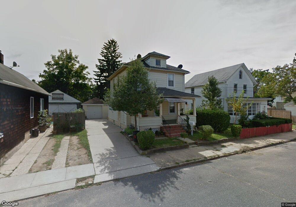
113 Leonard St Red Bank, NJ 07701
Estimated Value: $469,582 - $542,000
3
Beds
2
Baths
1,122
Sq Ft
$449/Sq Ft
Est. Value
About This Home
This home is located at 113 Leonard St, Red Bank, NJ 07701 and is currently estimated at $503,396, approximately $448 per square foot. 113 Leonard St is a home located in Monmouth County with nearby schools including Red Bank Primary School, Red Bank Middle School, and Red Bank Reg High School.
Ownership History
Date
Name
Owned For
Owner Type
Purchase Details
Closed on
Sep 4, 2024
Sold by
Ogidi Martin and Ogidi Mirian
Bought by
Ogidi Family Living Trust and Ogidi
Current Estimated Value
Purchase Details
Closed on
Sep 29, 1995
Sold by
Newton Henry
Bought by
Ogidi Martin and Ogidi Mirian
Home Financials for this Owner
Home Financials are based on the most recent Mortgage that was taken out on this home.
Original Mortgage
$76,000
Interest Rate
7.62%
Mortgage Type
VA
Create a Home Valuation Report for This Property
The Home Valuation Report is an in-depth analysis detailing your home's value as well as a comparison with similar homes in the area
Home Values in the Area
Average Home Value in this Area
Purchase History
| Date | Buyer | Sale Price | Title Company |
|---|---|---|---|
| Ogidi Family Living Trust | -- | None Listed On Document | |
| Ogidi Family Living Trust | -- | None Listed On Document | |
| Ogidi Martin | $74,500 | -- |
Source: Public Records
Mortgage History
| Date | Status | Borrower | Loan Amount |
|---|---|---|---|
| Previous Owner | Ogidi Martin | $76,000 |
Source: Public Records
Tax History Compared to Growth
Tax History
| Year | Tax Paid | Tax Assessment Tax Assessment Total Assessment is a certain percentage of the fair market value that is determined by local assessors to be the total taxable value of land and additions on the property. | Land | Improvement |
|---|---|---|---|---|
| 2025 | $5,771 | $343,400 | $155,200 | $188,200 |
| 2024 | $5,639 | $305,500 | $125,200 | $180,300 |
| 2023 | $5,639 | $295,100 | $119,800 | $175,300 |
| 2022 | $3,914 | $278,000 | $110,200 | $167,800 |
| 2021 | $3,914 | $244,600 | $91,800 | $152,800 |
| 2020 | $5,462 | $240,400 | $101,000 | $139,400 |
| 2019 | $5,094 | $230,400 | $96,000 | $134,400 |
| 2018 | $4,932 | $225,500 | $96,000 | $129,500 |
| 2017 | $4,528 | $214,600 | $86,000 | $128,600 |
| 2016 | $4,452 | $211,300 | $86,000 | $125,300 |
| 2015 | $4,149 | $216,400 | $128,000 | $88,400 |
| 2014 | $5,001 | $274,500 | $186,000 | $88,500 |
Source: Public Records
Map
Nearby Homes
- 32 Earl St
- 38 Bank St
- 167 River St
- 195 Bridge Ave
- 244 S Bridge Ave
- 24 River St
- 24 Cedar Crossing
- 23 Cedar Crossing
- 44 Sunset Ave W
- 3 Cedar Crossing
- 49 Sunset Ave W
- 58 W Westside Ave
- 19 Sunset Ave E
- 5 Clifford Graves Ct
- 9 Clifford Graves Ct
- 42 Chestnut St
- 11 Clifford Graves Ct
- 232 S Pearl St
- 253 Pearl St S
- 205 Maple Ave
- 109 Leonard St
- 117 Leonard St
- 107 Leonard St
- 114 Catherine St
- 112 Catherine St
- 108 Catherine St
- 108 Catherine St Unit 2
- 118 Catherine St
- 102 Catherine St
- 99 Leonard St
- 110 Leonard St
- 98 Catherine St
- 112 Leonard St
- 67 Leighton Ave
- 63 Leighton Ave
- 69 Leighton Ave
- 116 Leonard St
- 104 Leonard St
- 73 Leighton Ave
- 100 Leonard St