Estimated Value: $643,000 - $711,000
--
Bed
--
Bath
1,729
Sq Ft
$388/Sq Ft
Est. Value
About This Home
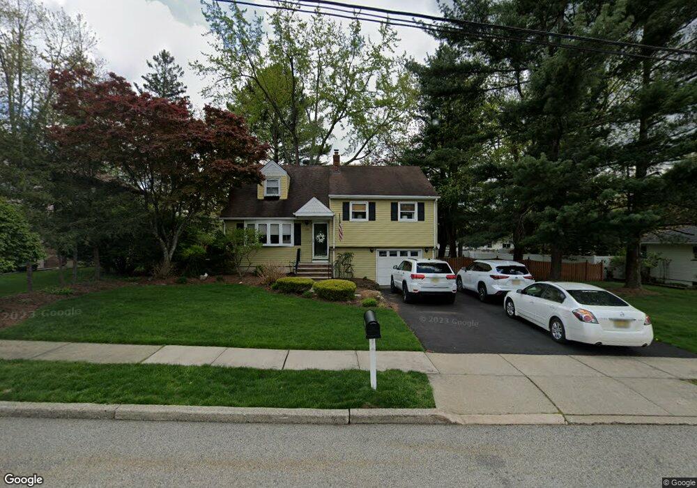
This home is located at 113 Longport Rd, Wayne, NJ 07470 and is currently estimated at $670,015, approximately $387 per square foot. 113 Longport Rd is a home located in Passaic County with nearby schools including Theunis Dey Elementary School, Schuyler-Colfax Middle School, and Wayne Hills High School.
Ownership History
Date
Name
Owned For
Owner Type
Purchase Details
Closed on
Sep 19, 2007
Sold by
Davies Christopher J
Bought by
Davies Christopher J and Davies Toni L
Current Estimated Value
Home Financials for this Owner
Home Financials are based on the most recent Mortgage that was taken out on this home.
Original Mortgage
$400,000
Outstanding Balance
$252,352
Interest Rate
6.59%
Mortgage Type
New Conventional
Estimated Equity
$417,663
Purchase Details
Closed on
Jun 2, 2003
Sold by
Oleary Susan
Bought by
Davies Chris
Home Financials for this Owner
Home Financials are based on the most recent Mortgage that was taken out on this home.
Original Mortgage
$299,900
Interest Rate
5.71%
Purchase Details
Closed on
Mar 17, 2003
Sold by
Giordano Dave
Bought by
O'Leary Susan
Home Financials for this Owner
Home Financials are based on the most recent Mortgage that was taken out on this home.
Original Mortgage
$360,000
Interest Rate
5.9%
Create a Home Valuation Report for This Property
The Home Valuation Report is an in-depth analysis detailing your home's value as well as a comparison with similar homes in the area
Home Values in the Area
Average Home Value in this Area
Purchase History
| Date | Buyer | Sale Price | Title Company |
|---|---|---|---|
| Davies Christopher J | -- | -- | |
| Davies Chris | $374,900 | -- | |
| O'Leary Susan | $450,000 | -- |
Source: Public Records
Mortgage History
| Date | Status | Borrower | Loan Amount |
|---|---|---|---|
| Open | Davies Christopher J | $400,000 | |
| Previous Owner | Davies Chris | $299,900 | |
| Previous Owner | O'Leary Susan | $360,000 |
Source: Public Records
Tax History Compared to Growth
Tax History
| Year | Tax Paid | Tax Assessment Tax Assessment Total Assessment is a certain percentage of the fair market value that is determined by local assessors to be the total taxable value of land and additions on the property. | Land | Improvement |
|---|---|---|---|---|
| 2025 | $10,649 | $179,100 | $105,800 | $73,300 |
| 2024 | $10,241 | $179,100 | $105,800 | $73,300 |
| 2022 | $10,126 | $179,100 | $105,800 | $73,300 |
| 2021 | $10,116 | $179,100 | $105,800 | $73,300 |
| 2020 | $10,071 | $179,100 | $105,800 | $73,300 |
| 2019 | $9,876 | $179,100 | $105,800 | $73,300 |
| 2018 | $9,788 | $179,100 | $105,800 | $73,300 |
| 2017 | $9,698 | $179,100 | $105,800 | $73,300 |
| 2016 | $9,562 | $179,100 | $105,800 | $73,300 |
| 2015 | $9,448 | $179,100 | $105,800 | $73,300 |
| 2014 | $9,181 | $179,100 | $105,800 | $73,300 |
Source: Public Records
Map
Nearby Homes
- 111 Deerfield Rd
- 4 Jeffrey Rd
- 12 Kingston Rd
- 20 Knight Rd
- 648 Black Oak Ridge Rd
- 26 Voorhis Place
- 26 Brookside Ave
- 20 Pitman Place
- 78 Maple Ln
- 120 Greenwood Ave
- 43 Madison St
- 520 Newark Pompton Turnpike Unit C316
- 7 Shore Rd
- 17 Garden Place
- 15 Shore Rd
- 23 Surrey Dr
- 29 Smith Ln
- 00 Oakwood Ave
- 1656 Hamburg Turnpike
- 2007 Hamburg Turnpike
- 109 Longport Rd
- 117 Longport Rd
- 106 Fieldstone Place
- 110 Fieldstone Place
- 105 Longport Rd
- 121 Longport Rd
- 114 Longport Rd
- 112 Longport Rd
- 100 Fieldstone Place
- 116 Fieldstone Place
- 89 Farmingdale Rd
- 108 Longport Rd
- 101 Longport Rd
- 105 Fieldstone Place
- 109 Fieldstone Place
- 83 Farmingdale Rd
- 96 Fieldstone Place
- 98 Farmingdale Rd
- 94 Farmingdale Rd
- 104 Longport Rd