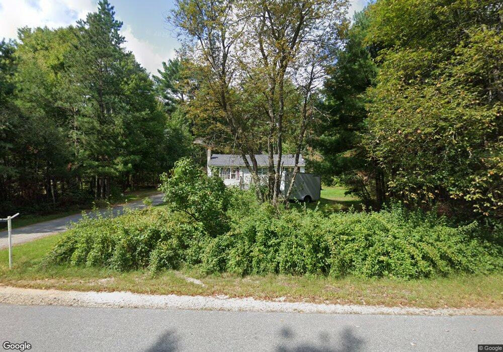
113 Lower Tarbox Rd Hollis Center, ME 04042
Hollis NeighborhoodEstimated Value: $354,000 - $389,000
3
Beds
1
Bath
960
Sq Ft
$387/Sq Ft
Est. Value
About This Home
This home is located at 113 Lower Tarbox Rd, Hollis Center, ME 04042 and is currently estimated at $371,674, approximately $387 per square foot. 113 Lower Tarbox Rd is a home located in York County with nearby schools including Bonny Eagle High School.
Ownership History
Date
Name
Owned For
Owner Type
Purchase Details
Closed on
Feb 9, 2010
Sold by
Parker Steven W Est
Bought by
Bailey Roberta J
Current Estimated Value
Home Financials for this Owner
Home Financials are based on the most recent Mortgage that was taken out on this home.
Original Mortgage
$132,000
Outstanding Balance
$87,449
Interest Rate
5.05%
Mortgage Type
Unknown
Estimated Equity
$284,225
Create a Home Valuation Report for This Property
The Home Valuation Report is an in-depth analysis detailing your home's value as well as a comparison with similar homes in the area
Home Values in the Area
Average Home Value in this Area
Purchase History
| Date | Buyer | Sale Price | Title Company |
|---|---|---|---|
| Bailey Roberta J | -- | -- |
Source: Public Records
Mortgage History
| Date | Status | Borrower | Loan Amount |
|---|---|---|---|
| Open | Bailey Roberta J | $132,000 |
Source: Public Records
Tax History Compared to Growth
Tax History
| Year | Tax Paid | Tax Assessment Tax Assessment Total Assessment is a certain percentage of the fair market value that is determined by local assessors to be the total taxable value of land and additions on the property. | Land | Improvement |
|---|---|---|---|---|
| 2024 | $2,122 | $141,460 | $57,120 | $84,340 |
| 2023 | $2,051 | $141,460 | $57,120 | $84,340 |
| 2022 | $2,122 | $141,460 | $57,120 | $84,340 |
| 2021 | $2,016 | $141,460 | $57,120 | $84,340 |
| 2020 | $1,980 | $141,460 | $57,120 | $84,340 |
| 2019 | $1,945 | $141,460 | $57,120 | $84,340 |
| 2018 | $1,874 | $141,460 | $57,120 | $84,340 |
| 2017 | $1,768 | $141,460 | $57,120 | $84,340 |
| 2016 | $1,690 | $141,460 | $57,120 | $84,340 |
| 2015 | $1,690 | $141,460 | $57,120 | $84,340 |
| 2014 | $1,627 | $141,460 | $57,120 | $84,340 |
| 2013 | $1,556 | $141,460 | $57,120 | $84,340 |
Source: Public Records
Map
Nearby Homes
- 252 Plains Rd
- 57 Landry Dr
- 47 Landry Dr
- 19 Frank Savage Rd
- 1102 Cape Rd
- 23 Old Limerick Rd
- 103 Hardscrabble Rd
- 24 Caroline Crossing
- 2 Bonny Eagle Rd
- TBD Green Acres
- 23 Bonny Eagle Rd
- 4 Pelletier Dr
- 18 Linda Ln
- 135 Bonny Eagle Rd
- 25 Adirondack Dr
- Lot 44A Hanson Ln
- Lot 44C Hanson Ln
- Lot # 0 Meadowbrook Dr
- 305 River Rd
- Lot 8 Pelletier Dr
- 119 Lower Tarbox Rd
- 112 Lower Tarbox Rd
- 107 Lower Tarbox Rd
- 366 Saco Rd
- 8 Fairwood Cir
- 5 Northwood Cir
- 382 Saco Rd
- 21 Northwood Cir
- 3 Fairwood Cir
- 25 Northwood Cir
- 14 Fairwood Cir
- 390 Saco Rd
- 350 Saco Rd
- 358 Saco Rd
- 357 Saco Rd
- 000 Saco Rd
- 29 Northwood Cir
- 46 Northwood Cir
- 398 Saco Rd
- 139 Lower Tarbox Rd