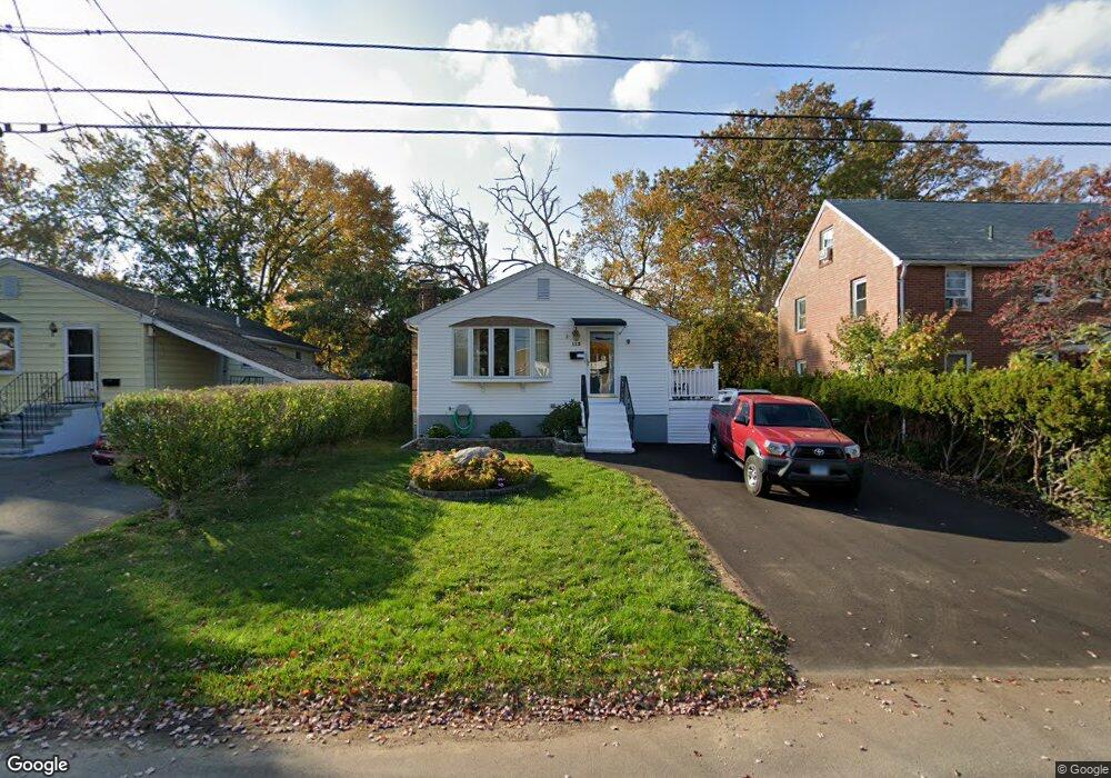
113 Lurton St New Britain, CT 06053
Estimated Value: $264,223 - $305,000
3
Beds
1
Bath
1,008
Sq Ft
$276/Sq Ft
Est. Value
About This Home
This home is located at 113 Lurton St, New Britain, CT 06053 and is currently estimated at $278,556, approximately $276 per square foot. 113 Lurton St is a home located in Hartford County with nearby schools including Jefferson School, Pulaski Middle School, and St. Francis of Assisi Middle School.
Create a Home Valuation Report for This Property
The Home Valuation Report is an in-depth analysis detailing your home's value as well as a comparison with similar homes in the area
Home Values in the Area
Average Home Value in this Area
Tax History Compared to Growth
Tax History
| Year | Tax Paid | Tax Assessment Tax Assessment Total Assessment is a certain percentage of the fair market value that is determined by local assessors to be the total taxable value of land and additions on the property. | Land | Improvement |
|---|---|---|---|---|
| 2025 | $4,410 | $112,560 | $32,690 | $79,870 |
| 2024 | $4,456 | $112,560 | $32,690 | $79,870 |
| 2023 | $4,309 | $112,560 | $32,690 | $79,870 |
| 2022 | $3,974 | $80,290 | $13,790 | $66,500 |
| 2021 | $3,936 | $79,520 | $13,790 | $65,730 |
| 2020 | $4,016 | $79,520 | $13,790 | $65,730 |
| 2019 | $4,016 | $79,520 | $13,790 | $65,730 |
| 2018 | $4,016 | $79,520 | $13,790 | $65,730 |
| 2017 | $3,949 | $78,190 | $13,790 | $64,400 |
| 2016 | $3,949 | $78,190 | $13,790 | $64,400 |
| 2015 | $3,831 | $78,190 | $13,790 | $64,400 |
| 2014 | $3,831 | $78,190 | $13,790 | $64,400 |
Source: Public Records
Map
Nearby Homes
- 34 Hutchinson St
- 910 Farmington Ave
- 59 Heather Ln
- 67 Eastwick Rd
- 187 Miriam Rd
- 83 Kim Dr
- 410 Farmington Ave Unit O6
- 148 Governor St
- 874 Slater Rd
- 152 Oakland Ave
- 394 Mcclintock St
- 57 Merigold Dr
- 234 Pierremount Ave
- 95 Pierremount Ave
- 27 Candlewood Ln
- 258 Eddy Glover Blvd
- 108 Commonwealth Ave
- 1114 Fienemann Rd
- 16 Jeffrey Dr
- 34 Oneida St