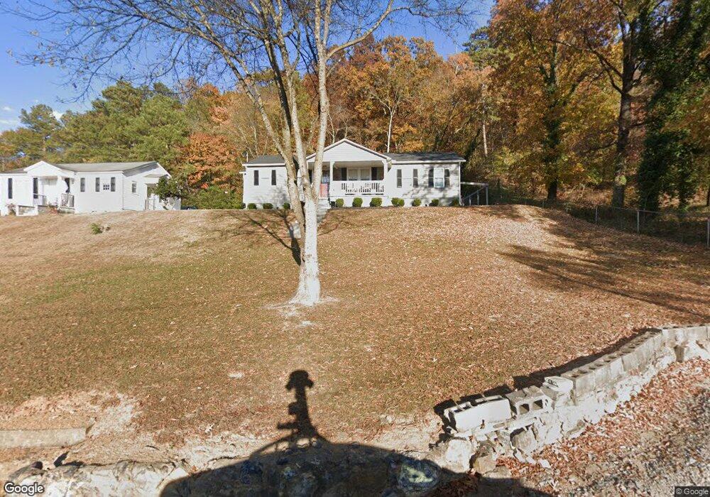
113 Mac Ave Calhoun, GA 30701
Estimated Value: $179,000 - $218,268
2
Beds
1
Bath
1,250
Sq Ft
$165/Sq Ft
Est. Value
About This Home
This home is located at 113 Mac Ave, Calhoun, GA 30701 and is currently estimated at $206,317, approximately $165 per square foot. 113 Mac Ave is a home located in Gordon County with nearby schools including Calhoun Elementary School, Calhoun Middle School, and Calhoun High School.
Ownership History
Date
Name
Owned For
Owner Type
Purchase Details
Closed on
Jan 15, 2021
Sold by
Harmon Timothy Lane
Bought by
Harmon Timothy Lane and Harmon Linda Michelle
Current Estimated Value
Purchase Details
Closed on
Nov 11, 2019
Sold by
Harmon Reavis Estate
Bought by
Harmon Timothy Lane
Purchase Details
Closed on
Apr 19, 1988
Sold by
Holland Jack
Bought by
Harmon Reavis
Purchase Details
Closed on
Jan 23, 1984
Sold by
Hayes Dean
Bought by
Holland Jack
Create a Home Valuation Report for This Property
The Home Valuation Report is an in-depth analysis detailing your home's value as well as a comparison with similar homes in the area
Purchase History
| Date | Buyer | Sale Price | Title Company |
|---|---|---|---|
| Harmon Timothy Lane | -- | -- | |
| Harmon Timothy Lane | -- | -- | |
| Harmon Reavis | $34,000 | -- | |
| Holland Jack | -- | -- |
Source: Public Records
Tax History
| Year | Tax Paid | Tax Assessment Tax Assessment Total Assessment is a certain percentage of the fair market value that is determined by local assessors to be the total taxable value of land and additions on the property. | Land | Improvement |
|---|---|---|---|---|
| 2025 | $1,600 | $64,920 | $5,520 | $59,400 |
| 2023 | $1,536 | $54,640 | $5,520 | $49,120 |
| 2022 | $493 | $51,840 | $5,520 | $46,320 |
| 2021 | $628 | $21,080 | $5,520 | $15,560 |
| 2020 | $640 | $21,320 | $5,520 | $15,800 |
| 2019 | $242 | $21,320 | $5,520 | $15,800 |
| 2018 | $175 | $20,160 | $5,520 | $14,640 |
| 2017 | $169 | $19,240 | $5,520 | $13,720 |
| 2016 | $173 | $19,548 | $5,520 | $14,028 |
| 2015 | $171 | $19,268 | $5,520 | $13,748 |
| 2014 | $160 | $18,378 | $5,530 | $12,848 |
Source: Public Records
Map
Nearby Homes
- 106 Mac Ave
- 200 Ridgeview Trail
- 0 Resaca Lafayette Rd Unit 10706558
- 0 Resaca Lafayette Rd Unit 10706565
- 156 Saddle Ridge Trail
- 138 Saddle Ridge Trail
- 00 Resaca Lafayette Rd
- 0 Resaca Lafayette Rd Unit 7731810
- 1401 Ga-53
- 101 Victory Ct
- 200 Cherry Hill Cir
- 198 Hillcrest Dr
- 300 Woodland Dr
- 212 Sherwood Dr
- 202 Woodland Cir
- 119 Peters St
- 105 Rory Dr
- 107 Rory Dr
- 102 Rory Dr
- 111 Rory Dr
- 111 Mac Ave
- 115 Mac Ave
- 109 Mac Ave
- 112 Mac Ave
- 420 S Wall St
- 110 Mac Ave
- 107 Mac Ave
- 422 S Wall St
- 105 Mac Ave
- 200 S Dale Ave
- S Wall Station Unit 414 & 418
- 518 (47) McGinnis Circles
- 00 Benstone Dr
- 102 S Dale Ave
- 102 S Dale Ave
- 202 Cove St
- 204 Cove St
- 414 S Wall St Unit 414 &
- 414 S Wall St Unit 418
- 200 Cove St
Your Personal Tour Guide
Ask me questions while you tour the home.