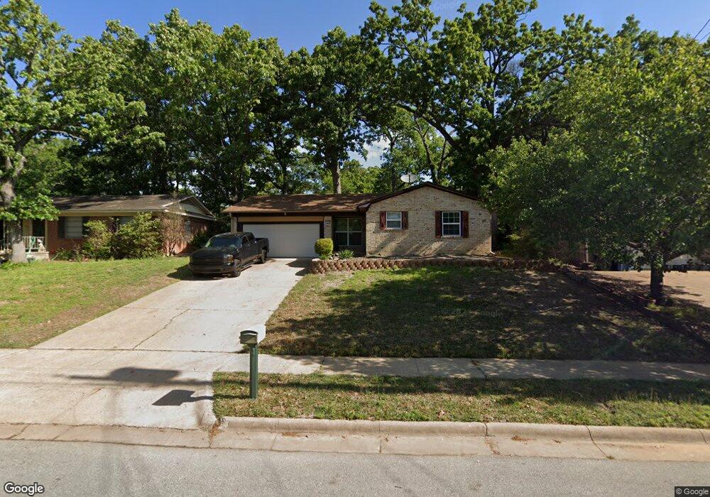
113 Mark Dr Denison, TX 75021
Estimated Value: $197,524 - $241,000
3
Beds
2
Baths
1,264
Sq Ft
$173/Sq Ft
Est. Value
About This Home
This home is located at 113 Mark Dr, Denison, TX 75021 and is currently estimated at $219,262, approximately $173 per square foot. 113 Mark Dr is a home located in Grayson County with nearby schools including Lamar Elementary School, Scott Middle School, and Denison High School.
Ownership History
Date
Name
Owned For
Owner Type
Purchase Details
Closed on
Jul 7, 2015
Sold by
Peterman Michael and Peterman Michael Ruben
Bought by
Jacobs Tyler Brooks
Current Estimated Value
Home Financials for this Owner
Home Financials are based on the most recent Mortgage that was taken out on this home.
Original Mortgage
$100,000
Outstanding Balance
$78,569
Interest Rate
4.08%
Mortgage Type
VA
Estimated Equity
$140,693
Purchase Details
Closed on
Sep 18, 2009
Sold by
Peterman Cathy Lyn
Bought by
Peterman Michael Ruben
Home Financials for this Owner
Home Financials are based on the most recent Mortgage that was taken out on this home.
Original Mortgage
$94,261
Interest Rate
5.36%
Mortgage Type
FHA
Purchase Details
Closed on
May 14, 2008
Sold by
Medearis Linda Lee Chapman
Bought by
Shaw Edwin S and Shaw Mary C
Create a Home Valuation Report for This Property
The Home Valuation Report is an in-depth analysis detailing your home's value as well as a comparison with similar homes in the area
Home Values in the Area
Average Home Value in this Area
Purchase History
| Date | Buyer | Sale Price | Title Company |
|---|---|---|---|
| Jacobs Tyler Brooks | -- | Ort | |
| Jacobs Tyler Brooks | -- | Ort | |
| Peterman Michael Ruben | -- | Security Title | |
| Peterman Michael | -- | Security Title | |
| Shaw Edwin S | -- | Grayson County Title |
Source: Public Records
Mortgage History
| Date | Status | Borrower | Loan Amount |
|---|---|---|---|
| Open | Jacobs Tyler Brooks | $100,000 | |
| Closed | Jacobs Tyler Brooks | $100,000 | |
| Previous Owner | Peterman Michael | $94,261 |
Source: Public Records
Tax History Compared to Growth
Tax History
| Year | Tax Paid | Tax Assessment Tax Assessment Total Assessment is a certain percentage of the fair market value that is determined by local assessors to be the total taxable value of land and additions on the property. | Land | Improvement |
|---|---|---|---|---|
| 2025 | $2,627 | $192,083 | $36,288 | $155,795 |
| 2024 | $4,180 | $179,929 | $0 | $0 |
| 2023 | $2,163 | $163,572 | $0 | $0 |
| 2022 | $3,533 | $148,702 | $29,952 | $118,750 |
| 2021 | $3,483 | $138,090 | $14,544 | $123,546 |
| 2020 | $3,422 | $129,744 | $14,544 | $115,200 |
| 2019 | $3,468 | $126,258 | $9,576 | $116,682 |
| 2018 | $3,178 | $114,573 | $9,576 | $104,997 |
| 2017 | $2,918 | $104,294 | $9,576 | $94,718 |
| 2016 | $2,751 | $98,347 | $9,576 | $88,771 |
| 2015 | $2,119 | $95,522 | $8,136 | $87,386 |
| 2014 | $2,046 | $83,267 | $8,136 | $75,131 |
Source: Public Records
Map
Nearby Homes
- 153 Circle Dr
- 1905 S Lamar Ave
- 1903 S Lamar Ave
- 1901 S Lamar Ave
- 430 W Coffin St
- 2000 S Fannin Ave
- 508 W Florence St
- 509 W Coffin St
- 513 W Coffin St
- 516 W Florence St
- 1927 S Fannin Ave
- 505 W Ford St
- 614 W Collins St
- 614 Rice St
- 607 W Baker St
- 611 W Baker St
- 616 & 618 Rice St
- 608 W Baker St
- 601 Dubois St
- 701 W Star St