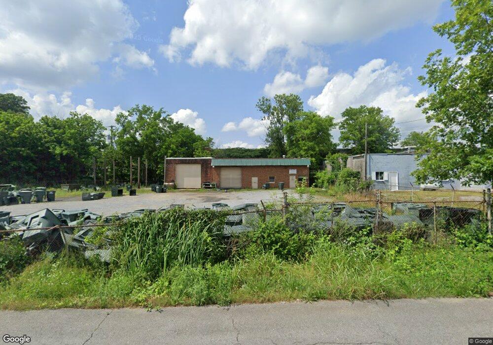
113 McFalls St Dalton, GA 30721
Estimated Value: $80,343
--
Bed
1
Bath
2,849
Sq Ft
$28/Sq Ft
Est. Value
About This Home
This home is located at 113 McFalls St, Dalton, GA 30721 and is currently estimated at $80,343, approximately $28 per square foot. 113 McFalls St is a home located in Whitfield County with nearby schools including Pleasant Grove Elementary School, New Hope Middle School, and Northwest Whitfield County High School.
Ownership History
Date
Name
Owned For
Owner Type
Purchase Details
Closed on
Aug 19, 2024
Sold by
Super Garbage Properties Llc
Bought by
Stanley Wanda Gail and Vance Gene
Current Estimated Value
Purchase Details
Closed on
Jun 15, 2021
Sold by
Mcfalls Brian Douglas
Bought by
Super Garbage Properties
Purchase Details
Closed on
Apr 28, 2021
Sold by
Talley Laura Mcfalls
Bought by
Mcfalls Brian Douglas
Purchase Details
Closed on
May 31, 2018
Sold by
Mcfalls
Bought by
Mcfalls Paula Allen
Create a Home Valuation Report for This Property
The Home Valuation Report is an in-depth analysis detailing your home's value as well as a comparison with similar homes in the area
Home Values in the Area
Average Home Value in this Area
Purchase History
| Date | Buyer | Sale Price | Title Company |
|---|---|---|---|
| Stanley Wanda Gail | $77,500 | None Listed On Document | |
| Super Garbage Properties | -- | -- | |
| Mcfalls Brian Douglas | -- | -- | |
| Mcfalls Brian Douglas | -- | -- | |
| Mcfalls Paula Allen | -- | -- |
Source: Public Records
Tax History Compared to Growth
Tax History
| Year | Tax Paid | Tax Assessment Tax Assessment Total Assessment is a certain percentage of the fair market value that is determined by local assessors to be the total taxable value of land and additions on the property. | Land | Improvement |
|---|---|---|---|---|
| 2024 | $1,206 | $43,794 | $24,000 | $19,794 |
| 2023 | $840 | $28,484 | $10,200 | $18,284 |
| 2022 | $840 | $28,484 | $10,200 | $18,284 |
| 2021 | $840 | $28,484 | $10,200 | $18,284 |
| 2020 | $869 | $28,484 | $10,200 | $18,284 |
| 2019 | $883 | $28,484 | $10,200 | $18,284 |
| 2018 | $897 | $28,484 | $10,200 | $18,284 |
| 2017 | $898 | $28,484 | $10,200 | $18,284 |
| 2016 | $864 | $28,484 | $10,200 | $18,284 |
| 2014 | $767 | $28,484 | $10,200 | $18,284 |
| 2013 | -- | $28,484 | $10,200 | $18,284 |
Source: Public Records
Map
Nearby Homes
- 1600 Puryear Dr NW
- 1696 Red Oak Dr Unit 184
- 1696 Red Oak Dr
- 1696 Red Oak Dr Unit 181
- 413 Gillum Dr
- 1699 Burnt Oak Dr
- 1699 Burnt Oak Dr Unit 195
- 1699 Pin Oak Dr Unit 133
- 1695 N Summit Dr
- 1713 Brighton Way
- 0 Smith Industrial Blvd
- 1614 Waring Rd NW
- 1702 Chestnut Oak Dr
- 1702 Chestnut Oak Dr Unit 83
- 1730 Brighton Way
- 1706 Chestnut Oak Dr Unit 90
- 1709 Willow Oak Ln Unit 53
- 1899 N Summit Dr Unit 66
- 1899 Middle Summit Dr Unit 98
- 1903 Middle Summit Dr
- 114 McFalls St
- 120 McFalls St
- 112 McFalls St
- 227 Hollywood Dr Unit 489-489
- 227 Hollywood Dr
- 259 Hollywood Dr
- 273 Hollywood Dr
- 125A Hollywood Dr
- 289 Hollywood Dr
- 1607 Cleveland Hwy
- 128 McFalls St
- 126 McFalls St
- 129 McFalls St
- 116 Pritchard Dr
- 126 York St
- 125B Hollywood Dr
- 120 Pritchard Dr
- 309 Hollywood Dr
- 128 York St
- 119 Hollywood Dr