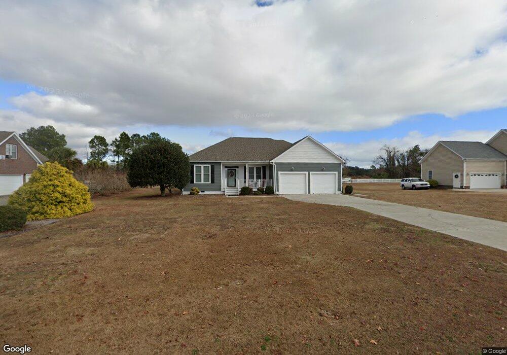
113 Middle Point Rd Hampstead, NC 28443
Estimated Value: $488,000 - $583,000
3
Beds
3
Baths
2,022
Sq Ft
$260/Sq Ft
Est. Value
About This Home
This home is located at 113 Middle Point Rd, Hampstead, NC 28443 and is currently estimated at $526,214, approximately $260 per square foot. 113 Middle Point Rd is a home located in Pender County with nearby schools including North Topsail Elementary School, Topsail Middle School, and Topsail High School.
Ownership History
Date
Name
Owned For
Owner Type
Purchase Details
Closed on
Sep 29, 2009
Sold by
Gillis Eric Allen and Gillis Anona Elizabeth
Bought by
Bryan Bobby J and Bryan Linda C
Current Estimated Value
Home Financials for this Owner
Home Financials are based on the most recent Mortgage that was taken out on this home.
Original Mortgage
$196,000
Outstanding Balance
$128,181
Interest Rate
5.11%
Mortgage Type
New Conventional
Estimated Equity
$398,033
Create a Home Valuation Report for This Property
The Home Valuation Report is an in-depth analysis detailing your home's value as well as a comparison with similar homes in the area
Home Values in the Area
Average Home Value in this Area
Purchase History
| Date | Buyer | Sale Price | Title Company |
|---|---|---|---|
| Bryan Bobby J | $245,000 | -- |
Source: Public Records
Mortgage History
| Date | Status | Borrower | Loan Amount |
|---|---|---|---|
| Open | Bryan Bobby J | $196,000 |
Source: Public Records
Tax History Compared to Growth
Tax History
| Year | Tax Paid | Tax Assessment Tax Assessment Total Assessment is a certain percentage of the fair market value that is determined by local assessors to be the total taxable value of land and additions on the property. | Land | Improvement |
|---|---|---|---|---|
| 2024 | $3,122 | $315,898 | $86,161 | $229,737 |
| 2023 | $2,850 | $315,898 | $86,161 | $229,737 |
| 2022 | $2,850 | $315,898 | $86,161 | $229,737 |
| 2021 | $2,850 | $315,898 | $86,161 | $229,737 |
| 2020 | $2,850 | $315,898 | $86,161 | $229,737 |
| 2019 | $2,850 | $315,898 | $86,161 | $229,737 |
| 2018 | $2,468 | $257,687 | $60,000 | $197,687 |
| 2017 | $2,468 | $257,687 | $60,000 | $197,687 |
| 2016 | $2,333 | $257,687 | $60,000 | $197,687 |
| 2015 | $2,315 | $257,687 | $60,000 | $197,687 |
| 2014 | $1,811 | $257,687 | $60,000 | $197,687 |
| 2013 | -- | $257,687 | $60,000 | $197,687 |
| 2012 | -- | $269,538 | $60,000 | $209,538 |
Source: Public Records
Map
Nearby Homes
- 120 Middle Point Rd
- Tr 9 W Windward Landing Place
- 396 Hickory Point Rd
- 506 E Windward Landing Place
- 207 Cole Dr
- 406 Compass Point
- 121 Summerset Landing
- 700 Bertram Ct
- 508 Navigator Dr
- 410 Masters Ln
- 305 Tall Ships Ln
- L14 Mallard Dr
- 11 E Bailey Ln
- 316 Masters Ln
- 108 S Lamplighters Walk
- 203 Hatteras Ct
- 1044 Mallard Bay Rd
- 2036 Sloop Point Loop Rd Unit A2
- 2036 Sloop Point Loop Rd Unit A6
- 2036 Sloop Point Loop Rd Unit A3
- 115 Middle Point Rd
- 111 Middle Point Rd
- 132 Middle Point Rd
- 20 Middle Point Rd
- 0 Middle Point Rd
- 1 Middle Point Rd
- 131 Middle Point Rd
- 50 Middle Point Rd
- 59 Middle Point Rd
- 117 Middle Point Rd
- 300 Frans Path
- 109 Middle Point Rd
- 301 Frans Path
- 20 Fran's Path
- 110 Middle Point Rd
- 107 Middle Point Rd
- 302 Frans Path
- 108 Middle Point Rd
- 118 Middle Point Rd
- 121 Middle Point Rd