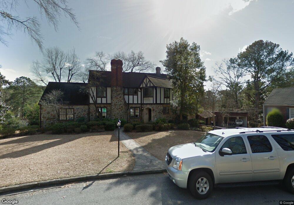
113 Mountary Cir Gadsden, AL 35901
Estimated Value: $473,000 - $657,000
5
Beds
5
Baths
5,733
Sq Ft
$99/Sq Ft
Est. Value
About This Home
This home is located at 113 Mountary Cir, Gadsden, AL 35901 and is currently estimated at $566,992, approximately $98 per square foot. 113 Mountary Cir is a home located in Etowah County with nearby schools including Eura Brown Elementary School, Gadsden Middle School, and Gadsden City High School.
Ownership History
Date
Name
Owned For
Owner Type
Purchase Details
Closed on
Oct 25, 2016
Bought by
Kemp William and Kemp Kelly
Current Estimated Value
Home Financials for this Owner
Home Financials are based on the most recent Mortgage that was taken out on this home.
Original Mortgage
$260,000
Outstanding Balance
$208,277
Interest Rate
3.52%
Estimated Equity
$358,715
Purchase Details
Closed on
Mar 9, 2012
Sold by
Kelling Dennis L
Bought by
Kemp Kelly H and Kemp William Bledsoe
Create a Home Valuation Report for This Property
The Home Valuation Report is an in-depth analysis detailing your home's value as well as a comparison with similar homes in the area
Home Values in the Area
Average Home Value in this Area
Purchase History
| Date | Buyer | Sale Price | Title Company |
|---|---|---|---|
| Kemp William | -- | -- | |
| Kemp Kelly H | -- | -- |
Source: Public Records
Mortgage History
| Date | Status | Borrower | Loan Amount |
|---|---|---|---|
| Open | Kemp William | $260,000 | |
| Closed | Kemp William | -- |
Source: Public Records
Tax History Compared to Growth
Tax History
| Year | Tax Paid | Tax Assessment Tax Assessment Total Assessment is a certain percentage of the fair market value that is determined by local assessors to be the total taxable value of land and additions on the property. | Land | Improvement |
|---|---|---|---|---|
| 2025 | $2,306 | $48,060 | $7,700 | $40,360 |
| 2024 | $2,306 | $48,060 | $7,700 | $40,360 |
| 2023 | $2,306 | $48,040 | $7,690 | $40,350 |
| 2022 | $4,203 | $42,890 | $7,690 | $35,200 |
| 2021 | $3,562 | $36,350 | $7,630 | $28,720 |
| 2020 | $1,733 | $36,360 | $0 | $0 |
| 2019 | $1,733 | $36,360 | $0 | $0 |
| 2017 | $1,510 | $31,820 | $0 | $0 |
| 2016 | $1,510 | $31,820 | $0 | $0 |
| 2015 | $1,510 | $31,820 | $0 | $0 |
| 2013 | -- | $49,840 | $0 | $0 |
Source: Public Records
Map
Nearby Homes
- 238 Sunnydale Rd
- 162 Fairoaks St
- 315 Alpine View
- 211 Alpine View
- 1879 Rainbow Dr
- 213 Lakewood Dr
- 1105 Sangster Rd
- 209 Beechwood Pass
- 147 Lakewood Dr
- 135 Bryant St
- 100 Lakepoint Dr
- 343 Lakepoint Dr
- 206 Lakepoint Dr
- 214 Lakepoint Dr
- 1255 Sangster Rd
- 219 Cordell St
- 11 Camille Cir
- 17 Waterford Place
- 19 Waterford Place
- .34 +/- Acres Lakeshore Dr
- 146 Fairoaks St
- 125 Mountary Cir
- 115 Arc 1
- 154 Fairoaks St
- 107 Arc 1
- 103 Mountary Cir
- 114 Mountary Cir
- 104 Mountary Cir
- 131 Mountary Cir
- 158 Fairoaks St
- 133 Mountary Cir
- 117 Sunnydale Rd
- 138 Fairoaks St
- 113 Hypoint St
- 124 Sunnydale Rd
- 155 Fairoaks St
- 242 Sunnydale Rd
- 120 Sunnydale Rd
- 132 Sunnydale Rd
- 147 Fairoaks St