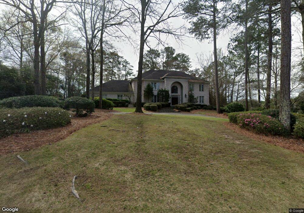
113 Muirfield Rd Macon, GA 31210
Estimated Value: $873,000 - $1,024,997
4
Beds
6
Baths
4,838
Sq Ft
$191/Sq Ft
Est. Value
About This Home
This home is located at 113 Muirfield Rd, Macon, GA 31210 and is currently estimated at $924,332, approximately $191 per square foot. 113 Muirfield Rd is a home located in Bibb County with nearby schools including Carter Elementary School, Howard Middle School, and Howard High School.
Ownership History
Date
Name
Owned For
Owner Type
Purchase Details
Closed on
May 10, 1994
Sold by
Koenig Thomas L and Koenig Elouise C
Bought by
Pitts Billy and Ruth Alfrida
Current Estimated Value
Create a Home Valuation Report for This Property
The Home Valuation Report is an in-depth analysis detailing your home's value as well as a comparison with similar homes in the area
Home Values in the Area
Average Home Value in this Area
Purchase History
| Date | Buyer | Sale Price | Title Company |
|---|---|---|---|
| Pitts Billy | $455,000 | -- |
Source: Public Records
Tax History Compared to Growth
Tax History
| Year | Tax Paid | Tax Assessment Tax Assessment Total Assessment is a certain percentage of the fair market value that is determined by local assessors to be the total taxable value of land and additions on the property. | Land | Improvement |
|---|---|---|---|---|
| 2025 | $8,341 | $346,411 | $67,680 | $278,731 |
| 2024 | $8,620 | $346,411 | $67,680 | $278,731 |
| 2023 | $9,353 | $322,750 | $67,680 | $255,070 |
| 2022 | $9,683 | $286,678 | $28,800 | $257,878 |
| 2021 | $9,988 | $269,830 | $28,800 | $241,030 |
| 2020 | $9,560 | $253,236 | $24,000 | $229,236 |
| 2019 | $8,782 | $231,332 | $24,000 | $207,332 |
| 2018 | $13,629 | $231,332 | $24,000 | $207,332 |
| 2017 | $8,405 | $231,332 | $24,000 | $207,332 |
| 2016 | $7,761 | $231,332 | $24,000 | $207,332 |
| 2015 | $10,986 | $231,332 | $24,000 | $207,332 |
| 2014 | $11,003 | $231,332 | $24,000 | $207,332 |
Source: Public Records
Map
Nearby Homes
- 111 Muirfield Rd
- 117 Troon Way
- 118 Troon Way
- 109 Muirfield Rd
- 110 Muirfield Rd
- 113 Legare Ct
- 115 Troon Way
- 116 Troon Way
- 107 Muirfield Rd
- 120 Legare Ct
- 108 Muirfield Rd
- 105 Legare Ct
- 105 Legare Ct Unit 2
- 114 Troon Way
- 101 Legare Ct
- 108 Legare Ct Unit 9
- 108 Legare Ct
- 111 Troon Way
- 116 Legare Ct
- 104 Legare Ct Unit 10