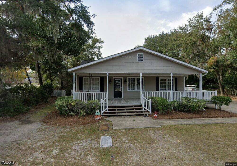
113 N Commerce St Hinesville, GA 31313
Estimated Value: $323,355
--
Bed
--
Bath
1,316
Sq Ft
$246/Sq Ft
Est. Value
About This Home
This home is located at 113 N Commerce St, Hinesville, GA 31313 and is currently estimated at $323,355, approximately $245 per square foot. 113 N Commerce St is a home located in Liberty County with nearby schools including Joseph Martin Elementary School, Snelson-Golden Middle School, and Liberty County High School.
Ownership History
Date
Name
Owned For
Owner Type
Purchase Details
Closed on
May 17, 2018
Sold by
Kent D Pedrick
Bought by
Long Trent
Current Estimated Value
Home Financials for this Owner
Home Financials are based on the most recent Mortgage that was taken out on this home.
Original Mortgage
$132,000
Outstanding Balance
$114,201
Interest Rate
4.61%
Estimated Equity
$209,154
Purchase Details
Closed on
Feb 8, 2018
Sold by
Pedrick Kent D
Bought by
Long Trent R
Home Financials for this Owner
Home Financials are based on the most recent Mortgage that was taken out on this home.
Original Mortgage
$132,000
Interest Rate
3.99%
Mortgage Type
Commercial
Purchase Details
Closed on
Oct 18, 2000
Sold by
Osteen C Joel
Bought by
Pedrick Kent D
Purchase Details
Closed on
Jun 30, 1997
Sold by
Carlson Wanda G
Bought by
Osteen C Joel
Purchase Details
Closed on
Aug 24, 1984
Bought by
Carlson Wanda G
Create a Home Valuation Report for This Property
The Home Valuation Report is an in-depth analysis detailing your home's value as well as a comparison with similar homes in the area
Home Values in the Area
Average Home Value in this Area
Purchase History
| Date | Buyer | Sale Price | Title Company |
|---|---|---|---|
| Long Trent | $165,000 | -- | |
| Long Trent R | $165,000 | -- | |
| Pedrick Kent D | $110,000 | -- | |
| Osteen C Joel | $69,000 | -- | |
| Carlson Wanda G | $40,800 | -- |
Source: Public Records
Mortgage History
| Date | Status | Borrower | Loan Amount |
|---|---|---|---|
| Open | Long Trent | $132,000 | |
| Closed | Long Trent | -- | |
| Previous Owner | Long Trent R | $132,000 |
Source: Public Records
Tax History Compared to Growth
Tax History
| Year | Tax Paid | Tax Assessment Tax Assessment Total Assessment is a certain percentage of the fair market value that is determined by local assessors to be the total taxable value of land and additions on the property. | Land | Improvement |
|---|---|---|---|---|
| 2024 | $2,117 | $43,366 | $12,760 | $30,606 |
| 2023 | $2,117 | $44,185 | $12,760 | $31,425 |
| 2022 | $1,747 | $37,829 | $12,760 | $25,069 |
| 2021 | $1,828 | $38,856 | $12,760 | $26,096 |
| 2020 | $2,016 | $42,436 | $15,988 | $26,448 |
| 2019 | $2,032 | $43,111 | $15,988 | $27,123 |
| 2018 | $1,917 | $40,891 | $15,988 | $24,903 |
| 2017 | $1,358 | $41,244 | $15,988 | $25,256 |
| 2016 | $1,872 | $41,918 | $15,988 | $25,930 |
| 2015 | $1,908 | $41,918 | $15,988 | $25,930 |
| 2014 | $1,908 | $42,274 | $15,988 | $26,287 |
| 2013 | -- | $42,627 | $15,987 | $26,639 |
Source: Public Records
Map
Nearby Homes
- 4 Lots Memorial Dr
- 996 Stone Ct
- 1 Oglethorpe Ave
- 980 Grayson Ave
- 804 Grayson Ave
- 864 Grayson Ave
- 1078 Grayson Ave
- 148 Marron Way
- 205 Wilson Ave
- 215 Collins Ln
- 215 Collins Ln Unit A
- 103 Stewart Terrace
- 402 W Oglethorpe Hwy
- 322 W Memorial West Dr
- 411 Woodland Dr
- 108 W General Stewart Way
- 0 General Stewart Way
- 411 Rogers Rd
- 76 Boundary Hall Way
- 86 Boundary Hall Way
- 0 Commerce St
- 114 N Commerce St
- 112 N Commerce St
- 110 N Commerce St
- 300 N Main St
- 101 E Memorial Dr
- 101 E Memorial Dr
- 201 E Memorial Dr
- 139 Hazy Ln
- 62 Hazy Ln
- 41 Hazy Ln
- 49 Hazy Ln
- 65 Hazy Ln
- 89 Hazy Ln
- 117 Hazy Ln
- 58 Honey Ct
- 100 Courthouse Dr
- 1-10 W. Courthouse Dr
- 203 N Main St
- 108 N Commerce St Unit D