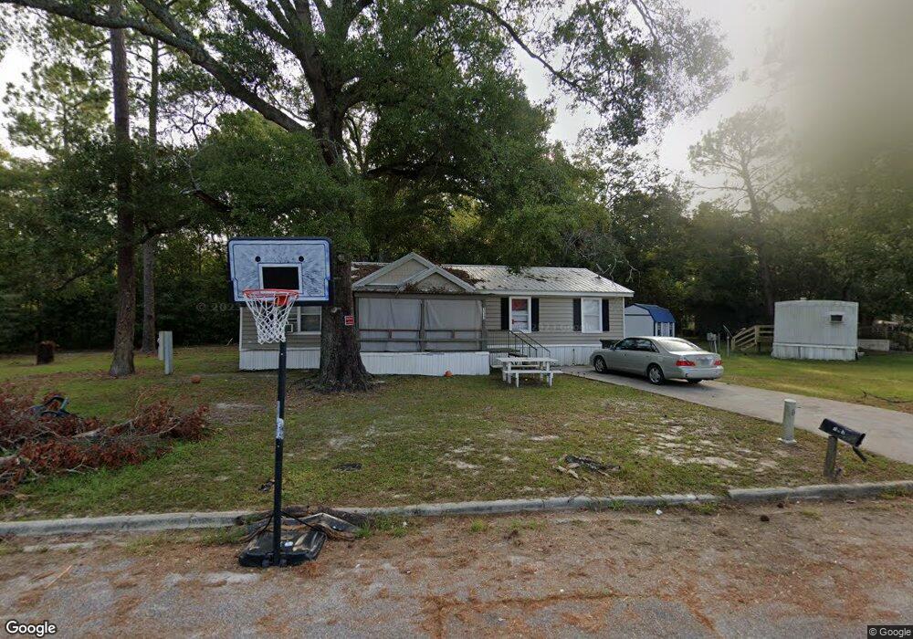
113 Phillips Ave Waycross, GA 31503
Estimated Value: $47,286 - $129,000
5
Beds
3
Baths
1,800
Sq Ft
$52/Sq Ft
Est. Value
About This Home
This home is located at 113 Phillips Ave, Waycross, GA 31503 and is currently estimated at $94,072, approximately $52 per square foot. 113 Phillips Ave is a home located in Ware County with nearby schools including Ruskin Elementary School, Ware County Middle School, and Ware County High School.
Ownership History
Date
Name
Owned For
Owner Type
Purchase Details
Closed on
Jun 11, 2024
Sold by
Conner Nicole Sunshine
Bought by
Luke Terry W
Current Estimated Value
Purchase Details
Closed on
Jun 5, 2024
Sold by
Conner Andrew Patrick
Bought by
Luke Terry W
Purchase Details
Closed on
Nov 10, 2020
Sold by
Primesouth Bank Waycross
Bought by
James Carol A and James Stephanie H
Purchase Details
Closed on
Nov 9, 2020
Sold by
James Carol A
Bought by
Rural Georgia Housing Llc
Purchase Details
Closed on
Oct 17, 2007
Sold by
Merchant Laura
Bought by
James Carol A
Create a Home Valuation Report for This Property
The Home Valuation Report is an in-depth analysis detailing your home's value as well as a comparison with similar homes in the area
Purchase History
| Date | Buyer | Sale Price | Title Company |
|---|---|---|---|
| Luke Terry W | $100,000 | -- | |
| Luke Terry W | -- | -- | |
| James Carol A | -- | -- | |
| Rural Georgia Housing Llc | $170,000 | -- | |
| James Carol A | $7,500 | -- |
Source: Public Records
Tax History
| Year | Tax Paid | Tax Assessment Tax Assessment Total Assessment is a certain percentage of the fair market value that is determined by local assessors to be the total taxable value of land and additions on the property. | Land | Improvement |
|---|---|---|---|---|
| 2025 | $120 | $3,560 | $1,560 | $2,000 |
| 2024 | $142 | $3,560 | $1,560 | $2,000 |
| 2023 | $175 | $4,400 | $2,800 | $1,600 |
| 2022 | $175 | $4,400 | $2,800 | $1,600 |
| 2021 | $115 | $7,119 | $0 | $7,119 |
| 2020 | $122 | $6,709 | $0 | $6,709 |
| 2019 | $124 | $7,018 | $0 | $7,018 |
| 2018 | $125 | $7,324 | $0 | $7,324 |
| 2017 | $122 | $7,364 | $0 | $7,364 |
Source: Public Records
Map
Nearby Homes
- 0 S Georgia Pkwy W
- 6905 Kendal Ct
- 0 Camp Branch Cross Rd Unit 25948480
- 920 Wilfred St
- 803 Bertha St
- 801 Bertha St
- 807 Bertha St
- 805 Bertha St
- 1009 Johanna St
- 1502 Roosevelt St
- 717 Glenmore Ave
- 00 Roosevelt St
- 1721 Minnesota Ave
- 1003 Carswell Ave
- 000 Minnesota Ave
- 907 Mary St
- 601 N Nicholls St
- 905 Mary St
- 915 Carswell Ave
- 1006 Roosevelt St
- 115 Phillips Ave
- 117 Phillips Ave
- 110 Phillips Ave
- 121 Phillips Ave
- 120 Phillips Ave
- 204 Norwood Dr
- 124 Phillips Ave
- 128 Phillips Ave
- 108 Phillips Ave
- 122 Phillips Ave
- 32 Norwood Cir
- 104 Phillips Ave
- 132 Phillips Ave
- 127 Phillips Ave
- 212 Norwood Dr
- 218 Norwood Dr
- 140 Phillips Ave
- 0 Highway 82 Unit 7458437
- 0 Highway 82 Unit 24541
- 45 Norwood Cir E
Your Personal Tour Guide
Ask me questions while you tour the home.