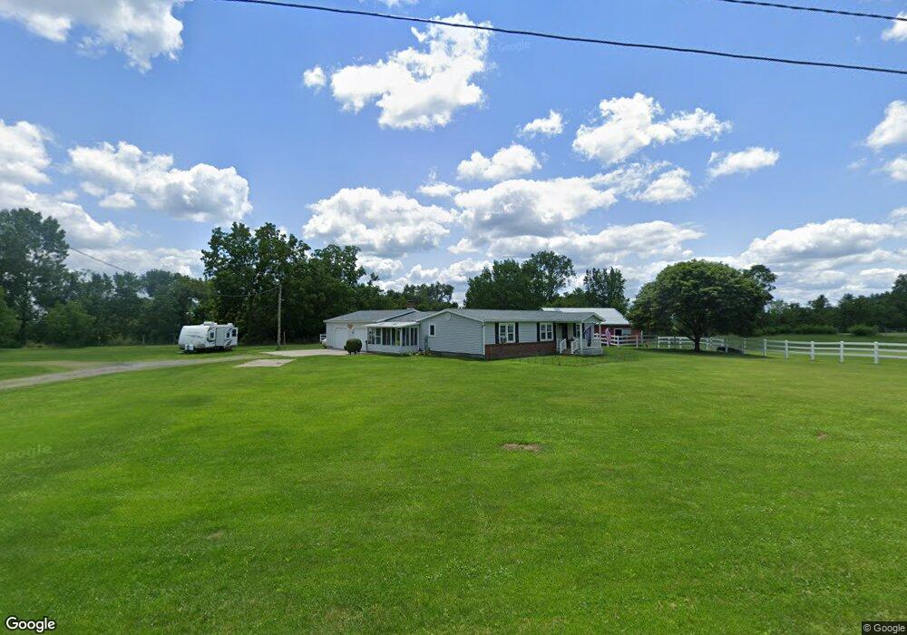
113 Pine St West Unity, OH 43570
Estimated Value: $170,000 - $212,000
3
Beds
2
Baths
1,440
Sq Ft
$136/Sq Ft
Est. Value
About This Home
This home is located at 113 Pine St, West Unity, OH 43570 and is currently estimated at $195,162, approximately $135 per square foot. 113 Pine St is a home located in Williams County with nearby schools including Hilltop Elementary School and Hilltop High School.
Ownership History
Date
Name
Owned For
Owner Type
Purchase Details
Closed on
Jun 13, 2025
Sold by
Spencer Bonnie K and Spencer Mark C
Bought by
Adkins Derrick and Beliveau Danya
Current Estimated Value
Home Financials for this Owner
Home Financials are based on the most recent Mortgage that was taken out on this home.
Original Mortgage
$148,000
Outstanding Balance
$147,616
Interest Rate
6.76%
Mortgage Type
New Conventional
Estimated Equity
$47,546
Purchase Details
Closed on
Jan 1, 1990
Bought by
Hornung Dale A
Create a Home Valuation Report for This Property
The Home Valuation Report is an in-depth analysis detailing your home's value as well as a comparison with similar homes in the area
Purchase History
| Date | Buyer | Sale Price | Title Company |
|---|---|---|---|
| Adkins Derrick | $185,000 | None Listed On Document | |
| Adkins Derrick | $185,000 | None Listed On Document | |
| Hornung Dale A | -- | -- |
Source: Public Records
Mortgage History
| Date | Status | Borrower | Loan Amount |
|---|---|---|---|
| Open | Adkins Derrick | $148,000 | |
| Closed | Adkins Derrick | $148,000 |
Source: Public Records
Tax History
| Year | Tax Paid | Tax Assessment Tax Assessment Total Assessment is a certain percentage of the fair market value that is determined by local assessors to be the total taxable value of land and additions on the property. | Land | Improvement |
|---|---|---|---|---|
| 2025 | $2,931 | $72,770 | $23,070 | $49,700 |
| 2024 | $2,931 | $72,770 | $23,070 | $49,700 |
| 2023 | $2,930 | $59,150 | $19,740 | $39,410 |
| 2022 | $2,831 | $59,150 | $19,740 | $39,410 |
| 2021 | $2,843 | $59,150 | $19,740 | $39,410 |
| 2020 | $2,538 | $51,210 | $16,940 | $34,270 |
| 2019 | $2,499 | $51,210 | $16,940 | $34,270 |
| 2018 | $2,526 | $51,210 | $16,940 | $34,270 |
| 2017 | $2,192 | $44,280 | $12,150 | $32,130 |
| 2016 | $2,125 | $44,280 | $12,150 | $32,130 |
| 2015 | $53 | $44,280 | $12,150 | $32,130 |
| 2014 | $53 | $990 | $600 | $390 |
| 2013 | $60 | $990 | $600 | $390 |
Source: Public Records
Map
Nearby Homes
- 000 W Jackson
- 611 W Jackson St
- 613 W Jackson St
- 106 W Catherine St
- 502 N Lincoln St
- 902 E Church St
- 22227 Us Highway 20a
- 9019 19-50 Rd
- 20095 County Road H50
- 8520 County Road 16
- 8520 Williams County Road 16
- 14640 U S 20a
- 301 Horton St
- 200 Tyler Ln
- 302 Tyler Ln
- 10918 Ohio 15
- 0 St Rt 15 Unit 10001011
- 16299 County Road F75
- 0 US Highway 20a
- 21672 County Road J
Your Personal Tour Guide
Ask me questions while you tour the home.