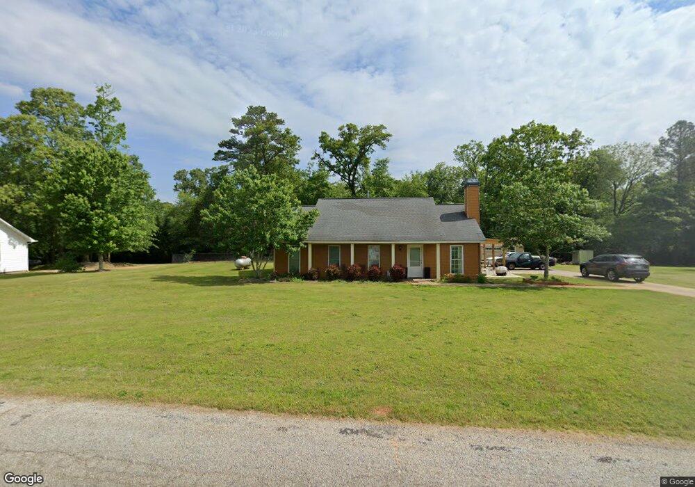
113 Reno Rd Royston, GA 30662
Estimated Value: $269,843 - $328,000
3
Beds
2
Baths
1,944
Sq Ft
$154/Sq Ft
Est. Value
About This Home
This home is located at 113 Reno Rd, Royston, GA 30662 and is currently estimated at $299,961, approximately $154 per square foot. 113 Reno Rd is a home located in Franklin County with nearby schools including Franklin County High School.
Ownership History
Date
Name
Owned For
Owner Type
Purchase Details
Closed on
Nov 29, 2006
Sold by
Rowell Michael E
Bought by
Rowell Michael E and Rowell Charlotte
Current Estimated Value
Purchase Details
Closed on
Sep 21, 2006
Sold by
Lunsford Aubrey
Bought by
Rowell Michael E
Home Financials for this Owner
Home Financials are based on the most recent Mortgage that was taken out on this home.
Original Mortgage
$101,434
Outstanding Balance
$59,585
Interest Rate
6.46%
Mortgage Type
New Conventional
Estimated Equity
$240,376
Create a Home Valuation Report for This Property
The Home Valuation Report is an in-depth analysis detailing your home's value as well as a comparison with similar homes in the area
Purchase History
| Date | Buyer | Sale Price | Title Company |
|---|---|---|---|
| Rowell Michael E | -- | -- | |
| Rowell Michael E | $75,000 | -- |
Source: Public Records
Mortgage History
| Date | Status | Borrower | Loan Amount |
|---|---|---|---|
| Open | Rowell Michael E | $101,434 |
Source: Public Records
Tax History
| Year | Tax Paid | Tax Assessment Tax Assessment Total Assessment is a certain percentage of the fair market value that is determined by local assessors to be the total taxable value of land and additions on the property. | Land | Improvement |
|---|---|---|---|---|
| 2025 | $2,103 | $93,024 | $8,000 | $85,024 |
| 2024 | $2,096 | $90,071 | $6,000 | $84,071 |
| 2023 | $1,981 | $78,787 | $6,000 | $72,787 |
| 2022 | $1,814 | $72,309 | $6,000 | $66,309 |
| 2021 | $1,731 | $64,899 | $4,800 | $60,099 |
| 2020 | $1,749 | $64,899 | $4,800 | $60,099 |
| 2019 | $1,407 | $54,359 | $4,800 | $49,559 |
| 2018 | $1,095 | $42,749 | $3,200 | $39,549 |
| 2017 | $1,107 | $41,620 | $3,200 | $38,420 |
| 2016 | $1,020 | $36,949 | $3,200 | $33,749 |
| 2015 | -- | $36,948 | $3,200 | $33,749 |
| 2014 | -- | $39,345 | $3,200 | $36,145 |
| 2013 | -- | $39,742 | $3,200 | $36,542 |
Source: Public Records
Map
Nearby Homes
- 222 Reno Rd
- 1112 Reno Rd
- 1905 Bond Bridge Rd
- 1190 James Adams Rd
- 80 Riverbend Cir
- 329 Riverbend Dr
- 340 Riverbend Cir
- 352 Jim Grizzle Rd
- 318 Jim Grizzle Rd
- 1898 Sandy Cross Rd
- 0 Noah Crow Rd Unit 10711924
- 0 Noah Crow Rd Unit 10711957
- 0 Noah Crow Rd Unit 10692629
- 5354 Highway 29
- 685 James Springs Rd
- 301 Collins Dudley Rd
- 529 Bond Bridge Rd
- 533 Pearwood Rd
- 0 Dove Hill Rd Unit 25439972
- 0 Dove Hill Rd Unit 10637645
- 113 Reno Rd
- 129 Reno Rd
- 151 Reno Rd
- 183 Reno Rd
- 195 Reno Rd
- 2415 Hale Crossing Rd
- 10 Reno Rd
- 173 Reno Rd
- 2395 Hale Crossing Rd
- 190 Reno Rd
- 2385 Hale Crossing Rd
- 2309 Hale Crossing Rd
- 207 Reno Rd
- 2343 Salem Rd
- 2219 Hale Crossing Rd
- 2325 Salem Rd
- 2430 Hale Crossing Rd
- 2235 Salem Rd
- 2918 Salem Rd
- 2594 Salem Rd
Your Personal Tour Guide
Ask me questions while you tour the home.