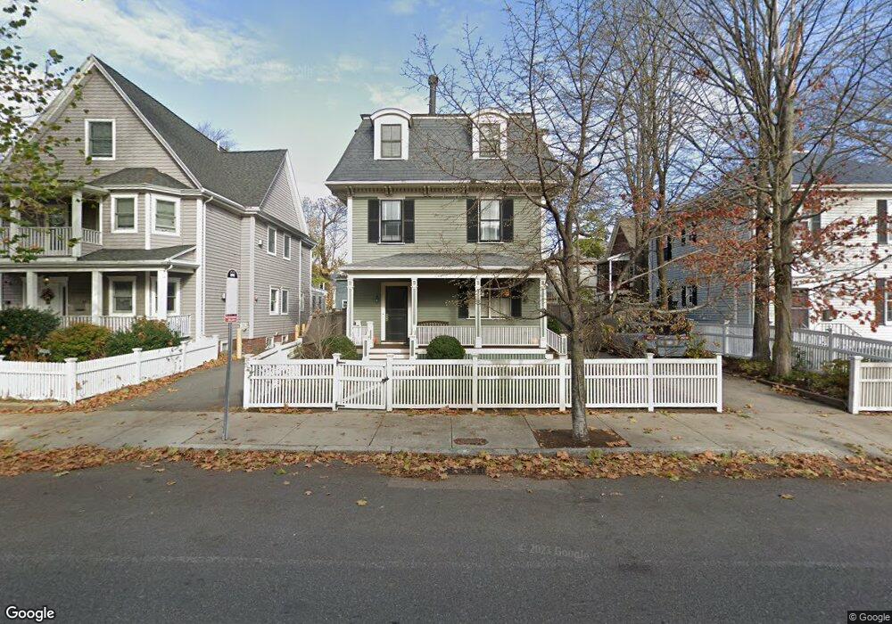
113 Rindge Ave Cambridge, MA 02140
North Cambridge NeighborhoodEstimated Value: $1,824,000 - $2,579,000
3
Beds
3
Baths
970
Sq Ft
$2,248/Sq Ft
Est. Value
About This Home
This home is located at 113 Rindge Ave, Cambridge, MA 02140 and is currently estimated at $2,180,227, approximately $2,247 per square foot. 113 Rindge Ave is a home located in Middlesex County with nearby schools including Benjamin Banneker Charter Public School, Cambridge Friends School, and Cambridge Montessori School.
Ownership History
Date
Name
Owned For
Owner Type
Purchase Details
Closed on
Dec 10, 1998
Sold by
Frenchman Dennis M and Prosnitz Linda C
Bought by
Robert William E and Robert Rosario
Current Estimated Value
Create a Home Valuation Report for This Property
The Home Valuation Report is an in-depth analysis detailing your home's value as well as a comparison with similar homes in the area
Home Values in the Area
Average Home Value in this Area
Purchase History
| Date | Buyer | Sale Price | Title Company |
|---|---|---|---|
| Robert William E | $356,500 | -- |
Source: Public Records
Mortgage History
| Date | Status | Borrower | Loan Amount |
|---|---|---|---|
| Open | Robert William E | $791,000 | |
| Closed | Robert William E | $110,000 | |
| Closed | Robert William E | $80,000 |
Source: Public Records
Tax History Compared to Growth
Tax History
| Year | Tax Paid | Tax Assessment Tax Assessment Total Assessment is a certain percentage of the fair market value that is determined by local assessors to be the total taxable value of land and additions on the property. | Land | Improvement |
|---|---|---|---|---|
| 2025 | $13,791 | $2,171,800 | $493,500 | $1,678,300 |
| 2024 | $12,562 | $2,121,900 | $515,500 | $1,606,400 |
| 2023 | $11,213 | $1,913,500 | $524,900 | $1,388,600 |
| 2022 | $10,220 | $1,726,300 | $497,800 | $1,228,500 |
| 2021 | $9,843 | $1,682,500 | $487,700 | $1,194,800 |
| 2020 | $9,248 | $1,608,400 | $476,900 | $1,131,500 |
| 2019 | $8,557 | $1,440,500 | $396,500 | $1,044,000 |
| 2018 | $8,500 | $1,351,400 | $333,900 | $1,017,500 |
| 2017 | $8,342 | $1,285,400 | $313,000 | $972,400 |
| 2016 | $8,223 | $1,176,400 | $271,300 | $905,100 |
| 2015 | $8,173 | $1,045,200 | $238,500 | $806,700 |
| 2014 | $8,416 | $1,004,300 | $208,700 | $795,600 |
Source: Public Records
Map
Nearby Homes
- 179 Rindge Ave Unit 1
- 183 Rindge Ave Unit 1
- 12 Rindge Ave Unit 1
- 30 Dudley St
- 17 Shea Rd
- 22 Harrington Rd
- 8 Cogswell Ave
- 61 Bolton St Unit 304
- 34 Day St
- 147 Sherman St Unit 201
- 110 Reed St
- 39 Bellis Cir Unit E
- 50 Howard St Unit 5
- 32 Cameron Ave
- 69 Harvey St Unit 1
- 70 Walden St Unit 1
- 70 Walden St Unit 7
- 70 Walden St Unit 11
- 2456 Massachusetts Ave Unit 402
- 124 Jackson St
- 113 Rindge Ave Unit Rindge Ave
- 117 Rindge Ave
- 115 Rindge Ave
- 117 Rindge Ave Unit 1L
- 107 Rindge Ave
- 29 Hollis St
- 29 Hollis St Unit 1
- 27 Hollis St
- 27 Hollis St Unit 1
- 121 Rindge Ave
- 121 Rindge Ave Unit 1
- 101 Rindge Ave
- 1 Yerxa Rd
- 1 Yerxa Rd Unit 3
- 1 Yerxa Rd Unit 2
- 1 Yerxa Rd Unit 1
- 25 Hollis St
- 25 Hollis St
- 25 Hollis St Unit 2
- 1 Hollis Park