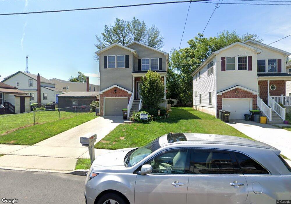
113 Robbins Ave Ewing, NJ 08638
Prospect NeighborhoodEstimated Value: $333,064 - $418,000
--
Bed
--
Bath
1,740
Sq Ft
$209/Sq Ft
Est. Value
About This Home
This home is located at 113 Robbins Ave, Ewing, NJ 08638 and is currently estimated at $363,016, approximately $208 per square foot. 113 Robbins Ave is a home located in Mercer County with nearby schools including Ewing High School, Foundation Academy Charter School, and Islamic School Of Trenton/Al-Bayaan Academy.
Ownership History
Date
Name
Owned For
Owner Type
Purchase Details
Closed on
Sep 14, 2007
Current Estimated Value
Home Financials for this Owner
Home Financials are based on the most recent Mortgage that was taken out on this home.
Original Mortgage
$269,999
Outstanding Balance
$171,645
Interest Rate
6.65%
Mortgage Type
New Conventional
Estimated Equity
$191,371
Purchase Details
Closed on
Jul 5, 2007
Sold by
Boston Properties
Bought by
Boston Harold M
Home Financials for this Owner
Home Financials are based on the most recent Mortgage that was taken out on this home.
Interest Rate
6.63%
Purchase Details
Closed on
Jun 14, 1996
Sold by
Gordon Vernon
Bought by
Robinson Mercedes
Create a Home Valuation Report for This Property
The Home Valuation Report is an in-depth analysis detailing your home's value as well as a comparison with similar homes in the area
Home Values in the Area
Average Home Value in this Area
Purchase History
| Date | Buyer | Sale Price | Title Company |
|---|---|---|---|
| -- | $270,000 | -- | |
| Burgess John J | $269,999 | -- | |
| Boston Harold M | -- | -- | |
| Robinson Mercedes | $31,000 | -- |
Source: Public Records
Mortgage History
| Date | Status | Borrower | Loan Amount |
|---|---|---|---|
| Open | Burgess John J | $269,999 | |
| Previous Owner | Boston Harold M | -- |
Source: Public Records
Tax History Compared to Growth
Tax History
| Year | Tax Paid | Tax Assessment Tax Assessment Total Assessment is a certain percentage of the fair market value that is determined by local assessors to be the total taxable value of land and additions on the property. | Land | Improvement |
|---|---|---|---|---|
| 2025 | $6,965 | $177,100 | $20,000 | $157,100 |
| 2024 | $6,547 | $177,100 | $20,000 | $157,100 |
| 2023 | $6,547 | $177,100 | $20,000 | $157,100 |
| 2022 | $6,370 | $177,100 | $20,000 | $157,100 |
| 2021 | $6,214 | $177,100 | $20,000 | $157,100 |
| 2020 | $5,876 | $177,100 | $20,000 | $157,100 |
| 2019 | $5,967 | $177,100 | $20,000 | $157,100 |
| 2018 | $6,117 | $115,800 | $12,000 | $103,800 |
| 2017 | $6,259 | $115,800 | $12,000 | $103,800 |
| 2016 | $6,174 | $115,800 | $12,000 | $103,800 |
| 2015 | $5,842 | $115,800 | $12,000 | $103,800 |
| 2014 | $5,826 | $115,800 | $12,000 | $103,800 |
Source: Public Records
Map
Nearby Homes
- 48 Homestead Ave
- 118 Hazel Ave
- 54 Kelsey Ave
- 16 Clover Ave
- 110 Parkway Ave
- 50 Kelsey Ave
- 27 -29-31 Kelsey
- 540 Pennington Ave
- 531 533 Pennington Ave
- 491 Pennington Ave
- 108 Homecrest Ave
- 86 Pennington Ave
- 152 Trent Ave
- 131 Homecrest Ave
- 1236 Prospect St
- 166 Clover Ave
- 34 Arlington Ave
- 645 N Willow St
- 252 Parkway Ave
- 803 Pennington Ave
- 115 Robbins Ave
- 117 Robbins Ave
- 52 Homestead Ave
- 44 Homestead Ave
- 119 Robbins Ave
- 110 Hazel Ave
- 108 Robbins Ave
- 40 Homestead Ave
- 125 Robbins Ave
- 118 Robbins Ave
- 124 Hazel Ave
- 131 Robbins Ave
- 36 Homestead Ave
- 124 Robbins Ave
- 111 Hazel Ave
- 34 Homestead Ave
- 109 Hazel Ave
- 117 Stokes Ave
- 119 Stokes Ave
- 32 Homestead Ave