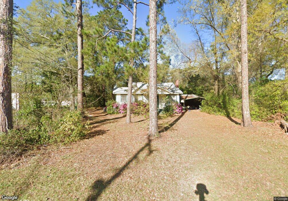
113 S Carroll St Albany, GA 31705
Estimated Value: $66,466 - $84,000
3
Beds
1
Bath
1,050
Sq Ft
$71/Sq Ft
Est. Value
About This Home
This home is located at 113 S Carroll St, Albany, GA 31705 and is currently estimated at $74,867, approximately $71 per square foot. 113 S Carroll St is a home located in Dougherty County with nearby schools including Robert H. Harvey Elementary School, Albany Middle School, and Radium Springs Middle School.
Ownership History
Date
Name
Owned For
Owner Type
Purchase Details
Closed on
Feb 21, 1995
Sold by
Chitty Charles A
Bought by
Gilbert Ed
Current Estimated Value
Purchase Details
Closed on
Feb 7, 1994
Sold by
Lauderdale Lauderdale Q and Lauderdale M
Bought by
Chitty Charles A
Purchase Details
Closed on
Mar 12, 1993
Sold by
Ch Of Christ-E Side
Bought by
Lauderdale Q D
Purchase Details
Closed on
Feb 19, 1993
Sold by
Flint River Presbyte
Bought by
Church Of Christ -
Purchase Details
Closed on
Feb 28, 1989
Sold by
Presb Of So We Ga
Bought by
Eastside Ch Of Chris
Purchase Details
Closed on
Jan 1, 1977
Sold by
Henderson Presby Chu
Bought by
Presbytery Of So Ga
Create a Home Valuation Report for This Property
The Home Valuation Report is an in-depth analysis detailing your home's value as well as a comparison with similar homes in the area
Home Values in the Area
Average Home Value in this Area
Purchase History
| Date | Buyer | Sale Price | Title Company |
|---|---|---|---|
| Gilbert Ed | $26,500 | -- | |
| Chitty Charles A | $9,000 | -- | |
| Lauderdale Q D | $6,000 | -- | |
| Church Of Christ - | -- | -- | |
| Eastside Ch Of Chris | -- | -- | |
| Presbytery Of So Ga | -- | -- |
Source: Public Records
Tax History Compared to Growth
Tax History
| Year | Tax Paid | Tax Assessment Tax Assessment Total Assessment is a certain percentage of the fair market value that is determined by local assessors to be the total taxable value of land and additions on the property. | Land | Improvement |
|---|---|---|---|---|
| 2024 | $752 | $15,760 | $2,320 | $13,440 |
| 2023 | $734 | $15,760 | $2,320 | $13,440 |
| 2022 | $737 | $15,760 | $2,320 | $13,440 |
| 2021 | $683 | $15,760 | $2,320 | $13,440 |
| 2020 | $685 | $15,760 | $2,320 | $13,440 |
| 2019 | $687 | $15,760 | $2,320 | $13,440 |
| 2018 | $690 | $15,760 | $2,320 | $13,440 |
| 2017 | $643 | $15,760 | $2,320 | $13,440 |
| 2016 | $643 | $15,760 | $2,320 | $13,440 |
| 2015 | $645 | $15,760 | $2,320 | $13,440 |
| 2014 | $637 | $15,760 | $2,320 | $13,440 |
Source: Public Records
Map
Nearby Homes
- 210 S Carroll St
- 205 Collins St
- 211 Collins St
- 1521 E Broad Ave
- 1408 E Mercer Ave
- 1400 E Lincoln Ave
- 1410 E Roosevelt Ave
- 1318 E Roosevelt Ave
- 1418 E Roosevelt Ave
- 1308 E Roosevelt Ave
- 1500 E Roosevelt Ave
- 1502 E Roosevelt Ave
- 1219 Bonnyview Ave
- 1411 E Gordon Ave
- 608 Cason St
- 1401 E Waddell Ave
- 811 S Maple St
- 1323 E Society Ave
- 1017 E Roosevelt Ave
- 1003 E Residence Ave
- 203 S Carroll St
- 112 Collins St
- 200 S Carroll St
- 103 S Carroll St
- 200 Collins St
- 108 Collins St
- 202 Collins St
- 207 S Carroll St
- 110 Collins St
- 1320 E Broad Ave
- 204 S Carroll St
- 1402 E Campbell St
- 106 Collins St
- 204 Collins St
- 1402 E Campbell Ave
- 206 S Carroll St
- 208 S Carroll St
- 1318 E Broad Ave
- 206 Collins St
- 208 Collins St