Estimated Value: $113,000 - $181,000
4
Beds
2
Baths
2,035
Sq Ft
$68/Sq Ft
Est. Value
About This Home
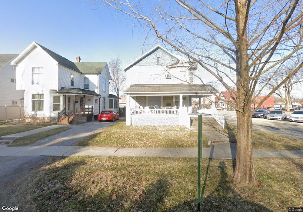
This home is located at 113 S Johnson St, Ada, OH 45810 and is currently estimated at $139,333, approximately $68 per square foot. 113 S Johnson St is a home located in Hardin County with nearby schools including Ada Elementary School and Ada High School.
Ownership History
Date
Name
Owned For
Owner Type
Purchase Details
Closed on
Sep 4, 2001
Bought by
Wyss Todd W
Current Estimated Value
Purchase Details
Closed on
Nov 9, 1999
Bought by
Wyss Patricia
Purchase Details
Closed on
Sep 24, 1996
Bought by
Wyss Robert W and Wyss Patricia
Purchase Details
Closed on
Feb 1, 1995
Bought by
Kraft Edwin M
Purchase Details
Closed on
Nov 1, 1988
Create a Home Valuation Report for This Property
The Home Valuation Report is an in-depth analysis detailing your home's value as well as a comparison with similar homes in the area
Home Values in the Area
Average Home Value in this Area
Purchase History
| Date | Buyer | Sale Price | Title Company |
|---|---|---|---|
| Wyss Todd W | $150,000 | -- | |
| Wyss Patricia | -- | -- | |
| Wyss Robert W | $55,000 | -- | |
| Kraft Edwin M | $45,000 | -- | |
| -- | $131,200 | -- |
Source: Public Records
Tax History
| Year | Tax Paid | Tax Assessment Tax Assessment Total Assessment is a certain percentage of the fair market value that is determined by local assessors to be the total taxable value of land and additions on the property. | Land | Improvement |
|---|---|---|---|---|
| 2024 | $1,482 | $36,590 | $1,660 | $34,930 |
| 2023 | $1,472 | $36,590 | $1,660 | $34,930 |
| 2022 | $1,237 | $26,740 | $1,620 | $25,120 |
| 2021 | $1,357 | $26,740 | $1,620 | $25,120 |
| 2020 | $1,374 | $26,740 | $1,620 | $25,120 |
| 2019 | $1,232 | $24,170 | $1,540 | $22,630 |
| 2018 | $1,207 | $24,170 | $1,540 | $22,630 |
| 2017 | $1,204 | $24,170 | $1,540 | $22,630 |
| 2016 | $1,224 | $26,410 | $1,480 | $24,930 |
| 2015 | $1,154 | $26,410 | $1,480 | $24,930 |
| 2014 | $1,196 | $26,410 | $1,480 | $24,930 |
| 2013 | $1,326 | $27,890 | $1,480 | $26,410 |
Source: Public Records
Map
Nearby Homes
- 211 S Main St
- 308-310 S Simon St
- 210 N Gilbert St
- 314 E University Ave
- 442 Edwards St
- 530 N Main St
- 710 S Main St
- 503 E North Ave
- 128 W North Ave
- 327 W North Ave
- 629 N Main St
- 602 Conley Ave
- 820 S Main St
- 724 N Main St
- 318 Willeke Ave
- 746 N Main St Unit 61
- 746 N Main St Unit 63
- 746 N Main St Unit 74
- 746 N Main St Unit 9
- 746 N Main St Unit 35
- 115 S Johnson St
- 121 S Johnson St
- 118 S Johnson St
- 112 S Johnson St
- 130 S Johnson St
- 125 E Buckeye Ave Unit 3
- 125 E Buckeye Ave
- 125 E Buckeye Ave
- 211 E Buckeye Ave
- 138 S Johnson St
- 120 S Main St
- 122 S Main St
- 125 E Lincoln Ave
- 218 E Lincoln Ave
- 1022 !Dnp! Residential Income Test Listing
- 102225 !Dnp! Residential Test Listing
- !dnp! 700 College
- 110 N Main St
- 102 N Main St
Your Personal Tour Guide
Ask me questions while you tour the home.