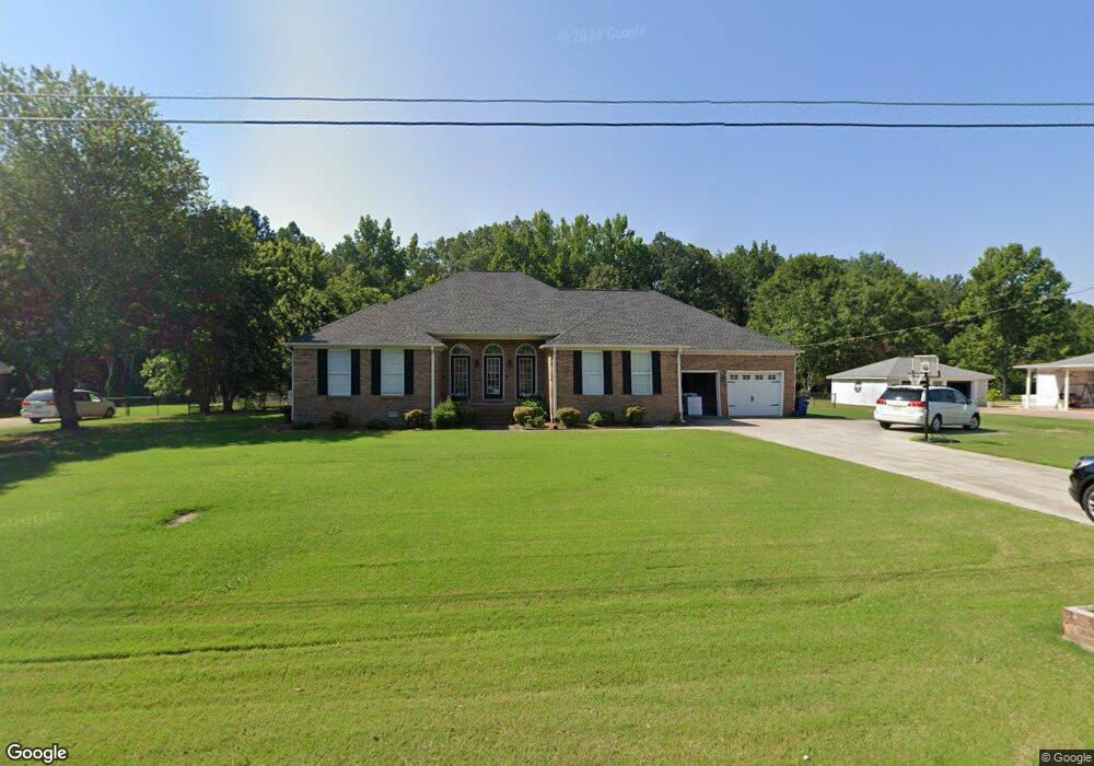
113 Sharp Dr Gadsden, AL 35903
Estimated Value: $309,628 - $386,000
Studio
3
Baths
2,606
Sq Ft
$134/Sq Ft
Est. Value
About This Home
This home is located at 113 Sharp Dr, Gadsden, AL 35903 and is currently estimated at $349,907, approximately $134 per square foot. 113 Sharp Dr is a home located in Etowah County with nearby schools including Glencoe Elementary School, Glencoe Middle School, and Glencoe High School.
Ownership History
Date
Name
Owned For
Owner Type
Purchase Details
Closed on
Sep 26, 2018
Bought by
Daugherty Dustin Ray and Daugherty April Gregg
Current Estimated Value
Home Financials for this Owner
Home Financials are based on the most recent Mortgage that was taken out on this home.
Original Mortgage
$187,000
Outstanding Balance
$162,932
Interest Rate
4.65%
Estimated Equity
$186,975
Create a Home Valuation Report for This Property
The Home Valuation Report is an in-depth analysis detailing your home's value as well as a comparison with similar homes in the area
Home Values in the Area
Average Home Value in this Area
Purchase History
| Date | Buyer | Sale Price | Title Company |
|---|---|---|---|
| Daugherty Dustin Ray | -- | -- |
Source: Public Records
Mortgage History
| Date | Status | Borrower | Loan Amount |
|---|---|---|---|
| Open | Daugherty Dustin Ray | $187,000 | |
| Closed | Daugherty Dustin Ray | -- |
Source: Public Records
Tax History
| Year | Tax Paid | Tax Assessment Tax Assessment Total Assessment is a certain percentage of the fair market value that is determined by local assessors to be the total taxable value of land and additions on the property. | Land | Improvement |
|---|---|---|---|---|
| 2025 | $1,116 | $32,360 | $2,100 | $30,260 |
| 2024 | $1,116 | $32,360 | $2,100 | $30,260 |
| 2023 | $1,116 | $32,360 | $2,100 | $30,260 |
| 2022 | $891 | $26,110 | $2,100 | $24,010 |
| 2021 | $720 | $21,350 | $1,750 | $19,600 |
| 2020 | $720 | $21,360 | $0 | $0 |
| 2019 | $764 | $22,580 | $0 | $0 |
| 2017 | $688 | $20,480 | $0 | $0 |
| 2016 | $688 | $20,480 | $0 | $0 |
| 2015 | $1,375 | $20,480 | $0 | $0 |
| 2013 | -- | $19,460 | $0 | $0 |
Source: Public Records
Map
Nearby Homes
- 400 Lonz St Unit Lonz St.
- 3.5 +/- E US Hwy 278
- 411 Meadowlark Place
- 2110 Cove Cir N
- 102 Meadowpoint Way
- 0 Riverchase Dr Unit 1339922
- 607 Riverview Dr
- 2580 Reeves St
- 51 Aqua Vista Dr W
- 916 Riverview Dr
- 2.5 Aqua Vista Dr E
- 0 US Highway 278 Unit 21252717
- 2482 Barnes Dr
- 1.48 Acres River Cliff Dr
- 2792 E Rexford St
- 2610 Barnes Dr
- 2794 Veranda Trace
- 105 Kaying Rd S
- Lot #5 Veranda Trace
- 3720 Tidmore Bend Rd
Your Personal Tour Guide
Ask me questions while you tour the home.