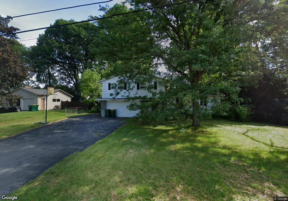
113 Single Dr Syracuse, NY 13212
Estimated Value: $302,671 - $373,000
4
Beds
2
Baths
2,391
Sq Ft
$138/Sq Ft
Est. Value
About This Home
This home is located at 113 Single Dr, Syracuse, NY 13212 and is currently estimated at $330,418, approximately $138 per square foot. 113 Single Dr is a home located in Onondaga County with nearby schools including North Syracuse Junior High School, Cicero-North Syracuse High School, and Little Lamb Christian School.
Ownership History
Date
Name
Owned For
Owner Type
Purchase Details
Closed on
Apr 18, 2013
Sold by
Hoerl Jeffrey
Bought by
Richard Hoerl Family Trus
Current Estimated Value
Purchase Details
Closed on
Mar 1, 2013
Sold by
Hoerl Jean
Bought by
Hoerl Jean
Purchase Details
Closed on
Jun 8, 2012
Sold by
Hoerl Richard
Bought by
Richard Hoerl Family Trus
Purchase Details
Closed on
Mar 25, 2005
Sold by
Brugler Cheryl H
Bought by
Hoerl Jeffrey L
Purchase Details
Closed on
Sep 12, 1995
Sold by
Harse Douglas H
Bought by
Brugler Cheryl and Lancette Linda Harse
Create a Home Valuation Report for This Property
The Home Valuation Report is an in-depth analysis detailing your home's value as well as a comparison with similar homes in the area
Home Values in the Area
Average Home Value in this Area
Purchase History
| Date | Buyer | Sale Price | Title Company |
|---|---|---|---|
| Richard Hoerl Family Trus | -- | John T. Kearns | |
| Hoerl Jean | -- | -- | |
| Richard Hoerl Family Trus | -- | Harlan B. Gingold | |
| Hoerl Jeffrey L | $166,900 | Joseph Callahan | |
| Brugler Cheryl | -- | -- |
Source: Public Records
Tax History
| Year | Tax Paid | Tax Assessment Tax Assessment Total Assessment is a certain percentage of the fair market value that is determined by local assessors to be the total taxable value of land and additions on the property. | Land | Improvement |
|---|---|---|---|---|
| 2024 | $8,869 | $7,500 | $600 | $6,900 |
| 2023 | $8,407 | $7,500 | $600 | $6,900 |
| 2022 | $8,427 | $7,500 | $600 | $6,900 |
| 2021 | $8,233 | $7,500 | $600 | $6,900 |
| 2020 | $7,997 | $7,500 | $600 | $6,900 |
| 2019 | $1,592 | $7,500 | $600 | $6,900 |
| 2018 | $7,665 | $7,500 | $600 | $6,900 |
| 2017 | $5,893 | $7,500 | $600 | $6,900 |
| 2016 | $7,424 | $7,500 | $600 | $6,900 |
| 2015 | -- | $7,500 | $600 | $6,900 |
| 2014 | -- | $7,500 | $600 | $6,900 |
Source: Public Records
Map
Nearby Homes
- 315 Herman Dr
- 314 Belmore Dr
- 102 Lena Terrace
- 309 Rebecca St
- 119 Gordon Rd
- 504 Chestnut St
- 461 S Main St
- 131 Hazelhurst Ave
- 110 Lynnhaven Dr
- 122 Elm St
- 110 Oakley Dr
- 5084 Audrey Dr
- 7593 Daphne Dr
- 0 Buckley Rd
- 5632 W Circle Dr
- 0 S Bay Rd
- 0 Elbow Rd Unit S1658518
- 111 Randall Terrace
- 100 Clarence Dr
- 7348 Farmstead Rd
- 115 Single Dr
- 111 Single Dr
- 114 Single Dr
- 109 Single Dr
- 117 Single Dr
- 116 Single Dr
- 110 Single Dr
- 114 Catherine St
- 112 Catherine St
- 116 Catherine St
- 110 Catherine St
- 108 Single Dr
- 118 Single Dr
- 118 Catherine St
- 119 Single Dr
- 108 Catherine St
- 107 Single Dr
- 106 Single Dr
- 120 Single Dr
- 120 Catherine St
Your Personal Tour Guide
Ask me questions while you tour the home.