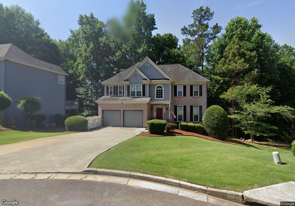
113 Springshade Ln Canton, GA 30114
Sutallee NeighborhoodEstimated Value: $556,661 - $565,000
4
Beds
4
Baths
3,228
Sq Ft
$174/Sq Ft
Est. Value
About This Home
This home is located at 113 Springshade Ln, Canton, GA 30114 and is currently estimated at $560,831, approximately $173 per square foot. 113 Springshade Ln is a home located in Cherokee County with nearby schools including Sixes Elementary School, Freedom Middle School, and Woodstock High School.
Ownership History
Date
Name
Owned For
Owner Type
Purchase Details
Closed on
Mar 12, 2013
Sold by
Patouillet L Jay
Bought by
Patouillet L Jat and The Patouillet Living Trust
Current Estimated Value
Purchase Details
Closed on
Jun 18, 2004
Sold by
Young Barbara L
Bought by
Patouillett Patouillett L and Patouillett Marilyn
Home Financials for this Owner
Home Financials are based on the most recent Mortgage that was taken out on this home.
Original Mortgage
$25,000
Interest Rate
6.3%
Mortgage Type
Unknown
Purchase Details
Closed on
Jul 16, 1998
Sold by
Raines Enterprises Inc
Bought by
Young Barbara Lee
Home Financials for this Owner
Home Financials are based on the most recent Mortgage that was taken out on this home.
Original Mortgage
$167,950
Interest Rate
7.02%
Mortgage Type
New Conventional
Create a Home Valuation Report for This Property
The Home Valuation Report is an in-depth analysis detailing your home's value as well as a comparison with similar homes in the area
Home Values in the Area
Average Home Value in this Area
Purchase History
| Date | Buyer | Sale Price | Title Company |
|---|---|---|---|
| Patouillet L Jat | $227,500 | -- | |
| Patouillett Patouillett L | $227,500 | -- | |
| Young Barbara Lee | $210,000 | -- |
Source: Public Records
Mortgage History
| Date | Status | Borrower | Loan Amount |
|---|---|---|---|
| Previous Owner | Patouillett Patouillett L | $25,000 | |
| Previous Owner | Patouillett Patouillett L | $179,750 | |
| Previous Owner | Young Barbara Lee | $167,950 |
Source: Public Records
Tax History Compared to Growth
Tax History
| Year | Tax Paid | Tax Assessment Tax Assessment Total Assessment is a certain percentage of the fair market value that is determined by local assessors to be the total taxable value of land and additions on the property. | Land | Improvement |
|---|---|---|---|---|
| 2025 | $1,151 | $202,304 | $41,600 | $160,704 |
| 2024 | $1,112 | $189,792 | $38,000 | $151,792 |
| 2023 | $3,943 | $184,680 | $38,000 | $146,680 |
| 2022 | $4,017 | $165,280 | $35,200 | $130,080 |
| 2021 | $3,765 | $140,120 | $25,600 | $114,520 |
| 2020 | $3,416 | $124,920 | $25,600 | $99,320 |
| 2019 | $3,301 | $119,960 | $25,600 | $94,360 |
| 2018 | $3,090 | $110,360 | $24,000 | $86,360 |
| 2017 | $3,041 | $269,500 | $20,400 | $87,400 |
| 2016 | $2,916 | $256,200 | $20,400 | $82,080 |
| 2015 | $2,747 | $239,300 | $18,000 | $77,720 |
| 2014 | $2,669 | $232,300 | $18,000 | $74,920 |
Source: Public Records
Map
Nearby Homes
- 711 Tall Oaks Dr
- 829 Valley Dr
- 834 Valley Dr Unit 1K
- 164 Henley St
- 160 Henley St Unit 15
- 160 Henley St
- Jasper II Plan at Cambridge at Steels Bridge
- Newton II Plan at Cambridge at Steels Bridge
- Fulton II Plan at Cambridge at Steels Bridge
- Brookwood Plan at Cambridge at Steels Bridge
- Tifton II Plan at Cambridge at Steels Bridge
- 3008 Heatherbrook Trace Unit 2B
- 3018 Heatherbrook Trace
- 601 Redwood Ln
- 3021 Heatherbrook Trace
- 552 Steels Bridge Rd
- 302 Magnolia Trace
- 414 Dogwood Way
- 265 Parc Dr
- 111 Springshade Ln
- 115 Springshade Ln
- 308 Tall Oaks Ct
- 109 Springshade Ln
- 306 Tall Oaks Ct
- 309 Tall Oaks Ct
- 114 Springshade Ln
- 116 Springshade Ln
- 112 Springshade Ln
- 107 Springshade Ln
- 0 Springshade Ln Unit 7261653
- 0 Springshade Ln Unit 7153597
- 0 Springshade Ln Unit 8548964
- 0 Springshade Ln Unit 8153596
- 0 Springshade Ln Unit 7145164
- 304 Tall Oaks Ct
- 105 Springshade Ln
- 203 Springshade Ct
- 307 Tall Oaks Ct
- 302 Tall Oaks Ct
