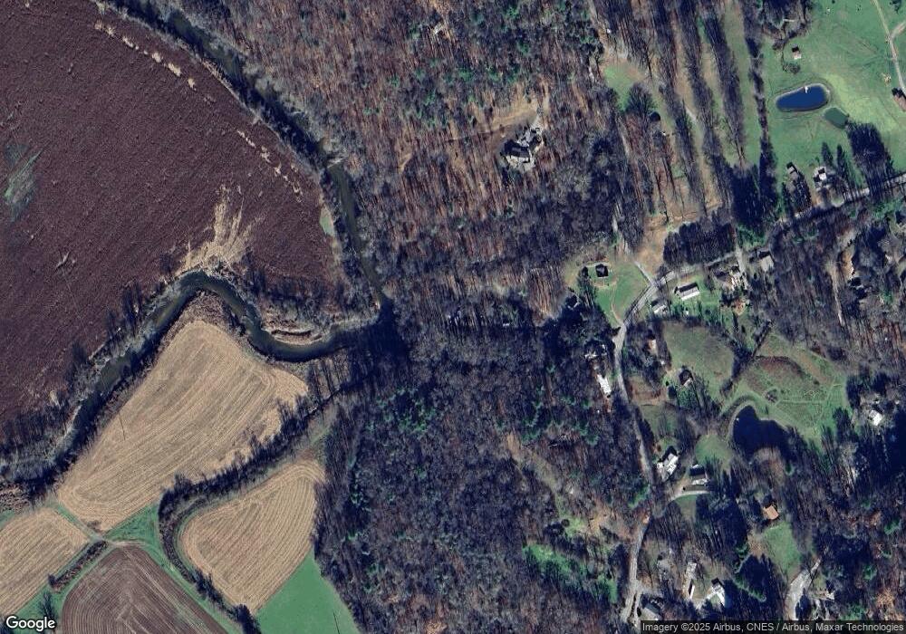
113 Starlight Cir Brevard, NC 28712
Estimated Value: $346,248 - $435,000
1
Bed
1
Bath
1,560
Sq Ft
$250/Sq Ft
Est. Value
About This Home
This home is located at 113 Starlight Cir, Brevard, NC 28712 and is currently estimated at $389,562, approximately $249 per square foot. 113 Starlight Cir is a home located in Transylvania County with nearby schools including Bethany Christian School.
Ownership History
Date
Name
Owned For
Owner Type
Purchase Details
Closed on
Oct 21, 2005
Sold by
Dupree Thomas W and Dupree Emily Owen
Bought by
Small Hannah L
Current Estimated Value
Home Financials for this Owner
Home Financials are based on the most recent Mortgage that was taken out on this home.
Original Mortgage
$136,000
Outstanding Balance
$72,793
Interest Rate
5.76%
Mortgage Type
New Conventional
Estimated Equity
$316,769
Create a Home Valuation Report for This Property
The Home Valuation Report is an in-depth analysis detailing your home's value as well as a comparison with similar homes in the area
Home Values in the Area
Average Home Value in this Area
Purchase History
| Date | Buyer | Sale Price | Title Company |
|---|---|---|---|
| Small Hannah L | $170,000 | None Available |
Source: Public Records
Mortgage History
| Date | Status | Borrower | Loan Amount |
|---|---|---|---|
| Open | Small Hannah L | $136,000 |
Source: Public Records
Tax History Compared to Growth
Tax History
| Year | Tax Paid | Tax Assessment Tax Assessment Total Assessment is a certain percentage of the fair market value that is determined by local assessors to be the total taxable value of land and additions on the property. | Land | Improvement |
|---|---|---|---|---|
| 2025 | $1,511 | $314,520 | $36,000 | $278,520 |
| 2024 | $1,227 | $186,360 | $36,000 | $150,360 |
| 2023 | $1,227 | $186,360 | $36,000 | $150,360 |
| 2022 | $1,227 | $186,360 | $36,000 | $150,360 |
| 2021 | $1,217 | $186,360 | $36,000 | $150,360 |
| 2020 | $1,103 | $158,480 | $0 | $0 |
| 2019 | $1,095 | $158,480 | $0 | $0 |
| 2018 | $942 | $158,480 | $0 | $0 |
| 2017 | $931 | $158,480 | $0 | $0 |
| 2016 | $916 | $158,480 | $0 | $0 |
| 2015 | $758 | $170,020 | $45,000 | $125,020 |
| 2014 | $758 | $170,020 | $45,000 | $125,020 |
Source: Public Records
Map
Nearby Homes
- 89 Whippoorwill Rd
- 132 Connestee Rd
- 185 Ben Nevis Rd
- 69 Pepperbush Rd
- 00000 Mountain Brook Trail Unit 37
- Lot 57 Stone Field Trail
- TBD High Hemlock Trail Unit 46
- Lot 52 High Hemlock Trail Unit 52
- Lot 59 High Hemlock Trail
- 215 High Hemlock Trail
- 1482 Island Ford Rd
- 115 Rockbrook Overlook
- 9999 Rockbrook Overlook
- Lot 12 Rockbrook Overlook
- Lot 25 (A and B) Rockbrook Overlook
- 66 Barberry Heights Dr
- TBD High Point Trail Unit 21
- TBD High Point Trail Unit 24
- 999 High Point Trail
- 33 High Point Trail
- 50 Starlight Cir
- 46 Starlight Cir
- 60 Starlight Cir
- 3759 Island Ford Rd
- 3777 Island Ford Rd
- 3735 Island Ford Rd
- 159 River Hill Ln
- 159 River Hill Ln
- 159 River Hill Ln
- 159 River Hill Ln
- 159 River Hill Ln
- 3770 Island Ford Rd
- 3870 Island Ford Rd
- 3826 Island Ford Rd
- 3664 Island Ford Rd
- 3868 Island Ford Rd
- 187 River Hill Ln
- 88 Shady View Dr
- 27 Pinecola Dr
- 3903 Island Ford Rd
