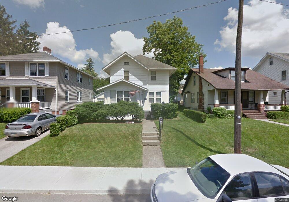
113 Stewart Ave S Mansfield, OH 44906
Estimated Value: $129,000 - $141,000
4
Beds
1
Bath
1,488
Sq Ft
$90/Sq Ft
Est. Value
About This Home
This home is located at 113 Stewart Ave S, Mansfield, OH 44906 and is currently estimated at $133,597, approximately $89 per square foot. 113 Stewart Ave S is a home located in Richland County with nearby schools including Goal Digital Academy, St. Peter's High School/Junior High, and Discovery School.
Ownership History
Date
Name
Owned For
Owner Type
Purchase Details
Closed on
Aug 23, 2002
Sold by
Lookenott Randall K
Bought by
Parker Timothy L
Current Estimated Value
Home Financials for this Owner
Home Financials are based on the most recent Mortgage that was taken out on this home.
Original Mortgage
$78,665
Outstanding Balance
$33,477
Interest Rate
6.63%
Mortgage Type
FHA
Estimated Equity
$100,120
Create a Home Valuation Report for This Property
The Home Valuation Report is an in-depth analysis detailing your home's value as well as a comparison with similar homes in the area
Home Values in the Area
Average Home Value in this Area
Purchase History
| Date | Buyer | Sale Price | Title Company |
|---|---|---|---|
| Parker Timothy L | $79,900 | -- |
Source: Public Records
Mortgage History
| Date | Status | Borrower | Loan Amount |
|---|---|---|---|
| Open | Parker Timothy L | $78,665 |
Source: Public Records
Tax History Compared to Growth
Tax History
| Year | Tax Paid | Tax Assessment Tax Assessment Total Assessment is a certain percentage of the fair market value that is determined by local assessors to be the total taxable value of land and additions on the property. | Land | Improvement |
|---|---|---|---|---|
| 2024 | $1,295 | $27,660 | $4,420 | $23,240 |
| 2023 | $1,295 | $27,660 | $4,420 | $23,240 |
| 2022 | $1,169 | $20,930 | $3,590 | $17,340 |
| 2021 | $1,178 | $20,930 | $3,590 | $17,340 |
| 2020 | $1,204 | $20,930 | $3,590 | $17,340 |
| 2019 | $1,335 | $20,930 | $3,590 | $17,340 |
| 2018 | $1,316 | $20,930 | $3,590 | $17,340 |
| 2017 | $1,283 | $20,930 | $3,590 | $17,340 |
| 2016 | $1,285 | $20,360 | $3,820 | $16,540 |
| 2015 | $1,227 | $20,360 | $3,820 | $16,540 |
| 2014 | $1,211 | $20,360 | $3,820 | $16,540 |
| 2012 | $486 | $21,430 | $4,020 | $17,410 |
Source: Public Records
Map
Nearby Homes
- 126 Dawson Ave
- 71 Glenwood Blvd
- 88 Sherman Ave
- 24 Stewart Ave S
- 21 Glenwood Blvd
- 41 Parkwood Blvd
- 76 Bartley Ave
- 118 Parkwood Blvd
- 38 Baldwin Ave
- 37 Baldwin Ave
- 114 Vennum Ave
- 118 Lind Ave
- 80 Rowland Ave
- 129 Fairlawn Ave
- 135 Fairlawn Ave
- 96 Helen Ave
- 143 Fairlawn Ave
- 470 Woodward Ave
- 191 Fairlawn Ave
- 201 Fairlawn Ave
- 117 Stewart Ave S
- 109 Stewart Ave S
- 101 Stewart Ave S
- 121 Stewart Ave S
- 97 Stewart Ave S
- 114 Dawson Ave
- 108 Dawson Ave
- 120 Dawson Ave
- 95 Stewart Ave S
- 127 Stewart Ave S
- 104 Dawson Ave
- 112 Stewart Ave S
- 108 Stewart Ave S
- 116 Stewart Ave S
- 126 Stewart Ave S
- 116 Dawson Ave
- 104 Stewart Ave S
- 120 Stewart Ave S
- 91 Stewart Ave S
- 133 Stewart Ave S