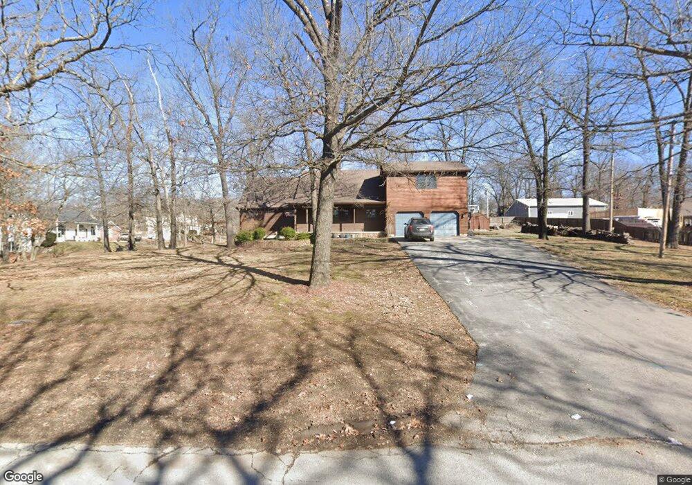
113 Sunset Dr Unit 1 Carl Junction, MO 64834
Estimated Value: $309,000 - $346,000
3
Beds
3
Baths
2,475
Sq Ft
$133/Sq Ft
Est. Value
About This Home
This home is located at 113 Sunset Dr Unit 1, Carl Junction, MO 64834 and is currently estimated at $328,686, approximately $132 per square foot. 113 Sunset Dr Unit 1 is a home located in Jasper County with nearby schools including Carl Junction Primary School (K-1), Carl Junction Intermediate School, and Carl Junction Primary School (2-3).
Ownership History
Date
Name
Owned For
Owner Type
Purchase Details
Closed on
Apr 18, 2017
Sold by
Robertson Calvin O and Robertson Judy M
Bought by
Robertson Matthew P and Robertson Karen E
Current Estimated Value
Home Financials for this Owner
Home Financials are based on the most recent Mortgage that was taken out on this home.
Original Mortgage
$154,800
Outstanding Balance
$128,582
Interest Rate
4.23%
Mortgage Type
New Conventional
Estimated Equity
$200,104
Purchase Details
Closed on
Jun 29, 2011
Sold by
Barrett Rita K
Bought by
Robertson Calvin O and Robertson Judy M
Home Financials for this Owner
Home Financials are based on the most recent Mortgage that was taken out on this home.
Original Mortgage
$142,025
Interest Rate
4.66%
Mortgage Type
Future Advance Clause Open End Mortgage
Create a Home Valuation Report for This Property
The Home Valuation Report is an in-depth analysis detailing your home's value as well as a comparison with similar homes in the area
Purchase History
| Date | Buyer | Sale Price | Title Company |
|---|---|---|---|
| Robertson Matthew P | -- | None Available | |
| Robertson Calvin O | -- | Abbey |
Source: Public Records
Mortgage History
| Date | Status | Borrower | Loan Amount |
|---|---|---|---|
| Open | Robertson Matthew P | $154,800 | |
| Previous Owner | Robertson Calvin O | $142,025 |
Source: Public Records
Tax History Compared to Growth
Tax History
| Year | Tax Paid | Tax Assessment Tax Assessment Total Assessment is a certain percentage of the fair market value that is determined by local assessors to be the total taxable value of land and additions on the property. | Land | Improvement |
|---|---|---|---|---|
| 2025 | $1,824 | $33,270 | $9,120 | $24,150 |
| 2024 | $1,836 | $31,180 | $9,120 | $22,060 |
| 2023 | $1,836 | $31,180 | $9,120 | $22,060 |
| 2022 | $1,848 | $31,300 | $9,120 | $22,180 |
| 2021 | $1,585 | $31,300 | $9,120 | $22,180 |
| 2020 | $1,516 | $29,420 | $9,120 | $20,300 |
| 2019 | $1,439 | $29,420 | $9,120 | $20,300 |
| 2018 | $1,542 | $31,590 | $0 | $0 |
| 2017 | $1,546 | $31,590 | $0 | $0 |
| 2016 | $1,578 | $32,560 | $0 | $0 |
| 2015 | $1,545 | $32,560 | $0 | $0 |
| 2014 | $1,545 | $32,560 | $0 | $0 |
Source: Public Records
Map
Nearby Homes
- 133 Red Oak Dr
- 121 Forest Dr
- 128 Par Ln
- 512 Dogwood Trails Loop
- 403 Dogwood Trail Loop
- 401 Dogwood Trails Loop
- 403 Dogwood Trails Loop
- 107 Foursome Ln
- 306 Lakeview Ln
- 710 Briarbrook Dr
- 6548 Mo-171
- 337 Fairway Dr
- 328 Briarbrook Dr
- XXX Lone Elm
- 9130 Missouri 171
- 305 Tee Ln
- 309 Turf Ln
- 232 Hickory Place
- 25122 Gum Rd
- 126 N Windwood
- 113 Sunset Dr
- 112 Sunset Dr
- 111 Sunset Loop
- 201 Sunset Dr
- 124 Sunset Loop
- 124 Sunset Loop
- 109 Sunset Loop
- 110 Sunset Dr
- 103 Sunset Loop
- 122 Sunset Loop
- 209 Sunset Dr
- 118 Sunset Loop
- 104 Red Oak Dr
- 114 Sunset Loop
- 107 Gum Rd
- 110 Sunset Loop
- 33.2 Acres Dogwood Trail
- 116 Sunset Loop
- Lot 5 Gum
- 109 Gum Rd Unit 1