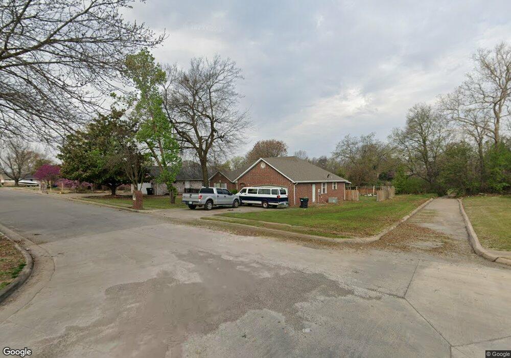
113 Tommye Ln Tahlequah, OK 74464
Estimated Value: $258,414 - $309,000
4
Beds
3
Baths
2,136
Sq Ft
$132/Sq Ft
Est. Value
About This Home
This home is located at 113 Tommye Ln, Tahlequah, OK 74464 and is currently estimated at $282,604, approximately $132 per square foot. 113 Tommye Ln is a home located in Cherokee County with nearby schools including Greenwood Elementary School, Cherokee Elementary School, and Tahlequah Middle School.
Ownership History
Date
Name
Owned For
Owner Type
Purchase Details
Closed on
Jul 12, 2013
Sold by
Weng Jin
Bought by
Weng Jin and Weng Xing
Current Estimated Value
Purchase Details
Closed on
Jul 2, 2012
Purchase Details
Closed on
Sep 19, 2011
Sold by
Federal Home Loan Mortgage Corporation
Bought by
Weng Jin and Yang Lu T
Purchase Details
Closed on
Jun 16, 2011
Sold by
Robinson Bill and Robinson Vivian
Bought by
Federal Home Loan Mortgage Corporation
Purchase Details
Closed on
Feb 3, 1997
Sold by
F & L Inc.
Bought by
Billy Robinson
Purchase Details
Closed on
Jan 3, 1996
Sold by
Scott and Tommye Wright
Bought by
F & L, Inc.
Create a Home Valuation Report for This Property
The Home Valuation Report is an in-depth analysis detailing your home's value as well as a comparison with similar homes in the area
Home Values in the Area
Average Home Value in this Area
Purchase History
| Date | Buyer | Sale Price | Title Company |
|---|---|---|---|
| Weng Jin | -- | None Available | |
| -- | -- | None Available | |
| Weng Jin | $8,667 | Okahoma City Abetract & Titl | |
| Federal Home Loan Mortgage Corporation | -- | None Available | |
| Billy Robinson | $88,000 | -- | |
| F & L, Inc. | $10,500 | -- |
Source: Public Records
Tax History Compared to Growth
Tax History
| Year | Tax Paid | Tax Assessment Tax Assessment Total Assessment is a certain percentage of the fair market value that is determined by local assessors to be the total taxable value of land and additions on the property. | Land | Improvement |
|---|---|---|---|---|
| 2025 | $1,436 | $16,639 | $2,406 | $14,233 |
| 2024 | $1,436 | $16,154 | $2,336 | $13,818 |
| 2023 | $1,436 | $15,683 | $2,200 | $13,483 |
| 2022 | $1,362 | $15,683 | $2,200 | $13,483 |
| 2021 | $1,367 | $15,683 | $2,200 | $13,483 |
| 2020 | $1,392 | $15,684 | $2,200 | $13,484 |
| 2019 | $1,349 | $15,356 | $2,154 | $13,202 |
| 2018 | $1,317 | $14,857 | $2,012 | $12,845 |
| 2017 | $1,274 | $14,424 | $1,953 | $12,471 |
| 2016 | $1,241 | $14,003 | $1,697 | $12,306 |
| 2015 | $1,182 | $13,596 | $1,906 | $11,690 |
| 2014 | $1,243 | $13,200 | $1,265 | $11,935 |
Source: Public Records
Map
Nearby Homes
- 104 Tommye Ln
- 103 S Harrison Ave
- 101 S Harrison Ave
- 111 N Logan Dr
- 200 Remington Place
- 619 E Cherrie St
- 605 S Oak Ave
- 215 S Maple Ave
- 508 Covington Place
- 0 S Hwy 82 A Hwy Unit 2532332
- 403 S Bluff Ave
- 508 Garden Rd
- 609 E Ward St
- 720 S East Ave
- 605 E Ward St
- 204 Woodhaven Ave
- 413 Greenwood Dr
- 1025 E Downing St
- 640 N Oklahoma Ave
- 201 Sandy Cir