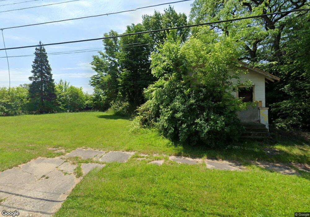
113 W Gillespie Ave Flint, MI 48505
King Avenue Plus NeighborhoodEstimated Value: $42,000 - $47,000
2
Beds
1
Bath
660
Sq Ft
$67/Sq Ft
Est. Value
About This Home
This home is located at 113 W Gillespie Ave, Flint, MI 48505 and is currently estimated at $44,500, approximately $67 per square foot. 113 W Gillespie Ave is a home located in Genesee County with nearby schools including Brownell STEM Academy, The New Standard Academy, and Greater Heights Academy.
Ownership History
Date
Name
Owned For
Owner Type
Purchase Details
Closed on
Mar 5, 2015
Sold by
The Genesee County Land Bank Authority
Bought by
Church Bethlehem Temple
Current Estimated Value
Purchase Details
Closed on
Dec 19, 2008
Sold by
Kildee Daniel T
Bought by
Genesee County Land Bank Authority
Purchase Details
Closed on
May 16, 2006
Sold by
Gardin Robert T
Bought by
Gardin Fredrick M
Purchase Details
Closed on
Oct 11, 2004
Sold by
Kildee Daniel T
Bought by
Gardin Robert
Purchase Details
Closed on
May 23, 2000
Sold by
Walker Ruth and Walker Robert
Bought by
Walker Robert and Walker Ruth
Home Financials for this Owner
Home Financials are based on the most recent Mortgage that was taken out on this home.
Original Mortgage
$35,250
Interest Rate
8.18%
Mortgage Type
Purchase Money Mortgage
Create a Home Valuation Report for This Property
The Home Valuation Report is an in-depth analysis detailing your home's value as well as a comparison with similar homes in the area
Home Values in the Area
Average Home Value in this Area
Purchase History
| Date | Buyer | Sale Price | Title Company |
|---|---|---|---|
| Church Bethlehem Temple | -- | None Available | |
| Genesee County Land Bank Authority | -- | None Available | |
| Gardin Fredrick M | -- | None Available | |
| Gardin Robert | $2,690 | -- | |
| Walker Robert | -- | Fidelity National Title Ins |
Source: Public Records
Mortgage History
| Date | Status | Borrower | Loan Amount |
|---|---|---|---|
| Previous Owner | Walker Robert | $35,250 | |
| Closed | Church Bethlehem Temple | $0 |
Source: Public Records
Tax History
| Year | Tax Paid | Tax Assessment Tax Assessment Total Assessment is a certain percentage of the fair market value that is determined by local assessors to be the total taxable value of land and additions on the property. | Land | Improvement |
|---|---|---|---|---|
| 2025 | $141 | $1,900 | $0 | $0 |
| 2024 | $133 | $1,500 | $0 | $0 |
| 2023 | $140 | $1,300 | $0 | $0 |
| 2022 | $0 | $1,000 | $0 | $0 |
| 2021 | $173 | $1,000 | $0 | $0 |
| 2020 | $179 | $1,200 | $0 | $0 |
| 2019 | $186 | $1,200 | $0 | $0 |
| 2018 | $163 | $1,400 | $0 | $0 |
| 2017 | $89 | $0 | $0 | $0 |
| 2016 | $89 | $0 | $0 | $0 |
| 2015 | -- | $0 | $0 | $0 |
| 2014 | -- | $0 | $0 | $0 |
| 2012 | -- | $0 | $0 | $0 |
Source: Public Records
Map
Nearby Homes
- 217 W Dewey St
- 132 W Jamieson St
- 200 W Mcclellan St
- 320 W Mcclellan St
- 115 E Genesee St
- 3810 Marvin St
- 409 W Genesee St
- 432 W Dartmouth St
- 3422 Race St
- 218 E Jackson Ave
- 3205 Dupont St
- 716 W Genesee St
- 606 W Stewart Ave
- 124 W Flint Park Blvd
- 3207 Milbourne Ave
- 702/718 W Flint Park Blvd
- 510 W Bishop Ave
- 630 E Dartmouth St
- 2718 N Chevrolet Ave
- 329 W Baltimore Blvd
- 115 W Gillespie Ave
- 121 W Gillespie Ave
- 3506 Cassius St
- 3602 Cassius St
- 3601 M l King Ave
- 3502 Cassius St
- 3606 Cassius St
- 3605 M l King Ave
- 3609 M l King Ave
- 3513 Cassius St
- 3610 Cassius St
- 3517 Cassius St
- 3509 Cassius St
- 3505 Cassius St
- 3418 Cassius St
- 3422 Cassius St
- 3601 Cassius St
- 3501 Cassius St
- 3614 Cassius St
- 3605 Cassius St
Your Personal Tour Guide
Ask me questions while you tour the home.