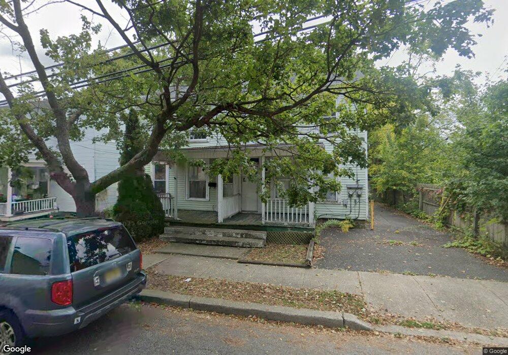
113 W Plane St Unit 115 Hackettstown, NJ 07840
Estimated Value: $439,000 - $520,000
--
Bed
--
Bath
2,521
Sq Ft
$189/Sq Ft
Est. Value
About This Home
This home is located at 113 W Plane St Unit 115, Hackettstown, NJ 07840 and is currently estimated at $477,305, approximately $189 per square foot. 113 W Plane St Unit 115 is a home located in Warren County with nearby schools including Hackettstown Middle School.
Ownership History
Date
Name
Owned For
Owner Type
Purchase Details
Closed on
Mar 2, 2017
Sold by
Federal Home Loan Mortgage Corporation
Bought by
Princess Angeliki Llc
Current Estimated Value
Home Financials for this Owner
Home Financials are based on the most recent Mortgage that was taken out on this home.
Original Mortgage
$97,500
Outstanding Balance
$80,830
Interest Rate
4.16%
Mortgage Type
New Conventional
Estimated Equity
$396,475
Purchase Details
Closed on
Oct 17, 2016
Sold by
Gallant David P Sheriff
Bought by
Federal Home Loan Mortgage Corp
Purchase Details
Closed on
May 9, 2002
Sold by
Baron Norman S and Baron Paula Christine
Bought by
Carter Thomas
Create a Home Valuation Report for This Property
The Home Valuation Report is an in-depth analysis detailing your home's value as well as a comparison with similar homes in the area
Home Values in the Area
Average Home Value in this Area
Purchase History
| Date | Buyer | Sale Price | Title Company |
|---|---|---|---|
| Princess Angeliki Llc | $129,900 | None Available | |
| Federal Home Loan Mortgage Corp | $2,152 | -- | |
| Carter Thomas | $160,000 | Fidelity National Title Ins |
Source: Public Records
Mortgage History
| Date | Status | Borrower | Loan Amount |
|---|---|---|---|
| Open | Princess Angeliki Llc | $97,500 |
Source: Public Records
Tax History Compared to Growth
Tax History
| Year | Tax Paid | Tax Assessment Tax Assessment Total Assessment is a certain percentage of the fair market value that is determined by local assessors to be the total taxable value of land and additions on the property. | Land | Improvement |
|---|---|---|---|---|
| 2025 | $9,717 | $284,200 | $98,800 | $185,400 |
| 2024 | $9,589 | $284,200 | $98,800 | $185,400 |
| 2023 | $9,276 | $284,200 | $98,800 | $185,400 |
| 2022 | $9,276 | $284,200 | $98,800 | $185,400 |
| 2021 | $9,083 | $284,200 | $98,800 | $185,400 |
| 2020 | $8,893 | $284,200 | $98,800 | $185,400 |
| 2019 | $8,594 | $284,200 | $98,800 | $185,400 |
| 2018 | $8,426 | $284,200 | $98,800 | $185,400 |
| 2017 | $8,427 | $284,200 | $98,800 | $185,400 |
| 2016 | $8,287 | $284,200 | $98,800 | $185,400 |
| 2015 | $7,941 | $284,200 | $98,800 | $185,400 |
| 2014 | $7,682 | $284,200 | $98,800 | $185,400 |
Source: Public Records
Map
Nearby Homes
- 201 Willow Grove St
- 398 U S 46
- 205 Warren St
- 403 W Plane St
- 310 Warren St
- 215 Grand Ave
- 412 W Plane St
- 313 Grand Ave
- 302 Grand Ave
- 209 Park Ave
- 9 Saw Mill Cir
- 113 W Valley View Ave
- 41 Main St
- 533 W Valley View Ave
- 522 W Valley View Ave
- 124 Canal Way
- 28 Mine Hill Rd
- 00 Russling Rd
- 39 Overlook Dr
- 5 Francis Terrace
- 113-115 Plane St
- 105 W Plane St Unit 111
- 501 Washington St
- 106 E Plane St
- 106 W Plane St
- 260 Main St
- 112 W Plane St
- 507 Washington St
- 431 Washington St
- 256 Main St Unit 2
- 256 Main St
- 256 Main St Unit 1
- 429 Washington St
- 236 Main St
- 268 Main St
- 270 Main St
- 517 Washington St
- 425 Washington St
- 253 Main St
- 255 Main St