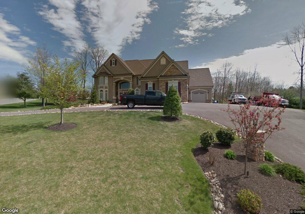
113 Wakefield Rd Shavertown, PA 18708
Estimated Value: $866,191 - $1,161,000
5
Beds
5
Baths
5,988
Sq Ft
$162/Sq Ft
Est. Value
About This Home
This home is located at 113 Wakefield Rd, Shavertown, PA 18708 and is currently estimated at $970,397, approximately $162 per square foot. 113 Wakefield Rd is a home located in Luzerne County with nearby schools including Dallas Senior High School.
Ownership History
Date
Name
Owned For
Owner Type
Purchase Details
Closed on
Sep 28, 2020
Sold by
Raineri Anthony J and Raineri Gina
Bought by
Gupta Snigdha M and Gupta Pravesh
Current Estimated Value
Home Financials for this Owner
Home Financials are based on the most recent Mortgage that was taken out on this home.
Original Mortgage
$636,000
Outstanding Balance
$565,688
Interest Rate
2.9%
Mortgage Type
New Conventional
Estimated Equity
$404,709
Purchase Details
Closed on
Sep 29, 2005
Sold by
Berger Brent L and Berger Kathleen A
Bought by
Raineri Anthony J and Raineri Gina
Create a Home Valuation Report for This Property
The Home Valuation Report is an in-depth analysis detailing your home's value as well as a comparison with similar homes in the area
Home Values in the Area
Average Home Value in this Area
Purchase History
| Date | Buyer | Sale Price | Title Company |
|---|---|---|---|
| Gupta Snigdha M | $795,000 | None Available | |
| Raineri Anthony J | $70,000 | None Available |
Source: Public Records
Mortgage History
| Date | Status | Borrower | Loan Amount |
|---|---|---|---|
| Open | Gupta Snigdha M | $636,000 |
Source: Public Records
Tax History
| Year | Tax Paid | Tax Assessment Tax Assessment Total Assessment is a certain percentage of the fair market value that is determined by local assessors to be the total taxable value of land and additions on the property. | Land | Improvement |
|---|---|---|---|---|
| 2025 | $12,777 | $590,000 | $60,000 | $530,000 |
| 2024 | $12,383 | $590,000 | $60,000 | $530,000 |
| 2023 | $12,383 | $590,000 | $60,000 | $530,000 |
| 2022 | $12,274 | $590,000 | $60,000 | $530,000 |
| 2021 | $12,274 | $590,000 | $60,000 | $530,000 |
| 2020 | $12,274 | $590,000 | $60,000 | $530,000 |
| 2019 | $12,159 | $590,000 | $60,000 | $530,000 |
| 2018 | $12,041 | $590,000 | $60,000 | $530,000 |
| 2017 | $11,867 | $590,000 | $60,000 | $530,000 |
| 2016 | -- | $590,000 | $60,000 | $530,000 |
| 2015 | $11,173 | $590,000 | $60,000 | $530,000 |
| 2014 | $11,173 | $590,000 | $60,000 | $530,000 |
Source: Public Records
Map
Nearby Homes
- 18 Louise Rd
- 31 Hilltop Dr
- 7 Echo Valley Dr
- 235 E Center St
- 39 Cardinal Dr
- 35 E Franklin St
- 1021 Lower Demunds Rd
- 65 Shaver Ave
- 1000 Lower Demunds Rd
- 695 Main St
- 680 Main Rd
- 3 N Pioneer Ave
- 242 Maple St
- 175 N Pioneer Ave
- Lot # 4 Pioneer Ave
- 0 Lt Michael Cleary Dr
- 747 Greens
- 642 Bodle Rd
- 0 Grandview Ave
- 0 Route 309
- 123 Wakefield Rd
- 114 Wakefield Rd
- 115 Wakefield Rd
- 111 Wakefield Rd
- 116 Wakefield Rd
- 140 Wakefield Rd
- 117 Wakefield Rd
- 112 Wakefield Rd
- 121 Wakefield Rd
- 138 Wakefield Rd
- 118 Wakefield Rd
- 43 Tiller Rd
- 110 Wakefield Rd
- 119 Wakefield Rd
- 109 Wakefield Rd
- 200 Greystone Dr
- 52 Alfred Rd
- 122 Wakefield Rd
- 120 Wakefield Rd
- 108 Wakefield Rd
Your Personal Tour Guide
Ask me questions while you tour the home.