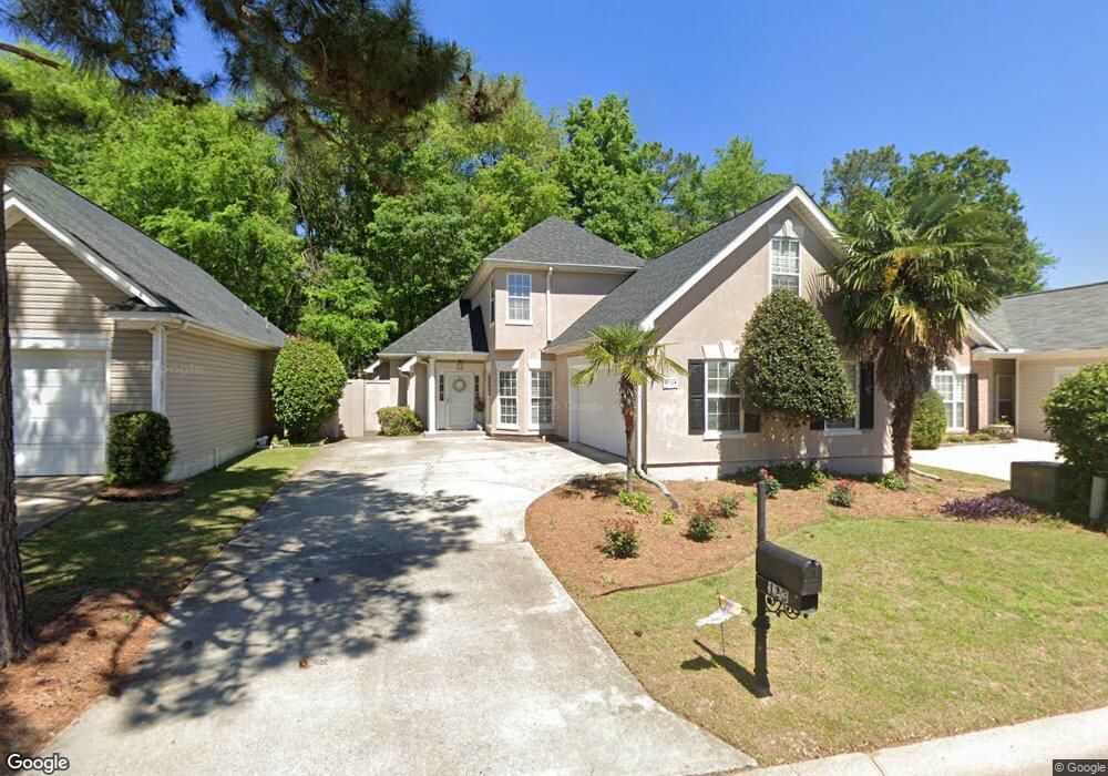
113 Wynfield Ct Columbia, SC 29210
Saint Andrews NeighborhoodEstimated Value: $230,000 - $301,000
4
Beds
3
Baths
2,343
Sq Ft
$115/Sq Ft
Est. Value
About This Home
This home is located at 113 Wynfield Ct, Columbia, SC 29210 and is currently estimated at $268,715, approximately $114 per square foot. 113 Wynfield Ct is a home located in Richland County with nearby schools including H. B. Rhame Elementary School, St. Andrews Middle School, and Columbia High School.
Ownership History
Date
Name
Owned For
Owner Type
Purchase Details
Closed on
Nov 1, 2007
Sold by
Neighbors Ronald A and Neighbors Denise B
Bought by
Williams Karen S
Current Estimated Value
Home Financials for this Owner
Home Financials are based on the most recent Mortgage that was taken out on this home.
Original Mortgage
$70,000
Outstanding Balance
$44,038
Interest Rate
6.27%
Mortgage Type
Negative Amortization
Estimated Equity
$224,677
Create a Home Valuation Report for This Property
The Home Valuation Report is an in-depth analysis detailing your home's value as well as a comparison with similar homes in the area
Home Values in the Area
Average Home Value in this Area
Purchase History
| Date | Buyer | Sale Price | Title Company |
|---|---|---|---|
| Williams Karen S | $200,000 | None Available |
Source: Public Records
Mortgage History
| Date | Status | Borrower | Loan Amount |
|---|---|---|---|
| Open | Williams Karen S | $70,000 |
Source: Public Records
Tax History Compared to Growth
Tax History
| Year | Tax Paid | Tax Assessment Tax Assessment Total Assessment is a certain percentage of the fair market value that is determined by local assessors to be the total taxable value of land and additions on the property. | Land | Improvement |
|---|---|---|---|---|
| 2024 | $1,697 | $196,900 | $0 | $0 |
| 2023 | $1,628 | $6,848 | $0 | $0 |
| 2022 | $1,477 | $171,200 | $15,000 | $156,200 |
| 2021 | $1,484 | $6,850 | $0 | $0 |
| 2020 | $1,510 | $6,850 | $0 | $0 |
| 2019 | $1,489 | $6,850 | $0 | $0 |
| 2018 | $1,461 | $6,740 | $0 | $0 |
| 2017 | $1,427 | $6,740 | $0 | $0 |
| 2016 | $1,421 | $6,740 | $0 | $0 |
| 2015 | $1,380 | $6,740 | $0 | $0 |
| 2014 | $1,337 | $168,600 | $0 | $0 |
| 2013 | -- | $6,740 | $0 | $0 |
Source: Public Records
Map
Nearby Homes
- 112 Gateway Ln
- 201 Burbank St
- 232 Burbank St
- 1650 Omarest Dr
- 1712 Omarest Dr
- 1127 Shirlington Rd
- 321 Cambout St
- 529 Cambout St
- 1510 Canal Dr
- 517 Innsbrook Dr
- 1820 Omarest Dr
- 116 Leyden Ln
- 137 Arrowwood Rd
- 219 Redbud Dr
- 105 River Bluff Ct
- 1509 Nunamaker Dr
- 506 Menlo Dr
- 409 Huntley Way
- 1850 Atlantic Dr
- 1850 Atlantic Dr Unit 416
- 109 Wynfield Ct
- 117 Wynfield Ct
- 121 Wynfield Ct
- 116 Wynfield Ct
- 112 Wynfield Ct
- 101 Wynfield Ct
- 125 Wynfield Ct
- 120 Wynfield Ct
- 108 Wynfield Ct
- 124 Wynfield Ct
- 104 Wynfield Ct
- 129 Wynfield Ct
- 128 Wynfield Ct
- 213 Gateway Ln
- 217 Gateway Ln
- 100 Wynfield Ct
- 133 Wynfield Ct
- 221 Gateway Ln
- 205 Gateway Ln
- 105 Gateway Ln