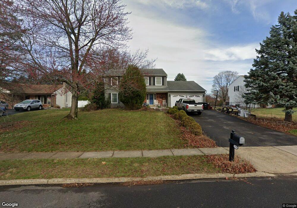
1130 Charter Rd Warminster, PA 18974
Estimated Value: $541,000 - $661,000
4
Beds
3
Baths
2,244
Sq Ft
$268/Sq Ft
Est. Value
About This Home
This home is located at 1130 Charter Rd, Warminster, PA 18974 and is currently estimated at $602,384, approximately $268 per square foot. 1130 Charter Rd is a home located in Bucks County with nearby schools including McDonald Elementary School, Log College Middle School, and William Tennent High School.
Ownership History
Date
Name
Owned For
Owner Type
Purchase Details
Closed on
Dec 22, 2010
Sold by
Zoog James E
Bought by
Zoog Evan J and Zoog Deborah L
Current Estimated Value
Home Financials for this Owner
Home Financials are based on the most recent Mortgage that was taken out on this home.
Original Mortgage
$350,000
Outstanding Balance
$235,899
Interest Rate
4.62%
Mortgage Type
Seller Take Back
Estimated Equity
$366,485
Purchase Details
Closed on
May 30, 1980
Bought by
Zoog James E and Zoog Lorraine
Create a Home Valuation Report for This Property
The Home Valuation Report is an in-depth analysis detailing your home's value as well as a comparison with similar homes in the area
Home Values in the Area
Average Home Value in this Area
Purchase History
| Date | Buyer | Sale Price | Title Company |
|---|---|---|---|
| Zoog Evan J | -- | None Available | |
| Zoog James E | $85,900 | -- |
Source: Public Records
Mortgage History
| Date | Status | Borrower | Loan Amount |
|---|---|---|---|
| Open | Zoog Evan J | $350,000 |
Source: Public Records
Tax History
| Year | Tax Paid | Tax Assessment Tax Assessment Total Assessment is a certain percentage of the fair market value that is determined by local assessors to be the total taxable value of land and additions on the property. | Land | Improvement |
|---|---|---|---|---|
| 2025 | $7,982 | $37,820 | $7,000 | $30,820 |
| 2024 | $7,982 | $37,820 | $7,000 | $30,820 |
| 2023 | $7,737 | $37,820 | $7,000 | $30,820 |
| 2022 | $7,571 | $37,820 | $7,000 | $30,820 |
| 2021 | $7,395 | $37,820 | $7,000 | $30,820 |
| 2020 | $7,291 | $37,820 | $7,000 | $30,820 |
| 2019 | $6,904 | $37,820 | $7,000 | $30,820 |
| 2018 | $6,739 | $37,820 | $7,000 | $30,820 |
| 2017 | $6,541 | $37,820 | $7,000 | $30,820 |
| 2016 | $6,541 | $37,820 | $7,000 | $30,820 |
| 2015 | $6,402 | $37,820 | $7,000 | $30,820 |
| 2014 | $6,402 | $37,820 | $7,000 | $30,820 |
Source: Public Records
Map
Nearby Homes
- 11 Lincoln Ave
- 111 Grandview Dr
- 55 Parry Way
- 403 Byron Rd
- 21 Spring Mill Dr Unit 12
- 11 Spring Dr
- 9 Spring Dr
- 1012 Mearns Rd
- 538 Parmentier Rd
- 130 E Street Rd
- 1192 Harper Dr
- 854 Phillips Rd
- 9108 Centennial Station Unit 910
- 9000 Centennial Station Unit 9000
- 8203 Centennial Station Unit 8203
- 7103 Centennial Station Unit 7103
- 4108 Centennial Station Unit 410
- 7206 Centennial Station Unit 7206
- 682 Whirlaway Dr
- 5303 Centennial Station Unit 5303
- 1120 Charter Rd
- 1140 Charter Rd
- 50 Dorsett Cir
- 1110 Charter Rd
- 1129 Charter Rd
- 40 Dorsett Cir
- 1139 Charter Rd
- 1119 Charter Rd
- 1109 Charter Rd
- 1145 Charter Rd
- 1100 Charter Rd
- 1150 Charter Rd
- 30 Dorsett Cir
- 20 Kirk Rd
- 1099 Charter Rd
- 41 Dorsett Cir
- 10 Kirk Rd
- 31 Dorsett Cir
- 1160 Charter Rd
- 1155 Charter Rd
Your Personal Tour Guide
Ask me questions while you tour the home.