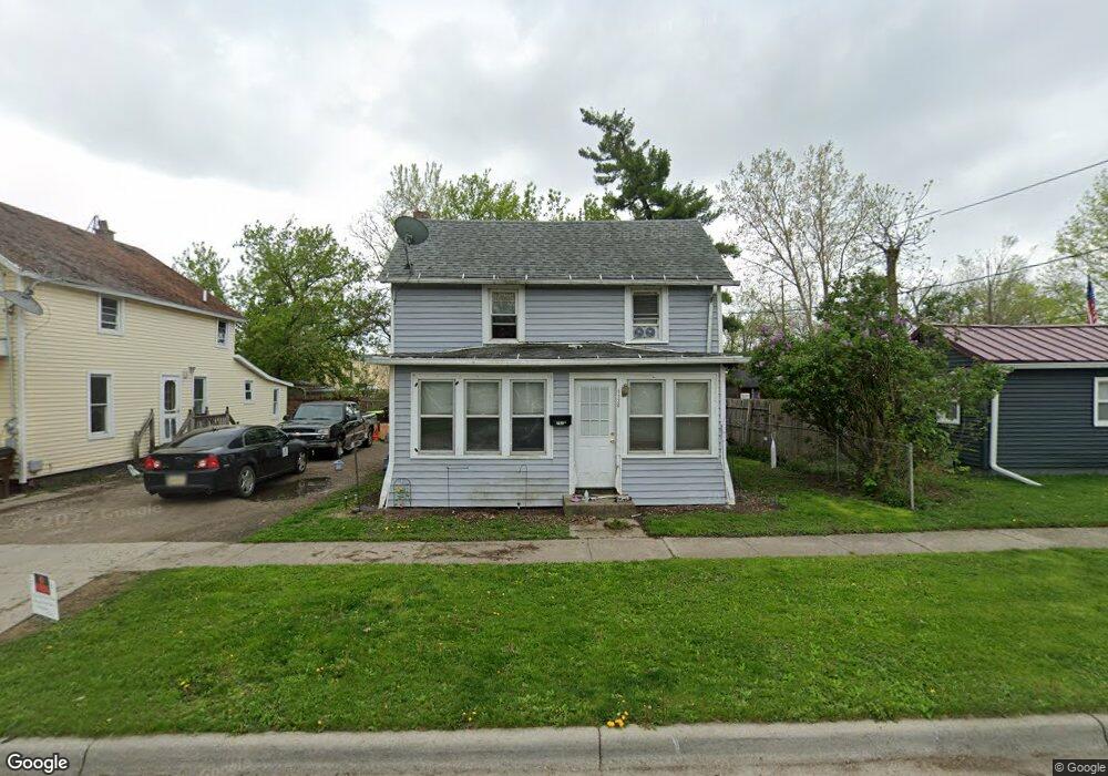
1130 Frank St Adrian, MI 49221
Estimated Value: $76,000 - $134,000
Studio
--
Bath
1,213
Sq Ft
$86/Sq Ft
Est. Value
About This Home
This home is located at 1130 Frank St, Adrian, MI 49221 and is currently estimated at $104,630, approximately $86 per square foot. 1130 Frank St is a home located in Lenawee County with nearby schools including Adrian High School, St. Joseph Academy, and St. Joseph's Academy.
Ownership History
Date
Name
Owned For
Owner Type
Purchase Details
Closed on
Apr 16, 2013
Sold by
Godwin Richard and Godwin Joann
Bought by
Davis Lisa
Current Estimated Value
Purchase Details
Closed on
Oct 16, 2008
Sold by
Bates Richard Dale and Clark Jessica Whitney
Bought by
Godwin Jo Ann and Jo Ann Godwin Trust
Purchase Details
Closed on
Mar 1, 2006
Sold by
Godwin Richard and Godwin Joann
Bought by
Bates Richard Dale and Clark Jessica Whitney
Home Financials for this Owner
Home Financials are based on the most recent Mortgage that was taken out on this home.
Original Mortgage
$7,000
Interest Rate
10%
Purchase Details
Closed on
Oct 4, 2005
Sold by
Hemphill Jeramie
Bought by
Godwin Jo Ann and Jo Ann Godwin Trust
Create a Home Valuation Report for This Property
The Home Valuation Report is an in-depth analysis detailing your home's value as well as a comparison with similar homes in the area
Home Values in the Area
Average Home Value in this Area
Purchase History
| Date | Buyer | Sale Price | Title Company |
|---|---|---|---|
| Davis Lisa | $38,575 | None Available | |
| Godwin Jo Ann | -- | None Available | |
| Bates Richard Dale | $70,000 | None Available | |
| Godwin Jo Ann | -- | None Available |
Source: Public Records
Mortgage History
| Date | Status | Borrower | Loan Amount |
|---|---|---|---|
| Previous Owner | Bates Richard Dale | $7,000 | |
| Closed | Davis Lisa | $0 |
Source: Public Records
Tax History
| Year | Tax Paid | Tax Assessment Tax Assessment Total Assessment is a certain percentage of the fair market value that is determined by local assessors to be the total taxable value of land and additions on the property. | Land | Improvement |
|---|---|---|---|---|
| 2025 | $1,187 | $36,000 | $0 | $0 |
| 2024 | $10 | $34,200 | $0 | $0 |
| 2023 | $1,445 | $31,100 | $0 | $0 |
| 2022 | $1,689 | $28,100 | $0 | $0 |
| 2021 | $986 | $24,400 | $0 | $0 |
| 2020 | $983 | $23,400 | $0 | $0 |
| 2019 | $54,868 | $21,300 | $0 | $0 |
| 2018 | $822 | $25,955 | $0 | $0 |
| 2017 | $796 | $19,258 | $0 | $0 |
| 2016 | $789 | $18,393 | $0 | $0 |
| 2014 | -- | $20,100 | $0 | $0 |
Source: Public Records
Map
Nearby Homes
- 924 Frank St
- 1015 E Hunt St
- 907 E Hunt St
- 206 Ormsby St
- 1635 Naomi Ave
- 518 Frank St
- 418 Ormsby St
- 810 E Beecher St
- 418 E Church St
- 220 Comstock St
- 717 Bristol St
- 820 Mulberry St
- 417 E Hunt St
- 229 Clinton St
- 709 N Locust St
- 612 N Clinton St
- 534 E Siena Heights Dr
- 2751 Cloverdale Ave
- 632 Division St
- 443 S Winter St
Your Personal Tour Guide
Ask me questions while you tour the home.