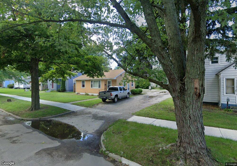
1130 Jennings Ave Benton Harbor, MI 49022
Estimated Value: $89,000 - $106,000
2
Beds
1
Bath
818
Sq Ft
$119/Sq Ft
Est. Value
About This Home
This home is located at 1130 Jennings Ave, Benton Harbor, MI 49022 and is currently estimated at $97,079, approximately $118 per square foot. 1130 Jennings Ave is a home located in Berrien County with nearby schools including Fair Plain Middle School, Benton Harbor High School, and Benton Harbor Charter School Academy.
Ownership History
Date
Name
Owned For
Owner Type
Purchase Details
Closed on
Mar 15, 2024
Sold by
Muhammad Linda A
Bought by
Muhammad Linda A and Whistnan Ronta
Current Estimated Value
Purchase Details
Closed on
Mar 14, 2023
Sold by
Mcafee Gwendolyn
Bought by
Muhammad Linda
Purchase Details
Closed on
Aug 24, 2006
Sold by
Burton Glenda K and Crumble Glenda K
Bought by
Sims Gwendolyn
Purchase Details
Closed on
Aug 2, 2006
Sold by
Muhammad Amming and Whistright Annie
Bought by
Sims Gwendolyn
Purchase Details
Closed on
Jun 29, 2006
Sold by
Najreb Annie Dolores and Haynes Deloise
Bought by
Sims Gwendolyn
Purchase Details
Closed on
Aug 1, 1976
Create a Home Valuation Report for This Property
The Home Valuation Report is an in-depth analysis detailing your home's value as well as a comparison with similar homes in the area
Home Values in the Area
Average Home Value in this Area
Purchase History
| Date | Buyer | Sale Price | Title Company |
|---|---|---|---|
| Muhammad Linda A | -- | None Listed On Document | |
| Muhammad Linda A | -- | None Listed On Document | |
| Muhammad Linda | -- | -- | |
| Sims Gwendolyn | -- | None Available | |
| Sims Gwendolyn | -- | None Available | |
| Sims Gwendolyn | -- | None Available | |
| Sims Gwendolyn | -- | None Available | |
| -- | $2,000 | -- |
Source: Public Records
Tax History Compared to Growth
Tax History
| Year | Tax Paid | Tax Assessment Tax Assessment Total Assessment is a certain percentage of the fair market value that is determined by local assessors to be the total taxable value of land and additions on the property. | Land | Improvement |
|---|---|---|---|---|
| 2025 | $934 | $31,800 | $0 | $0 |
| 2024 | $1,695 | $28,100 | $0 | $0 |
| 2023 | $719 | $19,900 | $0 | $0 |
| 2022 | $816 | $14,800 | $0 | $0 |
| 2021 | $821 | $14,200 | $700 | $13,500 |
| 2020 | $576 | $14,400 | $0 | $0 |
| 2019 | $824 | $12,700 | $0 | $0 |
| 2018 | $553 | $12,400 | $0 | $0 |
| 2017 | $543 | $13,900 | $0 | $0 |
| 2016 | $531 | $14,000 | $0 | $0 |
| 2015 | $530 | $13,500 | $0 | $0 |
| 2014 | $493 | $16,400 | $0 | $0 |
Source: Public Records
Map
Nearby Homes
- 1129 Jennings Ave
- 1219 Ogden Ave
- 960 Union Ave
- 960 Jennings Ave
- 361 E May St
- 1301 Superior St
- 1097 Pearl St
- 1332 Columbus Ave
- 1337 Agard Ave
- 972 Pearl St
- 1267 Broadway
- 349 E Empire Ave
- 1380 Milton St
- 833 Pearl St
- 730 Superior St
- 979 Lavette Ave
- 1045 Broadway
- 0 V/L E Empire Ave
- 180 Emery Ave
- 1591 Union Ave
- 1138 Jennings Ave
- 1122 Jennings Ave
- 1144 Jennings Ave
- 572 E May St
- 1110 Jennings Ave
- 1131 Monroe St
- 1139 Monroe St
- 566 E May St
- 1145 Monroe St
- 1160 Jennings Ave
- 560 E May St
- 1133 Jennings Ave
- 1139 Jennings Ave
- 1153 Monroe St
- 1111 Jennings Ave
- 1145 Jennings Ave
- 550 E May St
- 1166 Jennings Ave
- 1151 Jennings Ave
- 1159 Monroe St