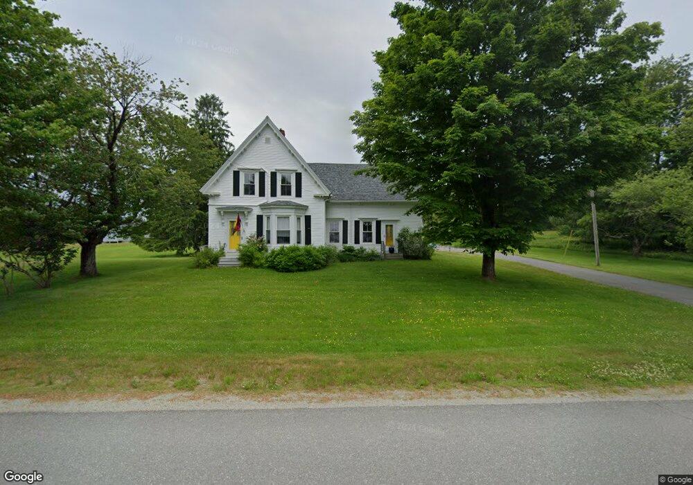
1130 Shore Rd Lamoine, ME 04605
Estimated Value: $431,000 - $657,000
--
Bed
--
Bath
--
Sq Ft
1.7
Acres
About This Home
This home is located at 1130 Shore Rd, Lamoine, ME 04605 and is currently estimated at $531,431. 1130 Shore Rd is a home located in Hancock County with nearby schools including Sumner Memorial High School and Acadia Christian School.
Ownership History
Date
Name
Owned For
Owner Type
Purchase Details
Closed on
Jun 25, 2024
Sold by
Smith Janice M
Bought by
Kulczycki Alexander and Hodkiewicz Kayla
Current Estimated Value
Home Financials for this Owner
Home Financials are based on the most recent Mortgage that was taken out on this home.
Original Mortgage
$210,000
Outstanding Balance
$206,945
Interest Rate
7.02%
Mortgage Type
Purchase Money Mortgage
Estimated Equity
$324,486
Purchase Details
Closed on
Feb 8, 2019
Sold by
Smith Janice M
Bought by
Hodkiewicz Kristina R and Smith Kristina R
Create a Home Valuation Report for This Property
The Home Valuation Report is an in-depth analysis detailing your home's value as well as a comparison with similar homes in the area
Home Values in the Area
Average Home Value in this Area
Purchase History
| Date | Buyer | Sale Price | Title Company |
|---|---|---|---|
| Kulczycki Alexander | $445,900 | None Available | |
| Hodkiewicz Kristina R | -- | -- | |
| Hodkiewicz Kristina R | -- | -- | |
| Hodkiewicz Kristina R | -- | -- |
Source: Public Records
Mortgage History
| Date | Status | Borrower | Loan Amount |
|---|---|---|---|
| Open | Kulczycki Alexander | $210,000 |
Source: Public Records
Tax History Compared to Growth
Tax History
| Year | Tax Paid | Tax Assessment Tax Assessment Total Assessment is a certain percentage of the fair market value that is determined by local assessors to be the total taxable value of land and additions on the property. | Land | Improvement |
|---|---|---|---|---|
| 2025 | $3,341 | $318,200 | $71,800 | $246,400 |
| 2024 | $3,132 | $364,200 | $117,800 | $246,400 |
| 2023 | $3,132 | $364,200 | $117,800 | $246,400 |
| 2022 | $2,437 | $217,600 | $86,400 | $131,200 |
| 2021 | $2,502 | $217,600 | $86,400 | $131,200 |
| 2020 | $2,524 | $217,600 | $86,400 | $131,200 |
| 2019 | $2,372 | $217,600 | $86,400 | $131,200 |
| 2018 | $2,465 | $220,100 | $88,900 | $131,200 |
| 2017 | $2,355 | $220,100 | $88,900 | $131,200 |
| 2016 | $5,558 | $220,100 | $88,900 | $131,200 |
| 2015 | $2,223 | $220,100 | $88,900 | $131,200 |
| 2014 | $2,267 | $220,100 | $88,900 | $131,200 |
| 2013 | $2,047 | $220,100 | $88,900 | $131,200 |
Source: Public Records
Map
Nearby Homes
- 754 Bar Harbor Rd
- Lot 5 Bar Harbor Rd
- 64 Lamoine Beach Rd
- M1 L81-11 Asa's Ln
- M1 L81-11 Asa's Ln
- Map7 Lot7 Maine 204
- Lot 11 Kennel Brook Dr
- Map 33, Lots 9 and 11 Bar Harbor Rd
- 694 Lamoine Beach Rd
- 71 Bay View Dr
- 37 Hanna Dr
- Lot 4 Belle Grande Dr
- Lot 3 Belle Grande Dr
- 0 Mallard Ln
- Lot #10 North Rd
- 22 Mallard Ln
- 782 Lamoine Beach Rd
- 791 Lamoine Beach Rd
- 1002 Bayside Rd
- 1427 State Highway 3