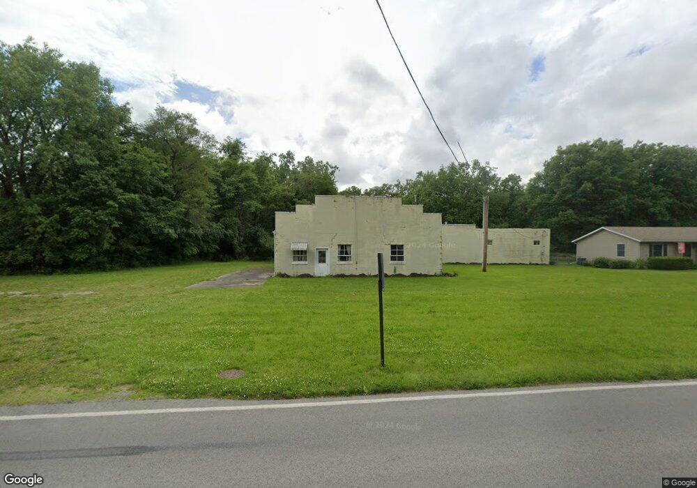
1130 Siler St Fremont, OH 43420
Estimated Value: $107,882 - $172,000
--
Bed
--
Bath
--
Sq Ft
5.12
Acres
About This Home
This home is located at 1130 Siler St, Fremont, OH 43420 and is currently estimated at $139,941. 1130 Siler St is a home located in Sandusky County with nearby schools including Fremont Ross High School, St. Joseph School, and Bishop Hoffman Catholic School - This is St Joe's School now.
Ownership History
Date
Name
Owned For
Owner Type
Purchase Details
Closed on
May 23, 2014
Sold by
Hicks Sarah J
Bought by
Burns Joseph A
Current Estimated Value
Purchase Details
Closed on
May 22, 2014
Sold by
Hicks Sarah J
Bought by
Burns Joseph A
Purchase Details
Closed on
May 31, 2013
Sold by
Sieberg Mary A
Bought by
Hicks Sarah J
Purchase Details
Closed on
Jun 9, 2008
Sold by
Estate Of Robert W Burns
Bought by
The Croghan Colonial Bank and Robert W Burns Irrevocable Trust
Purchase Details
Closed on
Feb 17, 1998
Sold by
Burns Thomas P
Bought by
Burns Robert W
Purchase Details
Closed on
Nov 1, 1993
Sold by
Burns Robert W
Bought by
Burns Joseph A
Purchase Details
Closed on
Oct 1, 1993
Sold by
Burns Robert W
Bought by
Burns Joseph A
Purchase Details
Closed on
Apr 1, 1986
Bought by
Burns Joseph A
Create a Home Valuation Report for This Property
The Home Valuation Report is an in-depth analysis detailing your home's value as well as a comparison with similar homes in the area
Home Values in the Area
Average Home Value in this Area
Purchase History
| Date | Buyer | Sale Price | Title Company |
|---|---|---|---|
| Burns Joseph A | $10,000 | Port Lawrence Title & Trust | |
| Burns Joseph A | $10,000 | Port Lawrence Title & Trust | |
| Hicks Sarah J | $15,000 | Attorney | |
| The Croghan Colonial Bank | -- | None Available | |
| Burns Robert W | $26,667 | -- | |
| Burns Joseph A | -- | -- | |
| Burns Joseph A | -- | -- | |
| Burns Joseph A | -- | -- |
Source: Public Records
Tax History Compared to Growth
Tax History
| Year | Tax Paid | Tax Assessment Tax Assessment Total Assessment is a certain percentage of the fair market value that is determined by local assessors to be the total taxable value of land and additions on the property. | Land | Improvement |
|---|---|---|---|---|
| 2024 | $627 | $20,660 | $13,760 | $6,900 |
| 2023 | $822 | $14,460 | $9,630 | $4,830 |
| 2022 | $614 | $14,460 | $9,630 | $4,830 |
| 2021 | $633 | $14,460 | $9,630 | $4,830 |
| 2020 | $581 | $13,020 | $8,190 | $4,830 |
| 2019 | $580 | $13,020 | $8,190 | $4,830 |
| 2018 | $561 | $13,020 | $8,190 | $4,830 |
| 2017 | $558 | $12,780 | $8,190 | $4,590 |
| 2016 | $490 | $12,780 | $8,190 | $4,590 |
| 2015 | $483 | $12,780 | $8,190 | $4,590 |
| 2014 | $762 | $19,320 | $15,190 | $4,130 |
| 2013 | $746 | $19,320 | $15,190 | $4,130 |
Source: Public Records
Map
Nearby Homes
- 1420 Center St
- 1485 Autumn Woods Dr
- 1719 Buckland Ave
- 10 Meadowbrook Dr
- 10 Meadowbrook Ln
- 64 River Run Dr Unit J
- 1013 Whittlesey St
- 905 Twinn St
- 1028 June St
- 135 Briarwood Cir
- 1611 Mcpherson Blvd
- 815 South St
- 2484 Buckland Ave
- 1015 Hayes Ave
- 616 S Wood St
- 625 Bush Place
- 1037 Buckland Ave
- 1818 Finley Dr
- 350 Conner Dr
- 619 Hayes Ave