Estimated Value: $334,000 - $525,000
3
Beds
4
Baths
3,071
Sq Ft
$149/Sq Ft
Est. Value
About This Home
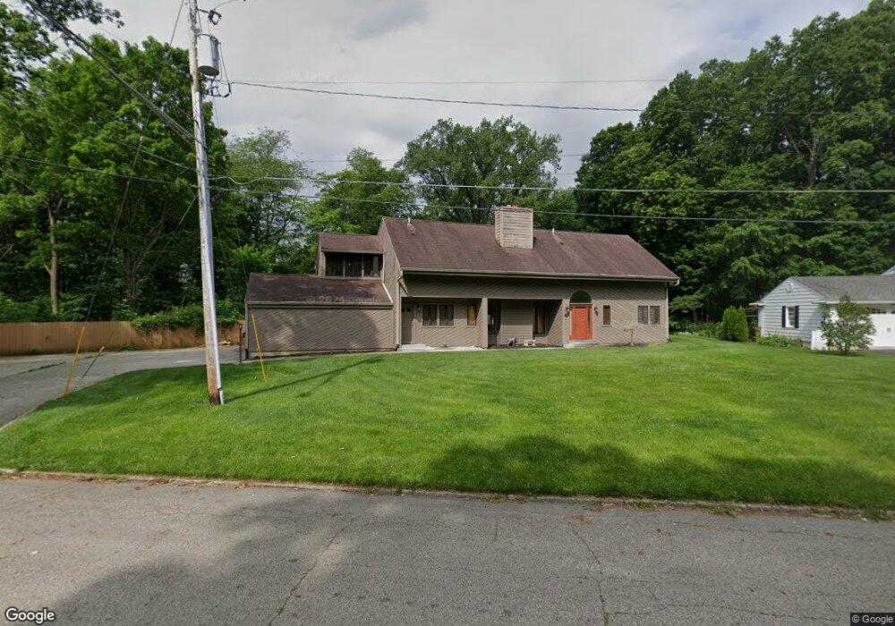
This home is located at 1130 Summit Ave, Troy, OH 45373 and is currently estimated at $458,876, approximately $149 per square foot. 1130 Summit Ave is a home located in Miami County with nearby schools including Heywood Elementary School, Van Cleve Elementary School, and Troy Junior High School.
Ownership History
Date
Name
Owned For
Owner Type
Purchase Details
Closed on
Mar 13, 2002
Sold by
Black Robert J and Black Jeanne C
Bought by
Daffner Daniel D and Wooddell Pamela S
Current Estimated Value
Home Financials for this Owner
Home Financials are based on the most recent Mortgage that was taken out on this home.
Original Mortgage
$237,750
Outstanding Balance
$94,559
Interest Rate
7.11%
Mortgage Type
New Conventional
Estimated Equity
$364,317
Purchase Details
Closed on
May 1, 1986
Bought by
Black Robert J
Create a Home Valuation Report for This Property
The Home Valuation Report is an in-depth analysis detailing your home's value as well as a comparison with similar homes in the area
Home Values in the Area
Average Home Value in this Area
Purchase History
| Date | Buyer | Sale Price | Title Company |
|---|---|---|---|
| Daffner Daniel D | $317,000 | -- | |
| Black Robert J | $75,000 | -- |
Source: Public Records
Mortgage History
| Date | Status | Borrower | Loan Amount |
|---|---|---|---|
| Open | Daffner Daniel D | $237,750 |
Source: Public Records
Tax History
| Year | Tax Paid | Tax Assessment Tax Assessment Total Assessment is a certain percentage of the fair market value that is determined by local assessors to be the total taxable value of land and additions on the property. | Land | Improvement |
|---|---|---|---|---|
| 2025 | $5,937 | $172,170 | $22,400 | $149,770 |
| 2024 | $5,937 | $135,000 | $23,420 | $111,580 |
| 2023 | $5,094 | $135,000 | $23,420 | $111,580 |
| 2022 | $4,243 | $135,000 | $23,420 | $111,580 |
| 2021 | $3,573 | $107,980 | $18,730 | $89,250 |
| 2020 | $3,578 | $107,980 | $18,730 | $89,250 |
| 2019 | $3,611 | $107,980 | $18,730 | $89,250 |
| 2018 | $3,501 | $100,770 | $20,230 | $80,540 |
| 2017 | $3,537 | $100,770 | $20,230 | $80,540 |
| 2016 | $3,484 | $100,770 | $20,230 | $80,540 |
| 2015 | $3,367 | $93,320 | $18,730 | $74,590 |
| 2014 | $3,367 | $93,320 | $18,730 | $74,590 |
| 2013 | $3,389 | $93,320 | $18,730 | $74,590 |
Source: Public Records
Map
Nearby Homes
- 0 Ohio 55
- 1426 Paul Revere Way Unit B
- 1426 Paul Revere Way Unit D
- 385 W Ross St
- 1479 Lantern Ln Unit 1479
- 1481 Lantern Ln
- 1141 Dickerson Dr
- 507 Lake St
- 920 Old Nursery Trail
- 510 Drury Ln
- 405 Lake St
- 67 W Dakota St
- 410 Armand Dr
- 517 S Cherry St
- 504 S Market St
- 1201 Maple St
- 302 Pennsylvania Ave
- 339 Lincoln Ave
- 408 S Market St
- 712 S Clay St
- 1110 Summit Ave
- 1151 Summit Ave
- 1190 Westridge Dr
- 651 W Market St
- 703 W Market St
- 1250 Ridgewood Dr
- 701 W Market St
- 1222 Ridgewood Dr
- 1208 Ridgewood Dr
- 705 W Market St
- 707 W Market St
- 1180 Westridge Dr
- 1195 Westridge Dr
- 1302 Ridgewood Dr
- 709 W Market St
- 715 W Market St
- 1162 Westridge Dr
- 1207 Ridgewood Dr
- 1171 Westridge Dr
- 1298 Ridgewood Dr
Your Personal Tour Guide
Ask me questions while you tour the home.