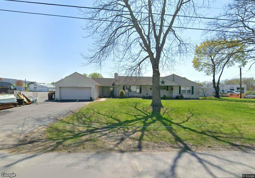
1130 Wea Wit St East Earl, PA 17519
Estimated Value: $365,000 - $436,467
3
Beds
2
Baths
2,238
Sq Ft
$177/Sq Ft
Est. Value
About This Home
This home is located at 1130 Wea Wit St, East Earl, PA 17519 and is currently estimated at $396,367, approximately $177 per square foot. 1130 Wea Wit St is a home located in Lancaster County with nearby schools including Garden Spot Middle School, Garden Spot Senior High School, and Conestoga Parochial School.
Ownership History
Date
Name
Owned For
Owner Type
Purchase Details
Closed on
Jul 19, 2013
Sold by
Schreiber Frederick J
Bought by
Kem Properties Llc
Current Estimated Value
Home Financials for this Owner
Home Financials are based on the most recent Mortgage that was taken out on this home.
Original Mortgage
$2,000,000
Outstanding Balance
$1,457,364
Interest Rate
3.97%
Mortgage Type
Credit Line Revolving
Estimated Equity
-$1,060,997
Create a Home Valuation Report for This Property
The Home Valuation Report is an in-depth analysis detailing your home's value as well as a comparison with similar homes in the area
Home Values in the Area
Average Home Value in this Area
Purchase History
| Date | Buyer | Sale Price | Title Company |
|---|---|---|---|
| Kem Properties Llc | $1,700,000 | None Available |
Source: Public Records
Mortgage History
| Date | Status | Borrower | Loan Amount |
|---|---|---|---|
| Open | Kem Properties Llc | $2,000,000 |
Source: Public Records
Tax History Compared to Growth
Tax History
| Year | Tax Paid | Tax Assessment Tax Assessment Total Assessment is a certain percentage of the fair market value that is determined by local assessors to be the total taxable value of land and additions on the property. | Land | Improvement |
|---|---|---|---|---|
| 2025 | $4,133 | $230,800 | $78,800 | $152,000 |
| 2024 | $4,133 | $230,800 | $78,800 | $152,000 |
| 2023 | $4,074 | $230,800 | $78,800 | $152,000 |
| 2022 | $4,030 | $230,800 | $78,800 | $152,000 |
| 2021 | $3,966 | $230,800 | $78,800 | $152,000 |
| 2020 | $3,966 | $230,800 | $78,800 | $152,000 |
| 2019 | $3,923 | $230,800 | $78,800 | $152,000 |
| 2018 | $5,717 | $230,800 | $78,800 | $152,000 |
| 2017 | $3,653 | $175,400 | $49,200 | $126,200 |
| 2016 | $3,653 | $175,400 | $49,200 | $126,200 |
| 2015 | $1,015 | $175,400 | $49,200 | $126,200 |
| 2014 | $2,659 | $184,500 | $49,200 | $135,300 |
Source: Public Records
Map
Nearby Homes
- 1276 Martin St
- 1215 Shetland Cir
- 1411 Martin St
- 1220 Shetland Cir
- 529 Ranck Rd Unit 6
- 529 Ranck Rd Unit 10
- 529 Ranck Rd Unit 9
- 529 Ranck Rd Unit 8
- 529 Ranck Rd Unit 5
- 529 Ranck Rd Unit 4
- 529 Ranck Rd Unit 3
- 529 Ranck Rd Unit 2
- 529 Ranck Rd Unit 1
- 1145 Brownstone Ridge
- 590 E Jackson St
- 28 Hearth Dr
- 44 Emily Ln
- 113 Windsock Way
- 13 Amber Cir
- 208 Willow Ridge
- 1140 Wea Wit St
- 1148 Wea Wit St
- 1152 Wea Wit St
- 1156 Wea Wit St
- 1153 Wea Wit St
- 1155 Wea Wit St
- 1158 Wea Wit St
- 1154 Rose Ave
- 1157 Weawit St
- 1160 Wea Wit St
- 1159 Wea Wit St
- 1155 Rose Ave
- 1162 Wea Wit St
- 1162 Rose Ave
- 1161 Wea Wit St
- 1164 Wea Wit St
- 1159 Rose Ave
- 4291 Division Hwy
- 4271 Division Hwy
- 4325 Division Hwy