Estimated Value: $166,000 - $185,000
3
Beds
2
Baths
2,016
Sq Ft
$87/Sq Ft
Est. Value
About This Home
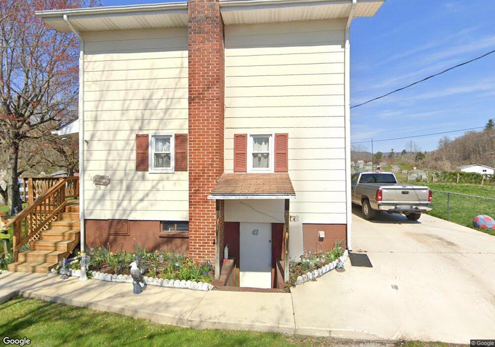
This home is located at 11306 Riverside Cir, Pound, VA 24279 and is currently estimated at $174,659, approximately $86 per square foot. 11306 Riverside Cir is a home located in Wise County.
Ownership History
Date
Name
Owned For
Owner Type
Purchase Details
Closed on
Oct 23, 2024
Sold by
Bolling Morgan E
Bought by
Denham Jackson and Wolford Heather
Current Estimated Value
Home Financials for this Owner
Home Financials are based on the most recent Mortgage that was taken out on this home.
Original Mortgage
$181,818
Outstanding Balance
$179,852
Interest Rate
6.2%
Mortgage Type
New Conventional
Estimated Equity
-$5,193
Purchase Details
Closed on
Jan 18, 2024
Sold by
Maggard Betty M and Maggard Catherine Anne
Bought by
Bolling Morgan E
Create a Home Valuation Report for This Property
The Home Valuation Report is an in-depth analysis detailing your home's value as well as a comparison with similar homes in the area
Home Values in the Area
Average Home Value in this Area
Purchase History
| Date | Buyer | Sale Price | Title Company |
|---|---|---|---|
| Denham Jackson | $180,000 | None Listed On Document | |
| Bolling Morgan E | -- | None Listed On Document |
Source: Public Records
Mortgage History
| Date | Status | Borrower | Loan Amount |
|---|---|---|---|
| Open | Denham Jackson | $181,818 |
Source: Public Records
Tax History Compared to Growth
Tax History
| Year | Tax Paid | Tax Assessment Tax Assessment Total Assessment is a certain percentage of the fair market value that is determined by local assessors to be the total taxable value of land and additions on the property. | Land | Improvement |
|---|---|---|---|---|
| 2025 | $914 | $132,500 | $11,600 | $120,900 |
| 2024 | $789 | $114,300 | $11,600 | $102,700 |
| 2023 | $789 | $114,300 | $11,600 | $102,700 |
| 2022 | $789 | $114,300 | $11,600 | $102,700 |
| 2021 | $768 | $111,300 | $11,600 | $99,700 |
| 2020 | $768 | $111,300 | $11,600 | $99,700 |
| 2019 | $768 | $111,300 | $11,600 | $99,700 |
| 2018 | $690 | $111,300 | $11,600 | $99,700 |
| 2017 | $668 | $111,300 | $11,600 | $99,700 |
| 2016 | $668 | $111,300 | $11,600 | $99,700 |
| 2015 | -- | $111,300 | $11,600 | $99,700 |
| 2010 | -- | $111,300 | $11,600 | $99,700 |
Source: Public Records
Map
Nearby Homes
- 8342 N River Rd
- Tbd Orby Cantrell Hwy
- TBD Indian Creek Rd
- 8102 Main St
- 8835 Maple Rd
- 11510 Dogwood Ln
- 11590 Cedar Rd
- 8006 Pansy St
- 7914 High Oak Rd
- Tbd Applebox Rd
- 11616 Alfred Cox Rd
- 7742 S Fork Rd
- 11511 Meade Fork Rd
- Tbd Clintwood Hwy
- 9616 Mountain Cove Rd
- 9707 Paso Ln
- 8366 Fishman Rd
- 210 Hickory Hollow Hill
- 9906 Dewey Cemetery Rd
- 9598 U S 119
- 11304 Riverside Cir
- 8507 Spruce St
- 11302 Riverside Cir
- 11296 Riverside Cir
- 8508 Spruce St
- 11316 Riverside Cir
- 8507 Walnut St
- 11292 Riverside Cir
- 11247 Indian Creek Rd
- 11323 Knowledge Dr
- 8508 Pine St
- 11329 Knowledge Dr
- 11249 Indian Creek Rd
- 00 Pine Mountain
- 8504 Pine St
- 11235 Indian Creek Rd
- 11317 Knowledge Dr
- 11223 Timbergrove Cir
- 8508 Walnut St
- 11333 Knowledge Dr