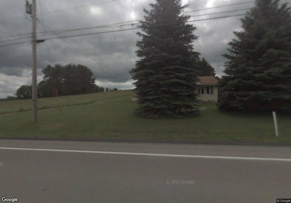
11306 Route 28 Brockway, PA 15824
Estimated Value: $103,000 - $166,000
--
Bed
--
Bath
1,176
Sq Ft
$109/Sq Ft
Est. Value
About This Home
This home is located at 11306 Route 28, Brockway, PA 15824 and is currently estimated at $128,202, approximately $109 per square foot. 11306 Route 28 is a home located in Jefferson County with nearby schools including Brockway Area Elementary School, Brockway Area Junior/Senior High School, and EAGLES NEST AMISH SCHOOL.
Ownership History
Date
Name
Owned For
Owner Type
Purchase Details
Closed on
Feb 26, 2016
Sold by
Byler Aaron D and Byler Ada D
Bought by
Calhoun James E and Calhoun Terri M
Current Estimated Value
Purchase Details
Closed on
Aug 14, 2013
Sold by
Jordan Jennifer L and Vivian Jennifer L
Bought by
Byler Aaron D and Byler Ada D
Home Financials for this Owner
Home Financials are based on the most recent Mortgage that was taken out on this home.
Original Mortgage
$36,000
Interest Rate
4.31%
Mortgage Type
Purchase Money Mortgage
Purchase Details
Closed on
Feb 21, 2007
Sold by
Inzana Donna and Deemer Paula
Bought by
Vivian Jennifer L
Home Financials for this Owner
Home Financials are based on the most recent Mortgage that was taken out on this home.
Original Mortgage
$37,800
Interest Rate
6.07%
Mortgage Type
Purchase Money Mortgage
Create a Home Valuation Report for This Property
The Home Valuation Report is an in-depth analysis detailing your home's value as well as a comparison with similar homes in the area
Home Values in the Area
Average Home Value in this Area
Purchase History
| Date | Buyer | Sale Price | Title Company |
|---|---|---|---|
| Calhoun James E | $67,500 | None Available | |
| Byler Aaron D | $45,000 | None Available | |
| Vivian Jennifer L | $42,000 | None Available |
Source: Public Records
Mortgage History
| Date | Status | Borrower | Loan Amount |
|---|---|---|---|
| Previous Owner | Byler Aaron D | $36,000 | |
| Previous Owner | Vivian Jennifer L | $37,800 |
Source: Public Records
Tax History Compared to Growth
Tax History
| Year | Tax Paid | Tax Assessment Tax Assessment Total Assessment is a certain percentage of the fair market value that is determined by local assessors to be the total taxable value of land and additions on the property. | Land | Improvement |
|---|---|---|---|---|
| 2025 | $1,300 | $33,510 | $3,700 | $29,810 |
| 2024 | $1,523 | $33,510 | $3,700 | $29,810 |
| 2023 | $1,266 | $33,510 | $3,700 | $29,810 |
| 2022 | $1,266 | $33,510 | $3,700 | $29,810 |
| 2021 | $1,266 | $33,510 | $3,700 | $29,810 |
| 2020 | $1,266 | $33,510 | $3,700 | $29,810 |
| 2019 | $1,211 | $33,510 | $3,700 | $29,810 |
| 2018 | $1,180 | $33,510 | $3,700 | $29,810 |
| 2017 | $1,161 | $33,510 | $3,700 | $29,810 |
| 2016 | $1,057 | $33,510 | $3,700 | $29,810 |
| 2015 | -- | $33,510 | $3,700 | $29,810 |
| 2012 | -- | $30,470 | $3,700 | $26,770 |
Source: Public Records
Map
Nearby Homes
- 0 Coal Glen Rd
- 19 Salandra Ln
- 5546 Stevenson Hill Rd
- 10217 Pennsylvania 28
- 725 Russel Rd
- 00 Pennsylvania 830
- 3539 Stevenson Hill Rd
- 1074 10th Ave
- 3243 Stevenson Hill Rd
- 0 U S 219
- 1549 Main St
- 970 Baghdad Rd
- 924 Elm St
- 1144 Shaffer Rd
- 559 Buskirk Rd
- 7956 U S 219
- 4908 Pennsylvania 28
- 1032 Beechtree Rd
- 23682 Pennsylvania 949
- 737 Crooked Pine Trail
- 80407 Alexander H Lindsay Memorial Hwy
- 11693 Route 28
- 11693 Route 28
- 25 Weisner Dr
- 11142 Route 28
- 82 Weisner Dr
- 11104 Route 28
- 140 Weisner Dr
- 11070 Route 28
- 11030 Route 28
- 10971 Route 28
- 11509 Route 28
- 10968 Route 28
- 10953 Route 28
- 11595 Route 28
- 10928 Route 28
- 11595 Pennsylvania 28
- 11612 Route 28
- 10896 Route 28
- 11712 Route 28