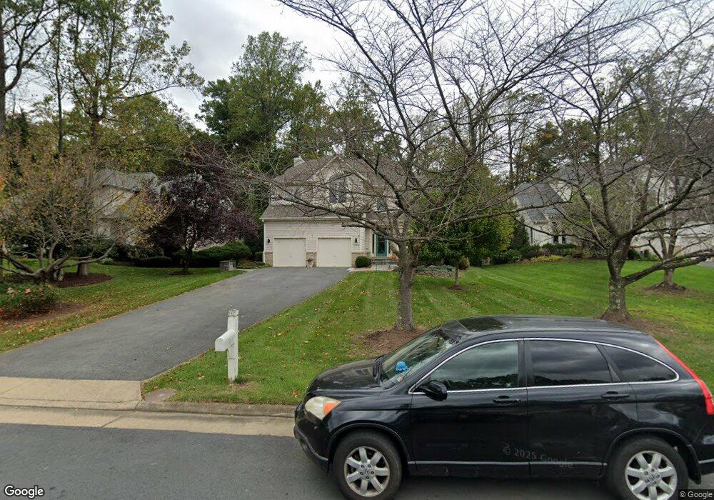
11306 Water Pointe Cir Reston, VA 20194
North Reston NeighborhoodEstimated Value: $1,229,000 - $1,291,595
4
Beds
4
Baths
2,956
Sq Ft
$426/Sq Ft
Est. Value
About This Home
This home is located at 11306 Water Pointe Cir, Reston, VA 20194 and is currently estimated at $1,257,899, approximately $425 per square foot. 11306 Water Pointe Cir is a home located in Fairfax County with nearby schools including Aldrin Elementary, Herndon Middle School, and Herndon High School.
Ownership History
Date
Name
Owned For
Owner Type
Purchase Details
Closed on
Sep 22, 2020
Sold by
Wire Joseph K and Wire Miye T
Bought by
Wire Miye T
Current Estimated Value
Purchase Details
Closed on
Oct 8, 1996
Sold by
Qulick Group Inc
Bought by
Gregg Miye T
Home Financials for this Owner
Home Financials are based on the most recent Mortgage that was taken out on this home.
Original Mortgage
$289,600
Interest Rate
7.9%
Purchase Details
Closed on
Jun 17, 1996
Sold by
Reston Land Corp
Bought by
Gulick Group Inc
Create a Home Valuation Report for This Property
The Home Valuation Report is an in-depth analysis detailing your home's value as well as a comparison with similar homes in the area
Home Values in the Area
Average Home Value in this Area
Purchase History
| Date | Buyer | Sale Price | Title Company |
|---|---|---|---|
| Wire Miye T | $450,000 | None Available | |
| Wire Joseph K | -- | None Available | |
| Gregg Miye T | $362,000 | -- | |
| Gulick Group Inc | $100,000 | -- |
Source: Public Records
Mortgage History
| Date | Status | Borrower | Loan Amount |
|---|---|---|---|
| Previous Owner | Gulick Group Inc | $289,600 | |
| Closed | Gulick Group Inc | $36,200 |
Source: Public Records
Tax History
| Year | Tax Paid | Tax Assessment Tax Assessment Total Assessment is a certain percentage of the fair market value that is determined by local assessors to be the total taxable value of land and additions on the property. | Land | Improvement |
|---|---|---|---|---|
| 2025 | $13,211 | $1,139,210 | $343,000 | $796,210 |
| 2024 | $13,211 | $1,095,920 | $333,000 | $762,920 |
| 2023 | $12,171 | $1,035,400 | $333,000 | $702,400 |
| 2022 | $10,875 | $913,520 | $308,000 | $605,520 |
| 2021 | $10,347 | $847,790 | $278,000 | $569,790 |
| 2020 | $10,128 | $823,100 | $273,000 | $550,100 |
| 2019 | $10,079 | $819,130 | $273,000 | $546,130 |
| 2018 | $9,082 | $789,700 | $273,000 | $516,700 |
| 2017 | $9,114 | $754,470 | $273,000 | $481,470 |
| 2016 | $9,214 | $764,300 | $273,000 | $491,300 |
Source: Public Records
Map
Nearby Homes
- 11300 Water Pointe Cir
- 1110 Round Pebble Ln
- 1156 Fieldview Dr
- 11417 Night Star Way
- 11316 Bright Pond Ln
- 11588 Cedar Chase Rd
- 1270 Vintage Place
- 0 Caris Glenne Outlot B
- 1039 Aziza Ct
- 11405H Windleaf Ct Unit 23
- 1305O Windleaf Dr
- 11665 Gilman Ln
- 1319 Sundial Dr
- 1361 Garden Wall Cir Unit 701
- 11668 Gilman Ln
- 1285 Lamplighter Way
- 1342 Garden Wall Cir Unit 503
- 1281 Wedgewood Manor Way
- 1334 Garden Wall Cir Unit "E"
- 1314 Garden Wall Cir Unit C
- 11304 Water Pointe Cir
- 1113 Water Pointe Ln
- 11301 Water Pointe Cir
- 1109 Water Pointe Ln
- 11307 Water Pointe Cir
- 11309 Water Pointe Cir
- 1114 Water Pointe Ln
- 11305 Water Pointe Cir
- 1112 Water Pointe Ln
- 11303 Water Pointe Cir
- 1110 Water Pointe Ln
- 1108 Water Pointe Ln
- 11326 Leesburg Pike
- 1106 Water Pointe Ln
- 1066 Northfalls Ct
- 1104 Water Pointe Ln
- 1065 Northfalls Ct
- 1102 Water Pointe Ln
- 1141 Water Pointe Ln
- 1101 Water Pointe Ln
Your Personal Tour Guide
Ask me questions while you tour the home.