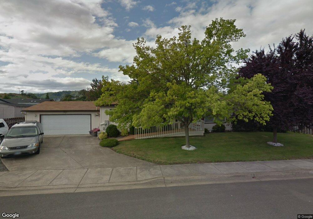
1131 Abraham Ave Winston, OR 97496
Estimated Value: $315,000 - $401,000
4
Beds
2
Baths
1,782
Sq Ft
$198/Sq Ft
Est. Value
About This Home
This home is located at 1131 Abraham Ave, Winston, OR 97496 and is currently estimated at $352,011, approximately $197 per square foot. 1131 Abraham Ave is a home located in Douglas County with nearby schools including Douglas High School.
Ownership History
Date
Name
Owned For
Owner Type
Purchase Details
Closed on
May 13, 2020
Sold by
Segur Janet L
Bought by
Segur Janet L and Atherton Lane Garret
Current Estimated Value
Purchase Details
Closed on
Dec 20, 2016
Sold by
Chappell Gloria D and Jones Ronald E
Bought by
Segur Janet L
Purchase Details
Closed on
Aug 20, 2015
Sold by
Segur Janet L
Bought by
Jones Mary G
Purchase Details
Closed on
Mar 23, 2015
Sold by
Jones Mary G
Bought by
Segur Janet L
Purchase Details
Closed on
Mar 25, 2014
Sold by
Segur Janet L
Bought by
Jones Mary G
Purchase Details
Closed on
Apr 29, 2011
Sold by
Jones Harold E and Jones Mary G
Bought by
Segur Janet L
Create a Home Valuation Report for This Property
The Home Valuation Report is an in-depth analysis detailing your home's value as well as a comparison with similar homes in the area
Home Values in the Area
Average Home Value in this Area
Purchase History
| Date | Buyer | Sale Price | Title Company |
|---|---|---|---|
| Segur Janet L | -- | None Available | |
| Segur Janet L | -- | None Available | |
| Jones Mary G | -- | Accommodation | |
| Segur Janet L | -- | None Available | |
| Jones Mary G | -- | None Available | |
| Segur Janet L | -- | Accommodation |
Source: Public Records
Tax History Compared to Growth
Tax History
| Year | Tax Paid | Tax Assessment Tax Assessment Total Assessment is a certain percentage of the fair market value that is determined by local assessors to be the total taxable value of land and additions on the property. | Land | Improvement |
|---|---|---|---|---|
| 2024 | $2,615 | $157,187 | -- | -- |
| 2023 | $2,541 | $152,609 | $0 | $0 |
| 2022 | $2,465 | $148,165 | $0 | $0 |
| 2021 | $2,399 | $143,850 | $0 | $0 |
| 2020 | $2,257 | $139,661 | $0 | $0 |
| 2019 | $2,269 | $136,695 | $0 | $0 |
| 2018 | $2,170 | $132,714 | $0 | $0 |
| 2017 | $1,935 | $118,384 | $0 | $0 |
| 2016 | $1,865 | $113,835 | $0 | $0 |
| 2015 | $1,772 | $107,584 | $0 | $0 |
| 2014 | $1,944 | $117,231 | $0 | $0 |
| 2013 | -- | $109,650 | $0 | $0 |
Source: Public Records
Map
Nearby Homes
- 364 NW Teal St
- 128 Watusi Ct
- 13224 Lookingglass Rd
- 140 Teresa Ln
- 0 Danielle Dr Unit 122251646
- 102 Sarah Bear Ln
- 635 Wil Way
- 0 Wil Way Unit 24292479
- 0 Wil Way Unit 24278136
- 0 Wil Way Unit 24094727
- 120 SW Brantley Dr
- 441 NW Galaxy Dr
- 0 NW Galaxy Dr
- 263 Wil Way
- 240 Wil Way
- 54 NW Rose St
- 68 NW Rose St
- 151 Sherry St
- 0 SW Main St
- 310 NW Lost Ln
- 1121 Abraham Ave
- 1130 Mark Ct
- 1140 Mark Ct
- 250 NW Bree Dr
- 1120 Abraham Ave
- 1120 Mark Ct
- 210 NW Timothy Ave
- 210 Timothy Ave
- 220 Timothy Ave
- 220 NW Timothy Ave
- 258 NW Bree Dr
- 1110 Abraham Ave
- 1110 NW Abraham
- 236 NW Bree Dr
- 1110 Mark Ct
- 0 Mark Ct
- 1141 Mark Ct
- 270 NW Bree Dr
- 270 NW Bree Dr Unit 25
- 102 NW Broc Dr