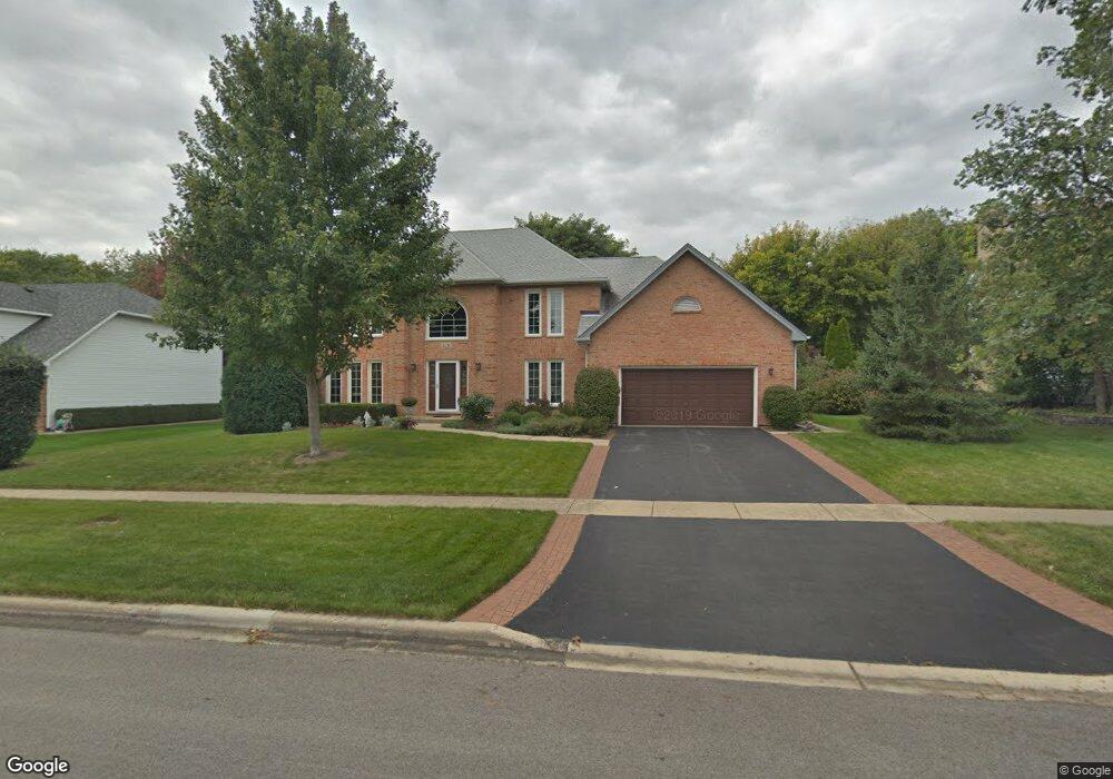
1131 Davey Dr Batavia, IL 60510
Southeast Batavia NeighborhoodEstimated Value: $607,000 - $705,000
4
Beds
--
Bath
3,075
Sq Ft
$213/Sq Ft
Est. Value
About This Home
This home is located at 1131 Davey Dr, Batavia, IL 60510 and is currently estimated at $655,220, approximately $213 per square foot. 1131 Davey Dr is a home located in Kane County with nearby schools including Hoover Wood Elementary School, Sam Rotolo Middle School, and Batavia Sr High School.
Ownership History
Date
Name
Owned For
Owner Type
Purchase Details
Closed on
Jan 17, 2023
Sold by
Kintz Michael J and Kintz Melinda A
Bought by
Kintz Family Trust
Current Estimated Value
Purchase Details
Closed on
May 25, 1999
Sold by
Mccoll Robert K and Stanton Gail M
Bought by
Kintz Michael J and Kintz Melinda A
Home Financials for this Owner
Home Financials are based on the most recent Mortgage that was taken out on this home.
Original Mortgage
$135,000
Interest Rate
7.28%
Create a Home Valuation Report for This Property
The Home Valuation Report is an in-depth analysis detailing your home's value as well as a comparison with similar homes in the area
Home Values in the Area
Average Home Value in this Area
Purchase History
| Date | Buyer | Sale Price | Title Company |
|---|---|---|---|
| Kintz Family Trust | -- | -- | |
| Kintz Michael J | $304,000 | Attorneys Natl Title Guarant |
Source: Public Records
Mortgage History
| Date | Status | Borrower | Loan Amount |
|---|---|---|---|
| Previous Owner | Kintz Michael J | $135,000 |
Source: Public Records
Tax History
| Year | Tax Paid | Tax Assessment Tax Assessment Total Assessment is a certain percentage of the fair market value that is determined by local assessors to be the total taxable value of land and additions on the property. | Land | Improvement |
|---|---|---|---|---|
| 2024 | $12,939 | $179,645 | $22,110 | $157,535 |
| 2023 | $13,304 | $163,047 | $20,067 | $142,980 |
| 2022 | $12,782 | $152,380 | $18,754 | $133,626 |
| 2021 | $12,279 | $144,518 | $17,786 | $126,732 |
| 2020 | $11,979 | $141,740 | $17,444 | $124,296 |
| 2019 | $11,789 | $136,722 | $16,826 | $119,896 |
| 2018 | $11,325 | $131,514 | $16,185 | $115,329 |
| 2017 | $11,055 | $127,177 | $15,651 | $111,526 |
| 2016 | $10,824 | $123,473 | $15,195 | $108,278 |
| 2015 | -- | $120,662 | $14,849 | $105,813 |
| 2014 | -- | $116,864 | $14,382 | $102,482 |
| 2013 | -- | $118,795 | $18,313 | $100,482 |
Source: Public Records
Map
Nearby Homes
- 1220 Davey Dr
- 1206 Beckman Ln
- 694 Hart Rd
- 1012 Edwards Dr
- Lot 4 Manchester Ave
- 1136 Pine Ct
- 860 S River St
- 527 Ridgelawn Trail
- 701 Viking Dr
- 1705 South Ct
- 1816 Burnell Ct
- 1402 Cherry Dr
- 304 S Prairie St
- 1687 Sauk Dr
- 414 Cleveland Ave
- 570 Violet Ln
- Lot 1 Center St
- 2007 Gillenwater St
- 121 S Raddant Rd
- 637 E Wilson St
- 1121 Davey Dr
- 1141 Davey Dr
- 1111 Davey Dr Unit 2
- 1151 Davey Dr Unit 2
- 801 Rotolo Ct
- 800 Rotolo Ct
- 622 Bailey Dr Unit 4
- 624 Bailey Dr
- 612 Bailey Dr Unit 4
- 1101 Davey Dr
- 1161 Davey Dr Unit 1
- 1110 Davey Dr Unit 2
- 811 Rotolo Ct
- 810 Rotolo Ct
- 820 Rotolo Ct
- 801 Burnham Ln
- 602 Bailey Dr Unit 4
- 810 Bailey Dr
- 811 Burnham Ln
- 1205 Davey Dr
Your Personal Tour Guide
Ask me questions while you tour the home.