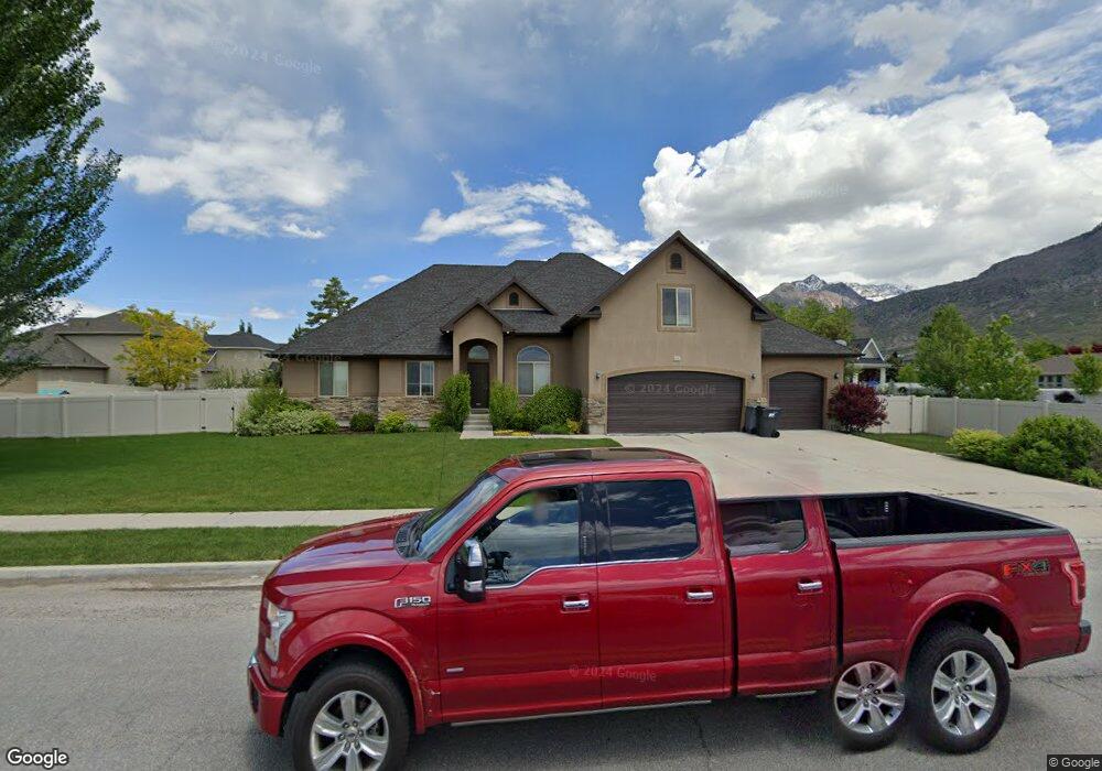
1131 E 1100 N Unit 3 American Fork, UT 84003
Estimated Value: $876,000 - $1,152,000
4
Beds
4
Baths
2,464
Sq Ft
$398/Sq Ft
Est. Value
About This Home
This home is located at 1131 E 1100 N Unit 3, American Fork, UT 84003 and is currently estimated at $980,503, approximately $397 per square foot. 1131 E 1100 N Unit 3 is a home located in Utah County with nearby schools including Deerfield Elementary School, Mountain Ridge Junior High School, and American Fork High School.
Ownership History
Date
Name
Owned For
Owner Type
Purchase Details
Closed on
May 12, 2011
Sold by
Bishop Homes Llc
Bought by
Anderson John D and Anderson Christine R
Current Estimated Value
Home Financials for this Owner
Home Financials are based on the most recent Mortgage that was taken out on this home.
Original Mortgage
$269,100
Outstanding Balance
$186,667
Interest Rate
4.84%
Mortgage Type
New Conventional
Estimated Equity
$793,836
Purchase Details
Closed on
Feb 9, 2011
Sold by
Capital Community Bank Inc
Bought by
Bishop Homes Llc
Home Financials for this Owner
Home Financials are based on the most recent Mortgage that was taken out on this home.
Original Mortgage
$50,000
Interest Rate
10%
Mortgage Type
Purchase Money Mortgage
Purchase Details
Closed on
Nov 15, 2010
Sold by
Southam Paul and Southam David L
Bought by
Capital Community Bank Inc
Purchase Details
Closed on
Nov 3, 2005
Sold by
Glenn Scott E and Glenn Amy Jones
Bought by
Glenn Scott E
Purchase Details
Closed on
Mar 5, 2003
Sold by
Jones Ronald Calvin and Jones Judie Francis
Bought by
Glenn Scott E and Glenn Amy Jones
Home Financials for this Owner
Home Financials are based on the most recent Mortgage that was taken out on this home.
Original Mortgage
$212,000
Interest Rate
5.85%
Create a Home Valuation Report for This Property
The Home Valuation Report is an in-depth analysis detailing your home's value as well as a comparison with similar homes in the area
Home Values in the Area
Average Home Value in this Area
Purchase History
| Date | Buyer | Sale Price | Title Company |
|---|---|---|---|
| Anderson John D | -- | Hickman Land Title Company | |
| Bishop Homes Llc | -- | Hickman Land Title Company | |
| Capital Community Bank Inc | $80,000 | None Available | |
| Glenn Scott E | -- | Access Title Company | |
| Glenn Scott E | -- | Access Title Company |
Source: Public Records
Mortgage History
| Date | Status | Borrower | Loan Amount |
|---|---|---|---|
| Open | Anderson John D | $269,100 | |
| Previous Owner | Bishop Homes Llc | $50,000 | |
| Previous Owner | Glenn Scott E | $212,000 |
Source: Public Records
Tax History Compared to Growth
Tax History
| Year | Tax Paid | Tax Assessment Tax Assessment Total Assessment is a certain percentage of the fair market value that is determined by local assessors to be the total taxable value of land and additions on the property. | Land | Improvement |
|---|---|---|---|---|
| 2025 | $3,908 | $468,050 | $266,400 | $584,600 |
| 2024 | $3,908 | $434,225 | $0 | $0 |
| 2023 | $3,727 | $439,010 | $0 | $0 |
| 2022 | $3,947 | $458,810 | $0 | $0 |
| 2021 | $3,459 | $628,100 | $186,500 | $441,600 |
| 2020 | $3,369 | $593,300 | $172,700 | $420,600 |
| 2019 | $3,191 | $581,200 | $160,600 | $420,600 |
| 2018 | $3,156 | $549,700 | $152,600 | $397,100 |
| 2017 | $3,170 | $297,935 | $0 | $0 |
| 2016 | $2,893 | $252,670 | $0 | $0 |
| 2015 | $2,952 | $244,640 | $0 | $0 |
| 2014 | $2,674 | $218,570 | $0 | $0 |
Source: Public Records
Map
Nearby Homes
- 1162 E 1180 N
- 1228 E 1030 N
- 1058 N 930 E Unit 64
- 1243 N 1270 E
- 1089 N 950 E
- The McKenzie Plan at Autumn Crest
- The Christine Plan at Autumn Crest
- The Avery Plan at Autumn Crest
- The Madison Plan at Autumn Crest
- The Roosevelt Plan at Autumn Crest
- The Annie Plan at Autumn Crest
- The Michelle Plan at Autumn Crest
- 1059 N 930 E
- 1053 N 930 E Unit 73
- 1045 N 930 E Unit 58
- 1172 Murdock Dr
- 4441 W Bridgestone Dr
- 9587 N 4500 W
- 2969 N 1350 W
- 248 N Deerfield Ln
- 1131 E 1100 N
- 1153 E 1100 N
- 1153 E 1100 N Unit 4
- 1100 E 1100 N
- 1115 E 1100 N
- 1159 N 1150 E Unit 2
- 1159 N 1150 E
- 1118 N 1100 E
- 1158 N 1150 E
- 1158 N 1150 E Unit 1
- 1163 E Candy Ln Unit 67
- 1132 N 1100 E
- 1175 E Candy Ln Unit 68
- 1111 N 1190 E
- 1093 E 1100 N
- 1151 E Candy Ln Unit 66
- 1113 N 1100 E
- 1154 N 1100 E
- 1133 N 1190 E
- 1167 N 1150 E