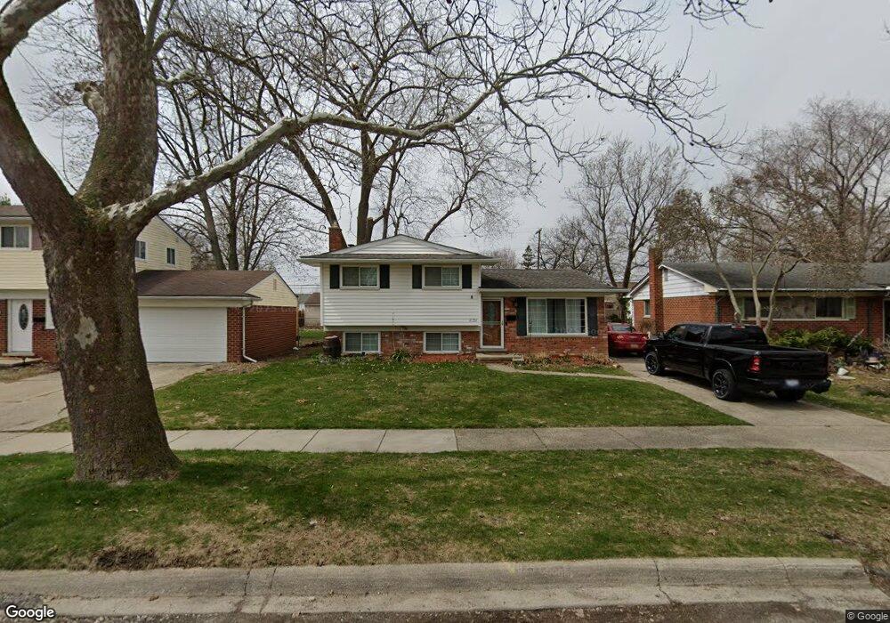
1131 Langley Blvd Clawson, MI 48017
Estimated Value: $309,757 - $344,000
3
Beds
2
Baths
1,355
Sq Ft
$245/Sq Ft
Est. Value
About This Home
This home is located at 1131 Langley Blvd, Clawson, MI 48017 and is currently estimated at $331,439, approximately $244 per square foot. 1131 Langley Blvd is a home located in Oakland County with nearby schools including Clawson Middle School, Clawson High School, and Japhet School.
Ownership History
Date
Name
Owned For
Owner Type
Purchase Details
Closed on
Jun 30, 1999
Sold by
Nahhat Frederick S
Bought by
Twydell Michael J
Current Estimated Value
Home Financials for this Owner
Home Financials are based on the most recent Mortgage that was taken out on this home.
Original Mortgage
$141,700
Interest Rate
7.76%
Create a Home Valuation Report for This Property
The Home Valuation Report is an in-depth analysis detailing your home's value as well as a comparison with similar homes in the area
Home Values in the Area
Average Home Value in this Area
Purchase History
| Date | Buyer | Sale Price | Title Company |
|---|---|---|---|
| Twydell Michael J | $149,180 | -- |
Source: Public Records
Mortgage History
| Date | Status | Borrower | Loan Amount |
|---|---|---|---|
| Previous Owner | Twydell Michael J | $141,700 |
Source: Public Records
Tax History
| Year | Tax Paid | Tax Assessment Tax Assessment Total Assessment is a certain percentage of the fair market value that is determined by local assessors to be the total taxable value of land and additions on the property. | Land | Improvement |
|---|---|---|---|---|
| 2025 | $3,227 | $139,340 | $0 | $0 |
| 2024 | $3,083 | $132,280 | $0 | $0 |
| 2023 | $2,956 | $119,880 | $0 | $0 |
| 2022 | $2,980 | $111,030 | $0 | $0 |
| 2021 | $2,919 | $104,040 | $0 | $0 |
| 2020 | $2,828 | $96,530 | $0 | $0 |
| 2019 | $2,922 | $90,700 | $0 | $0 |
| 2018 | $2,901 | $84,700 | $0 | $0 |
| 2017 | $2,884 | $81,760 | $0 | $0 |
| 2016 | $2,922 | $76,680 | $0 | $0 |
| 2015 | -- | $70,050 | $0 | $0 |
| 2014 | -- | $60,840 | $0 | $0 |
| 2011 | -- | $55,990 | $0 | $0 |
Source: Public Records
Map
Nearby Homes
- 1109 Kenilworth Place
- 930 Elmsford Dr
- 1087 N Stephen Ave
- 1451 Kenilworth Place
- 816 W Baker Ave
- 822 Phillips Ave
- 2130 Wickham St Unit 4
- 4905 Coventry St
- 659 W Maple Rd
- 503 W Elmwood Ave
- 5065 Crooks Rd Unit 49
- 4921 N Crooks Rd Unit N-10
- 4909 Crooks Rd Unit D6
- 4909 Crooks Rd Unit 4
- 609 John M Ave
- 4921 Crooks Rd Unit N 3
- 4921 Crooks Rd Unit M-10
- 4905 Crooks A2 Rd
- 124 Leroy Ave
- 114 Knollwood Blvd
- 1141 Langley Blvd
- 1121 Langley Blvd
- 1151 Langley Blvd
- 1111 Langley Blvd
- 1122 Kenilworth Place
- 1132 Kenilworth Place
- 1110 Kenilworth Place
- 1142 Kenilworth Place
- 1161 Langley Blvd
- 1101 Langley Blvd
- 1083 W Stephen Ave
- 1100 Kenilworth Place
- 1152 Kenilworth Place
- 1076 W Stephen Ave
- 1203 Langley Blvd
- 1087 Langley Blvd
- 1073 W Stephen Ave
- 1202 Kenilworth Place
- 1160 Langley Blvd
- 1088 Kenilworth Place
Your Personal Tour Guide
Ask me questions while you tour the home.