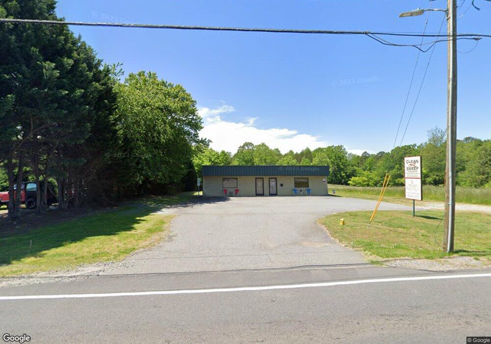
1131 Malcom Blvd Rutherford College, NC 28671
Estimated Value: $178,000 - $264,054
--
Bed
1
Bath
1,500
Sq Ft
$147/Sq Ft
Est. Value
About This Home
This home is located at 1131 Malcom Blvd, Rutherford College, NC 28671 and is currently estimated at $221,027, approximately $147 per square foot. 1131 Malcom Blvd is a home located in Burke County with nearby schools including Rutherford College Elementary, Heritage Middle School, and Jimmy C. Draughn High School.
Ownership History
Date
Name
Owned For
Owner Type
Purchase Details
Closed on
Dec 28, 2017
Sold by
Daye Michael A and Daye Lisa S
Bought by
Kwcs Properties Llc
Current Estimated Value
Home Financials for this Owner
Home Financials are based on the most recent Mortgage that was taken out on this home.
Original Mortgage
$110,500
Outstanding Balance
$93,201
Interest Rate
3.92%
Mortgage Type
Commercial
Estimated Equity
$127,826
Purchase Details
Closed on
Aug 30, 2006
Sold by
Daye Kenneth D and Daye Anna C
Bought by
Daye Michael A and Daye Kenneth D
Create a Home Valuation Report for This Property
The Home Valuation Report is an in-depth analysis detailing your home's value as well as a comparison with similar homes in the area
Home Values in the Area
Average Home Value in this Area
Purchase History
| Date | Buyer | Sale Price | Title Company |
|---|---|---|---|
| Kwcs Properties Llc | $130,000 | None Available | |
| Daye Michael A | -- | None Available |
Source: Public Records
Mortgage History
| Date | Status | Borrower | Loan Amount |
|---|---|---|---|
| Open | Kwcs Properties Llc | $110,500 |
Source: Public Records
Tax History Compared to Growth
Tax History
| Year | Tax Paid | Tax Assessment Tax Assessment Total Assessment is a certain percentage of the fair market value that is determined by local assessors to be the total taxable value of land and additions on the property. | Land | Improvement |
|---|---|---|---|---|
| 2025 | $1,145 | $173,434 | $24,300 | $149,134 |
| 2024 | $1,153 | $173,434 | $24,300 | $149,134 |
| 2023 | $1,153 | $173,434 | $24,300 | $149,134 |
| 2022 | $1,045 | $130,650 | $24,300 | $106,350 |
| 2021 | $1,045 | $130,650 | $24,300 | $106,350 |
| 2020 | $1,045 | $130,650 | $24,300 | $106,350 |
| 2019 | $1,045 | $130,650 | $24,300 | $106,350 |
| 2018 | $1,035 | $129,370 | $24,300 | $105,070 |
| 2017 | $1,035 | $129,370 | $24,300 | $105,070 |
| 2016 | $1,003 | $129,370 | $24,300 | $105,070 |
| 2015 | $1,003 | $129,370 | $24,300 | $105,070 |
| 2014 | $1,003 | $129,370 | $24,300 | $105,070 |
| 2013 | $1,003 | $129,370 | $24,300 | $105,070 |
Source: Public Records
Map
Nearby Homes
- 1290 Gardiol Ave NE
- 811 Kathy Dr NE
- 2643 Locust
- 110 Sharon Ln
- 112 Bleynat St NE
- 2167 Inlet Shore Rd NE
- 2226 Inlet Shore Rd NE Unit 29
- 2188 Snowmass Dr
- 917 Zeline Ave NE
- 2109 Inlet Shore Rd NE
- 2195 Inlet Shore Rd NE
- 2080 Inlet Shore Rd NE Unit 26
- 2048 Inlet Shore Rd NE Unit 25
- 2038 & 2048 Inlet Shore Rd NE Unit 24 & 25
- 2038 Inlet Shore Rd NE Unit 24
- 1366 Lake Vista Dr NE
- 1545 Lake Vista Dr NE
- 2039 Lake Vista Dr NE Unit 38
- 1408 Lake Vista Dr NE Unit 11/12
- 1545 & 1489 Lake Vista Dr NE Unit 16B, 17B, 18B
- 1131 Malcolm Blvd
- 1141 Malcolm Blvd
- 1121 Malcolm Blvd
- 1115 Malcolm Blvd
- 1111 Malcolm Blvd
- 1120 Malcolm Blvd
- 1100 Malcolm Blvd
- 1161 Malcolm Blvd
- 1130 Malcolm Blvd
- 1101 Malcolm Blvd
- 100 Benfield Dr
- 1040 Malcolm Blvd
- 100 Liberty St
- 1171 Malcolm Blvd
- 111 Carnegie St
- 1030 Malcolm Blvd
- 110 Liberty St
- 101 Benfield Dr
- 101 Liberty St
- 1031 Malcolm Blvd