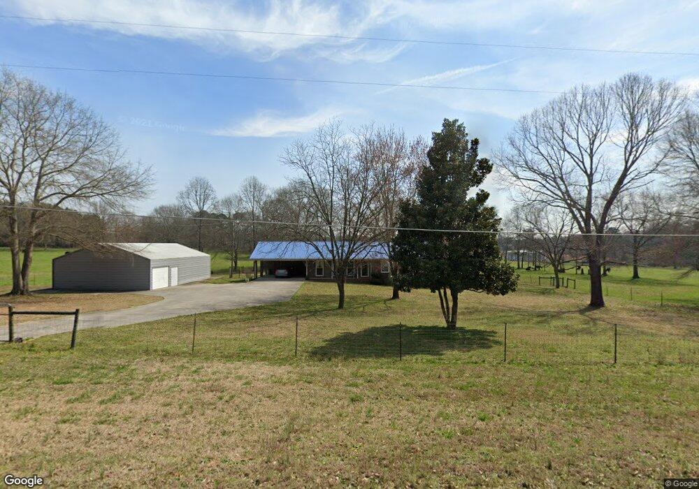
1131 Treadwell Bridge Rd Statham, GA 30666
Estimated Value: $620,966 - $711,000
3
Beds
2
Baths
1,930
Sq Ft
$334/Sq Ft
Est. Value
About This Home
This home is located at 1131 Treadwell Bridge Rd, Statham, GA 30666 and is currently estimated at $645,492, approximately $334 per square foot. 1131 Treadwell Bridge Rd is a home located in Oconee County with nearby schools including Rocky Branch Elementary School, Malcom Bridge Middle School, and North Oconee High School.
Ownership History
Date
Name
Owned For
Owner Type
Purchase Details
Closed on
Nov 21, 2011
Sold by
Skinner Virginia A
Bought by
Davila Marco A
Current Estimated Value
Home Financials for this Owner
Home Financials are based on the most recent Mortgage that was taken out on this home.
Original Mortgage
$128,500
Interest Rate
4.17%
Mortgage Type
Purchase Money Mortgage
Create a Home Valuation Report for This Property
The Home Valuation Report is an in-depth analysis detailing your home's value as well as a comparison with similar homes in the area
Home Values in the Area
Average Home Value in this Area
Purchase History
| Date | Buyer | Sale Price | Title Company |
|---|---|---|---|
| Davila Marco A | $145,000 | -- | |
| Davila Marco A | $145,000 | -- |
Source: Public Records
Mortgage History
| Date | Status | Borrower | Loan Amount |
|---|---|---|---|
| Closed | Davila Marco A | $128,500 |
Source: Public Records
Tax History Compared to Growth
Tax History
| Year | Tax Paid | Tax Assessment Tax Assessment Total Assessment is a certain percentage of the fair market value that is determined by local assessors to be the total taxable value of land and additions on the property. | Land | Improvement |
|---|---|---|---|---|
| 2024 | $4,690 | $210,826 | $107,687 | $103,139 |
| 2023 | $2,602 | $179,910 | $99,712 | $80,198 |
| 2022 | $1,682 | $149,126 | $79,770 | $69,356 |
| 2021 | $1,611 | $124,259 | $62,263 | $61,996 |
| 2020 | $1,514 | $118,920 | $61,042 | $57,878 |
| 2019 | $1,427 | $105,872 | $50,868 | $55,004 |
| 2018 | $1,285 | $92,552 | $44,233 | $48,319 |
| 2017 | $1,185 | $84,667 | $40,212 | $44,455 |
| 2016 | $1,158 | $77,893 | $34,014 | $43,879 |
| 2015 | $1,142 | $77,176 | $34,014 | $43,161 |
| 2014 | $1,122 | $72,479 | $30,922 | $41,556 |
| 2013 | -- | $71,980 | $31,497 | $40,483 |
Source: Public Records
Map
Nearby Homes
- 0 Hebron Church Rd Unit 25176734
- 0 Hebron Church Rd Unit 10624104
- 0 Monroe Hwy Unit 1025333
- Marlene Plan at Westland
- 1547 Westland Ct
- Hampshire Plan at Westland
- 1621 Westland Ct
- Jean Lee Plan at Westland
- Edison Plan at Westland
- 1547 Westland Ct Unit 2015
- Summit Plan at Westland
- 2903 Brookstone Crossing Unit 34-B
- 2903 Brookstone Crossing
- 1201 Dove Creek Cir
- 4611 Monroe Hwy - Hwy 78 Unit PARCEL C
- 4611 Monroe Hwy - Hwy 78
- 1111 Brookstone Crossing Unit 11D
- 1901 Hog Mountain Rd
- 1921 Hog Mountain Rd
- N/A Hog Mountain Rd
- 1131 Treadwell Bridge
- 1101 Treadwell Bridge Rd
- 1181 Treadwell Bridge Rd
- 1081 Treadwell Bridge Rd
- 1190 Choyce Johnson Rd
- 1060 Treadwell Bridge Rd
- 1170 Choyce Johnson Rd
- 1120 Choyce Johnson Rd
- 1230 Treadwell Bridge Rd Unit Lot 6
- 1230 Treadwell Bridge Rd Unit Lot 3
- 1210 Choyce Johnson Rd
- 1061 Treadwell Bridge Rd
- 1090 Choyce Johnson Rd
- 1240 Treadwell Bridge Rd
- 1230 Choyce Johnson Rd
- 1270 Choyce Johnson Rd
- 1551 Hebron Church Rd
- 1021 Treadwell Bridge Rd
- 1030 Choyce Johnson Rd
- 1281 Treadwell Bridge Rd