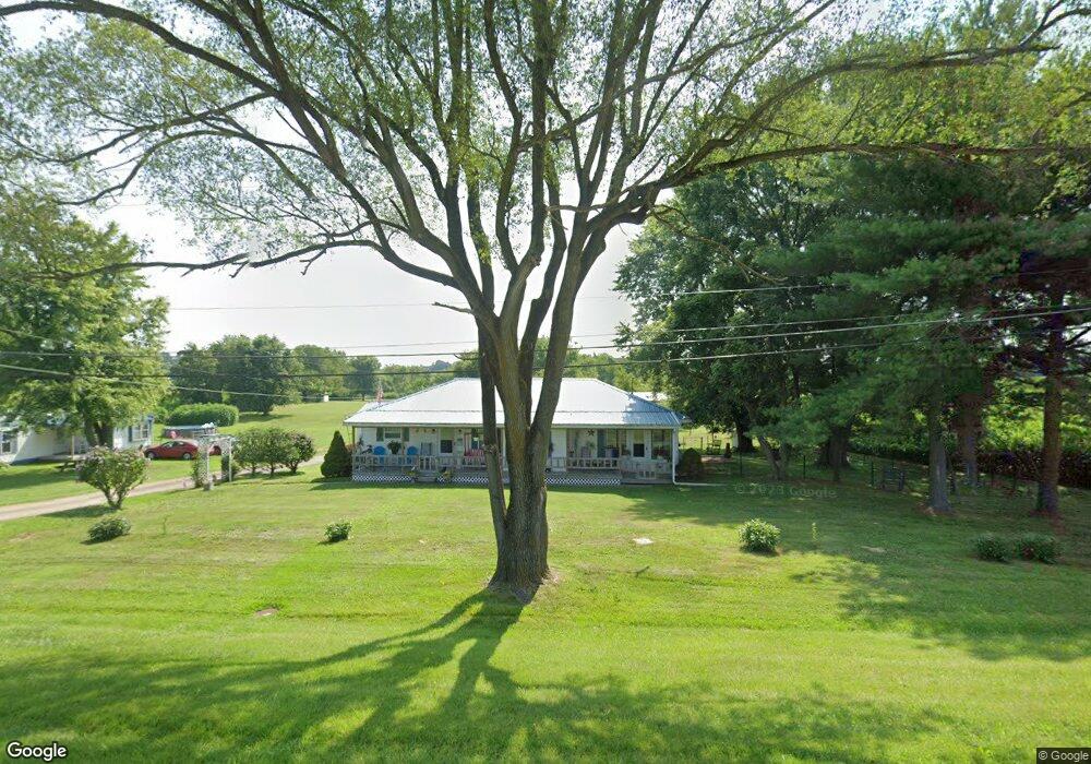
11310 State Route 339 Vincent, OH 45784
Estimated Value: $198,000 - $257,090
3
Beds
2
Baths
1,400
Sq Ft
$156/Sq Ft
Est. Value
About This Home
This home is located at 11310 State Route 339, Vincent, OH 45784 and is currently estimated at $219,023, approximately $156 per square foot. 11310 State Route 339 is a home located in Washington County with nearby schools including Warren High School.
Ownership History
Date
Name
Owned For
Owner Type
Purchase Details
Closed on
Feb 5, 2019
Sold by
Huffman Tina M
Bought by
Swain Terrance O and Swain Linda M
Current Estimated Value
Purchase Details
Closed on
Sep 26, 2005
Sold by
Greney Jill C
Bought by
Swain Linda M and Swain Terrance O
Home Financials for this Owner
Home Financials are based on the most recent Mortgage that was taken out on this home.
Original Mortgage
$118,000
Interest Rate
5.93%
Mortgage Type
New Conventional
Purchase Details
Closed on
Sep 24, 1999
Bought by
Greuey Jill C
Purchase Details
Closed on
Feb 5, 1999
Bought by
Perry Edna C
Create a Home Valuation Report for This Property
The Home Valuation Report is an in-depth analysis detailing your home's value as well as a comparison with similar homes in the area
Home Values in the Area
Average Home Value in this Area
Purchase History
| Date | Buyer | Sale Price | Title Company |
|---|---|---|---|
| Swain Terrance O | -- | None Available | |
| Swain Linda M | $118,000 | Title First Agency | |
| Greuey Jill C | $92,500 | -- | |
| Perry Edna C | -- | -- |
Source: Public Records
Mortgage History
| Date | Status | Borrower | Loan Amount |
|---|---|---|---|
| Previous Owner | Swain Linda M | $118,000 |
Source: Public Records
Tax History Compared to Growth
Tax History
| Year | Tax Paid | Tax Assessment Tax Assessment Total Assessment is a certain percentage of the fair market value that is determined by local assessors to be the total taxable value of land and additions on the property. | Land | Improvement |
|---|---|---|---|---|
| 2024 | $2,540 | $64,010 | $12,140 | $51,870 |
| 2023 | $2,540 | $64,010 | $12,140 | $51,870 |
| 2022 | $2,514 | $64,010 | $12,140 | $51,870 |
| 2021 | $2,266 | $55,120 | $10,670 | $44,450 |
| 2020 | $2,258 | $55,120 | $10,670 | $44,450 |
| 2019 | $2,233 | $55,120 | $10,670 | $44,450 |
| 2018 | $2,113 | $50,620 | $8,530 | $42,090 |
| 2017 | $2,139 | $51,870 | $9,780 | $42,090 |
| 2016 | $1,876 | $51,870 | $9,780 | $42,090 |
| 2015 | $1,712 | $45,910 | $9,430 | $36,480 |
| 2014 | $2,363 | $45,910 | $9,430 | $36,480 |
| 2013 | $855 | $45,910 | $9,430 | $36,480 |
Source: Public Records
Map
Nearby Homes
- 11584 State Route 339
- 10507 Ohio 339
- 1998 Reese Rd
- 0 Fisher Ridge Rd
- 0 Fisher Ridge Rd Tract 1
- 0 Fisher Ridge Rd Tract 2
- 0 Fisher Ridge Rd Tract 4
- 0 Fisher Ridge Rd Tract 5
- 0 Fisher Ridge Rd Tract 6
- 0 Fisher Ridge Rd Tract 7
- 1876 Pine Ridge Rd
- 10270 Ohio 550
- 0 Ohio 550
- 0 Layman Rd Unit 5162075
- 0 Layman Rd Unit 5162072
- 6570 State Route 339
- 545 Lewis Pointe Dr
- Lot 1 Shinn Rd
- 254 Riggenbach Hill Rd
- Lot 2 Shinn Rd
- 11445 State Route 339
- 11185 State Route 339
- 11160 State Route 339
- 11167 State Route 339
- 1492 Woodruff Rd
- 11140 State Route 339
- 1543 Woodruff Rd
- 11562 State Route 339
- 11573 State Route 339
- 11034 State Route 339
- 11620 State Route 339
- 3211 Deming Rd
- 10998 State Route 339
- 10956 State Route 339
- 2924 Deming Rd
- 10874 State Route 339
- 11737 State Route 339
- 11065 State Route 339
- 2844 Deming Rd
- 2975 Deming Rd