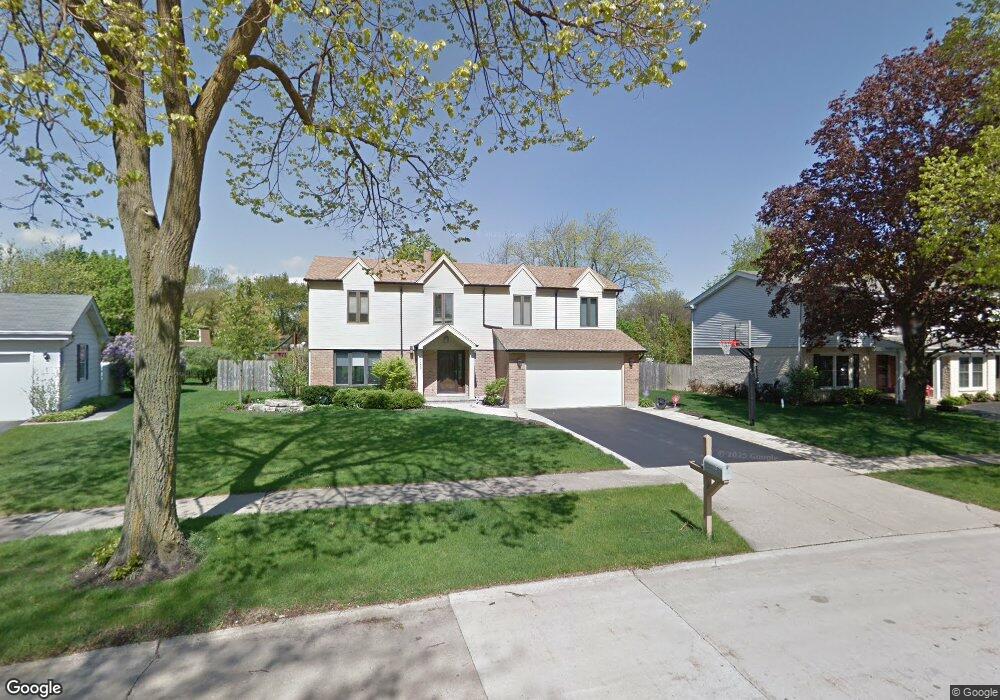
1132 Cayuga Dr Northbrook, IL 60062
Estimated Value: $534,000 - $944,000
4
Beds
4
Baths
2,833
Sq Ft
$292/Sq Ft
Est. Value
About This Home
This home is located at 1132 Cayuga Dr, Northbrook, IL 60062 and is currently estimated at $827,522, approximately $292 per square foot. 1132 Cayuga Dr is a home located in Cook County with nearby schools including Hickory Point Elementary School, Shabonee Elementary School, and Wood Oaks Jr High School.
Ownership History
Date
Name
Owned For
Owner Type
Purchase Details
Closed on
Aug 9, 2006
Sold by
Rane Michael J and Rane Michelle G
Bought by
Molay Matthew and Molay Julie
Current Estimated Value
Home Financials for this Owner
Home Financials are based on the most recent Mortgage that was taken out on this home.
Original Mortgage
$245,000
Outstanding Balance
$145,753
Interest Rate
6.88%
Mortgage Type
Unknown
Estimated Equity
$681,769
Purchase Details
Closed on
Jun 1, 1999
Sold by
Levin Stuart and Levin Susan G
Bought by
Rane Michael J and Rane Michelle G
Home Financials for this Owner
Home Financials are based on the most recent Mortgage that was taken out on this home.
Original Mortgage
$280,000
Interest Rate
7.61%
Create a Home Valuation Report for This Property
The Home Valuation Report is an in-depth analysis detailing your home's value as well as a comparison with similar homes in the area
Home Values in the Area
Average Home Value in this Area
Purchase History
| Date | Buyer | Sale Price | Title Company |
|---|---|---|---|
| Molay Matthew | $776,500 | Multiple | |
| Rane Michael J | $350,000 | Professional National Title |
Source: Public Records
Mortgage History
| Date | Status | Borrower | Loan Amount |
|---|---|---|---|
| Open | Molay Matthew | $245,000 | |
| Previous Owner | Rane Michael J | $280,000 |
Source: Public Records
Tax History
| Year | Tax Paid | Tax Assessment Tax Assessment Total Assessment is a certain percentage of the fair market value that is determined by local assessors to be the total taxable value of land and additions on the property. | Land | Improvement |
|---|---|---|---|---|
| 2025 | $13,086 | $78,333 | $16,331 | $62,002 |
| 2024 | $13,086 | $59,421 | $16,331 | $43,090 |
| 2023 | $12,617 | $59,421 | $16,331 | $43,090 |
| 2022 | $12,617 | $59,421 | $16,331 | $43,090 |
| 2021 | $11,306 | $47,991 | $14,153 | $33,838 |
| 2020 | $11,195 | $47,991 | $14,153 | $33,838 |
| 2019 | $10,926 | $52,738 | $14,153 | $38,585 |
| 2018 | $11,237 | $50,057 | $12,520 | $37,537 |
| 2017 | $10,936 | $50,057 | $12,520 | $37,537 |
| 2016 | $10,448 | $50,057 | $12,520 | $37,537 |
| 2015 | $10,141 | $44,168 | $10,342 | $33,826 |
| 2014 | $9,909 | $44,168 | $10,342 | $33,826 |
| 2013 | $9,615 | $44,168 | $10,342 | $33,826 |
Source: Public Records
Map
Nearby Homes
- 3110 Pheasant Creek Dr Unit 101
- 3110 Pheasant Creek Dr Unit 206
- 6 the Court of Lagoon View
- 925 Spring Hill Dr Unit 101
- 1400 Kingsport Ct
- 3030 Pheasant Creek Dr Unit 102
- 3050 Pheasant Creek Dr Unit 305
- 3050 Pheasant Creek Dr Unit 407
- 8 The Court of Charlwood
- 1331 Pfingsten Rd
- 795 Greenwood Rd
- 2917 Koepke Rd
- 1649 Central Ave
- 2535 Stonebridge Ln
- 1621 Mission Hills Rd Unit 108
- 1671 Mission Hills Rd Unit 201
- 1671 Mission Hills Rd Unit 302
- 3549 Bayberry Dr
- 250 Violet Ln
- 240 Violet Ln
- 1124 Cayuga Dr
- 1140 Cayuga Dr
- 1115 Adirondack Dr
- 1114 Cayuga Dr
- 3107 Concord Ct
- 1148 Cayuga Dr
- 1135 Cayuga Dr
- 3115 Concord Ct
- 1145 Cayuga Dr
- 1105 Adirondack Dr
- 1125 Adirondack Dr
- 1127 Cayuga Dr
- 1106 Cayuga Dr Unit 7
- 1121 Cayuga Dr
- 1156 Cayuga Dr
- 1155 Cayuga Dr
- 1135 Adirondack Dr
- 3123 Concord Ct
- 1115 Cayuga Dr
- 3100 Concord Ct