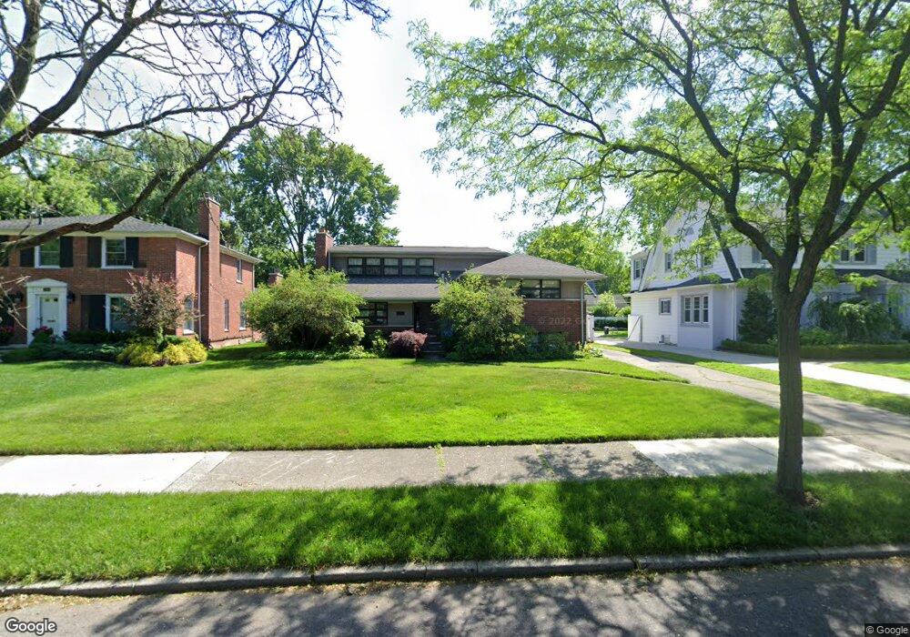
1132 Kensington Ave Grosse Pointe Park, MI 48230
Estimated Value: $474,533 - $674,000
--
Bed
3
Baths
2,920
Sq Ft
$200/Sq Ft
Est. Value
About This Home
This home is located at 1132 Kensington Ave, Grosse Pointe Park, MI 48230 and is currently estimated at $584,633, approximately $200 per square foot. 1132 Kensington Ave is a home located in Wayne County with nearby schools including Lewis Maire Elementary School, Pierce Middle School, and Grosse Pointe South High School.
Ownership History
Date
Name
Owned For
Owner Type
Purchase Details
Closed on
Jun 20, 2001
Sold by
Tyler David M
Bought by
Corbin Kim
Current Estimated Value
Purchase Details
Closed on
Mar 19, 1999
Sold by
Tyler Rose L
Bought by
Tyler Rose L
Create a Home Valuation Report for This Property
The Home Valuation Report is an in-depth analysis detailing your home's value as well as a comparison with similar homes in the area
Home Values in the Area
Average Home Value in this Area
Purchase History
| Date | Buyer | Sale Price | Title Company |
|---|---|---|---|
| Corbin Kim | $255,000 | -- | |
| Tyler Rose L | -- | -- |
Source: Public Records
Tax History Compared to Growth
Tax History
| Year | Tax Paid | Tax Assessment Tax Assessment Total Assessment is a certain percentage of the fair market value that is determined by local assessors to be the total taxable value of land and additions on the property. | Land | Improvement |
|---|---|---|---|---|
| 2025 | $3,734 | $223,900 | $0 | $0 |
| 2024 | $3,734 | $219,400 | $0 | $0 |
| 2023 | $3,566 | $200,400 | $0 | $0 |
| 2022 | $3,388 | $180,600 | $0 | $0 |
| 2021 | $6,680 | $168,200 | $0 | $0 |
| 2019 | $6,874 | $158,300 | $0 | $0 |
| 2018 | $3,230 | $140,900 | $0 | $0 |
| 2017 | $7,398 | $87,300 | $0 | $0 |
| 2016 | $6,834 | $144,300 | $0 | $0 |
| 2015 | $12,088 | $136,300 | $0 | $0 |
| 2013 | $11,710 | $118,700 | $0 | $0 |
| 2012 | $3,244 | $123,600 | $57,000 | $66,600 |
Source: Public Records
Map
Nearby Homes
- 1117 Bishop Rd
- 1036 Yorkshire Rd
- 1131 Audubon Rd
- 1200 Audubon Rd
- 616 Cadieux Rd
- 43 Cranford Ln
- 25 Village Ln
- 1148 Devonshire Rd
- 16935 Maumee Ave
- 1387 Kensington Ave
- 1358 Harvard Rd
- 1386 Grayton St
- 1386 Three Mile Dr
- 775 Notre Dame St
- 386 Notre Dame St
- 497 Neff Rd
- 1350 Buckingham Rd
- 1425 Bedford Rd
- 674 Neff Rd
- 3476 Audubon Rd
- 1122 Kensington Ave
- 1138 Kensington Ave
- 1118 Kensington Ave
- 1144 Kensington Ave
- 1129 Yorkshire Rd
- 1135 Yorkshire Rd
- 1123 Yorkshire Rd
- 1141 Yorkshire Rd
- 1152 Kensington Ave
- 1112 Kensington Ave
- 1147 Yorkshire Rd
- 1117 Yorkshire Rd
- 1133 Kensington Ave
- 1137 Kensington Ave
- 1127 Kensington Ave
- 1153 Yorkshire Rd
- 1119 Kensington Ave
- 1104 Kensington Ave
- 1160 Kensington Ave
- 1111 Yorkshire Rd