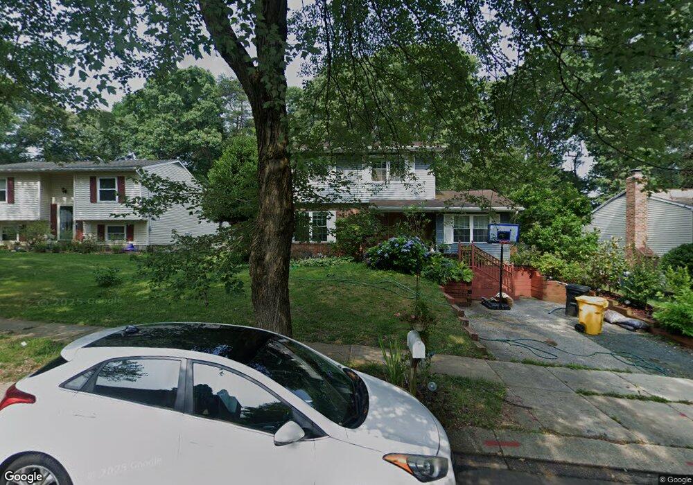
1132 Mermaid Dr Annapolis, MD 21409
Cape Saint Claire NeighborhoodEstimated Value: $571,737 - $621,000
4
Beds
4
Baths
1,670
Sq Ft
$358/Sq Ft
Est. Value
About This Home
This home is located at 1132 Mermaid Dr, Annapolis, MD 21409 and is currently estimated at $597,434, approximately $357 per square foot. 1132 Mermaid Dr is a home located in Anne Arundel County with nearby schools including Cape St. Claire Elementary School, Magothy River Middle School, and Broadneck High School.
Ownership History
Date
Name
Owned For
Owner Type
Purchase Details
Closed on
Nov 19, 2009
Sold by
Hickey John J
Bought by
Lewocz John S and Leni Sandra
Current Estimated Value
Home Financials for this Owner
Home Financials are based on the most recent Mortgage that was taken out on this home.
Original Mortgage
$306,800
Outstanding Balance
$198,889
Interest Rate
4.86%
Mortgage Type
New Conventional
Estimated Equity
$398,545
Purchase Details
Closed on
Aug 23, 2002
Sold by
Santoriello Ronald J
Bought by
Hickey John J
Purchase Details
Closed on
Dec 28, 1994
Sold by
Sieradzki Henry F
Bought by
Santoriello Ronald J
Home Financials for this Owner
Home Financials are based on the most recent Mortgage that was taken out on this home.
Original Mortgage
$169,000
Interest Rate
9.2%
Create a Home Valuation Report for This Property
The Home Valuation Report is an in-depth analysis detailing your home's value as well as a comparison with similar homes in the area
Home Values in the Area
Average Home Value in this Area
Purchase History
| Date | Buyer | Sale Price | Title Company |
|---|---|---|---|
| Lewocz John S | $383,500 | -- | |
| Hickey John J | $264,900 | -- | |
| Santoriello Ronald J | $177,900 | -- |
Source: Public Records
Mortgage History
| Date | Status | Borrower | Loan Amount |
|---|---|---|---|
| Open | Lewocz John S | $306,800 | |
| Previous Owner | Santoriello Ronald J | $169,000 | |
| Closed | Hickey John J | -- |
Source: Public Records
Tax History Compared to Growth
Tax History
| Year | Tax Paid | Tax Assessment Tax Assessment Total Assessment is a certain percentage of the fair market value that is determined by local assessors to be the total taxable value of land and additions on the property. | Land | Improvement |
|---|---|---|---|---|
| 2025 | $4,760 | $460,700 | -- | -- |
| 2024 | $4,760 | $423,300 | $253,700 | $169,600 |
| 2023 | $4,640 | $417,367 | $0 | $0 |
| 2022 | $4,343 | $411,433 | $0 | $0 |
| 2021 | $8,537 | $405,500 | $228,700 | $176,800 |
| 2020 | $4,146 | $390,100 | $0 | $0 |
| 2019 | $4,067 | $374,700 | $0 | $0 |
| 2018 | $3,643 | $359,300 | $185,300 | $174,000 |
| 2017 | $3,811 | $346,900 | $0 | $0 |
| 2016 | -- | $334,500 | $0 | $0 |
| 2015 | -- | $322,100 | $0 | $0 |
| 2014 | -- | $322,100 | $0 | $0 |
Source: Public Records
Map
Nearby Homes
- 1181 Ramblewood Dr
- 1165 Green Holly Ct
- 1167 Green Holly Dr
- 1199 Ramblewood Dr
- 1138 Ramblewood Dr
- 810 Chestnut Tree Dr
- 1214 Ramblewood Dr
- 786 Rolling View Dr
- 1031 Lake Claire Dr
- 1247 Ramblewood Dr
- 975 Phillips Dr
- 959 Morgan Dr
- 1019 Landon Ln
- 1094 Linden Tree Drive - Taft Model
- 1162 Saint George Dr
- 1217 Hampton Rd
- 1096
- 1219 Hampton Rd
- 724 Darlow Dr
- 1208 Darlow Place
- 1134 Mermaid Dr
- 1130 Mermaid Dr
- 1136 Mermaid Dr
- 1128 Mermaid Dr
- 939 Marine Dr
- 941 Marine Dr
- 937 Marine Dr
- 1131 Mermaid Dr
- 943 Marine Dr
- 1126 Mermaid Dr
- 1133 Mermaid Dr
- 1138 Mermaid Dr
- 935 Marine Dr
- 1129 Mermaid Dr
- 1135 Mermaid Dr
- 945 Marine Dr
- 933 Marine Dr
- 1127 Mermaid Dr
- 1140 Mermaid Dr
- 1124 Mermaid Dr